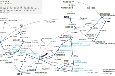
The Land is Enchanting, the Scenery Picturesque - Memories of a Self-Driving Tour on the American West Grand Loop!
Time goes back to the summer of 2017. Little Bean had just completed three years of kindergarten. Dad and Mom decided that before Little Bean started school, the whole family would take an overseas trip to let her see more of the world. Why the United States? First, the United States is the most powerful country in the world; second, we had experience driving in the U.S.; third, Little Bean's uncle lives in the U.S. So, in the summer of 2017, a month-long, longest road trip across the eastern and western U.S. began.
On June 2nd, in the morning of Shenzhen, the sky was clear blue, the sea breeze gentle. The beautiful weather added to our good mood for the trip. At 10 a.m., "Ladies and gentlemen, our flight is about to take off." With the flight attendant's pleasant voice, the plane shot into the sky like an arrow. Looking down at Shenzhen, Qianhai looked like two crescent moons hanging by the shore. As the plane climbed higher, Shenzhen slowly faded from view, and our hearts drifted further from home.
After nearly three hours of flight, we landed at Beijing Capital Airport. We had a meal in the VIP lounge and rested a bit. At 15:40, amid the roar of the plane, we left Beijing, heading for San Francisco, thousands of miles away.
After a 12-hour flight covering over 10,000 kilometers, we landed at San Francisco International Airport at 12:20 local time on June 2nd (Beijing is 15 hours ahead of San Francisco). We got off the plane, went through customs. The customs officer asked a few simple questions: What are you doing in the U.S.? Where do you work? ... Apart from understanding the question about why we came to the U.S., we understood nothing else. We could only shake our heads and smile foolishly. The customs officer probably thought we wouldn't cause any trouble, waved his hand, and we swaggered into America.
Leaving the airport, we waited at the exit for our Uber reservation. But the driver couldn't find us. When we called, he couldn't understand me, and I couldn't understand him. We struggled for half an hour, and the driver finally gave up on us. So we decided to take the subway to the hotel. At the ticket machine, while we were staring at it in confusion, a friendly American young man helped us buy tickets and told us to get off at Powell St station.
After a half-hour ride, we arrived at the Hilton Hotel at Union Square. After checking in, we officially began our U.S. trip. "Food is the first necessity for the people," so we headed to Chinatown to fill our stomachs. On the way to Chinatown, we passed Union Square. The square is actually quite small, with the Goddess of Victory standing in the center, surrounded by department stores, luxury boutiques, tourist souvenir shops, and art galleries. Even without buying anything, it was a feast for the eyes.
After about 30 minutes of walking, we arrived at the famous Z & Y Restaurant in Chinatown. This restaurant was highly recommended by Little Bean's uncle. Many Chinese and foreign celebrities have visited. It is said that the head chef used to work at the Chinese Consulate in San Francisco. When we arrived, there were many people waiting outside. After waiting about half an hour, we entered the restaurant. The strong Chinese atmosphere and the pleasant Chinese language made us feel like we had forgotten we were in a foreign land.
[Time]: June 3rd - June 4th
[Attractions]: Lombard Street, Italian City, Fisherman's Wharf, Palace of Fine Arts, Golden Gate Bridge
San Francisco, a port city on the Pacific coast of California, is a world-famous tourist destination. When you mention the Golden Gate Bridge, Fisherman's Wharf, or Silicon Valley, you naturally think of San Francisco, but San Francisco is far more than that...
In 2013, Mom and I had visited San Francisco with a tour group. We stayed half a day, symbolically visiting the Golden Gate Bridge, the Palace of Fine Arts, and Fisherman's Wharf. At that time, we made a pact to come back and truly experience San Francisco's warmth and passion, to discover its beauty on foot.
On June 3rd, the sun was bright, the sky clear blue. Although it was midsummer in San Francisco, the Pacific sea breeze was still cool. As Mark Twain said, "The coldest winter I ever spent was a summer in San Francisco." We armed ourselves with long sleeves and pants and headed to our first attraction—Lombard Street.
Lombard Street is a famous street at the top of Russian Hill in San Francisco. Located between Hyde Street and Leavenworth Street, it has eight sharp turns and is the crookedest street in the world. Why is Lombard Street so popular among tourists? Besides its many turns and steepness, it's more about the lush trees, colorful flowers, and unique villas on both sides.
After visiting Lombard Street, we walked a few minutes to North Beach. Actually, it's not a beach but the so-called Italian City, with European romantic cafes and restaurants. We strolled along the street, enjoying the scenery. Then, we came across a community park with all sorts of children's play equipment. Little Bean's eyes lit up, and she rushed into the playground to have fun. Little Bean became a true foreigner here, but she wasn't shy. The Chinese and American people soon got along well.
After playing for a while, we continued walking and soon arrived at Fisherman's Wharf. The sea breeze was strong, tourists bustled about. Fisherman's Wharf is one of San Francisco's most popular attractions. Of course, what interested Little Bean the most were the street performers and the sea lions on the rafts. These animals, accustomed to big crowds, were quite cooperative, playing with each other, sometimes confronting each other, sometimes leaping out of the water, sometimes sliding gracefully back in, as if this was their kingdom.
After spending over two hours at Fisherman's Wharf, we took a taxi to the Golden Gate Bridge. The Golden Gate Bridge is a symbol of San Francisco. Its orange-red color gives the bridge an extraordinary appearance. It is widely considered a model of beauty by the international bridge community and is one of the most photographed bridges in the world. The wind at the Golden Gate Bridge is usually strong. The cold sea breeze not only messes up your hair but also makes your head ache.
After a 15-minute walk from the Golden Gate Bridge, we arrived at the Palace of Fine Arts. The Palace of Fine Arts is actually a main building abandoned after the Panama-Pacific Exposition. It wasn't until 1962 that the famous architect Bernard Maybeck redesigned and rebuilt it, giving it its current splendor. In front of the palace, there is a pond with white swans and a group of wild geese and ducks chasing and playing in the water. We strolled on the grassy bank. Wild geese and ducks would occasionally appear nearby. Little Bean was scared and hid behind her mom, but that tall white goose was quite fierce, always chasing people, as if trying to drive us "invaders" out of its territory. We ended the day's itinerary at sunset and returned to Chinatown to satisfy our taste buds!
On the morning of June 4th, we walked west along Geary Street. From time to time, there were some ragged homeless people on the streets. Although they didn't actively beg, they still made us foreigners feel a bit uneasy.
After walking for about ten minutes, we came to St. Mary's Cathedral. The reason for visiting this cathedral was our admiration for the Chinese architect I.M. Pei. Approaching St. Mary's Cathedral, it indeed gives a non-traditional church feel—neither Gothic nor weighted with history. The cathedral is full of modern design, with a huge cross on the top of the building. We are not believers, so we could only skim through the master's work.
After visiting the cathedral, a 15-minute walk brought us to the famous City Hall. It is famous because San Francisco City Hall is widely recognized as one of the most beautiful public buildings in the United States. Its tall golden dome exceeds the height of the U.S. Capitol. It is said that when the city hall was rebuilt in 1915, the budget was as high as $300 million, an astronomical figure at the time, which was opposed by all citizens. To persuade the citizens, officials promised that after completion, the public could freely visit.
Opposite City Hall are the War Memorial Opera House and the San Francisco Performing Arts Library, both historic buildings. When we went, Van Ness Avenue was under renovation with many traffic cones, so we could only appreciate them from outside, feeling regretful.
Behind City Hall is the Asian Art Museum. Entering the exhibition hall, we were shocked by the vast number of Chinese artifacts (over 2,000 pieces of Chinese porcelain, over 1,200 jade items, over 800 bronze pieces). Seeing so many Chinese relics across the ocean filled me with both pride and heaviness—pride in China's brilliant historical civilization, and heaviness wondering how these Chinese artifacts were collected.
After the Asian Art Museum, we visited the "Six Sisters" (Painted Ladies) in San Francisco. Located opposite Alamo Square, they are six differently colored Victorian-style attached houses. They are famous because they survived the 1906 San Francisco earthquake intact.
[Time]: June 5th
[Location]: Highway 1
On June 5th, the weather was clear, with half the sky occupied by white clouds. At 9 a.m., we went to the car rental office opposite the hotel to pick up our car (we had chosen the Hilton Hotel for its convenient car rental). After waiting in line for half an hour, we finally got into the imposing "Big White" and headed to our first destination—Stanford University.
We chose to visit Stanford not only for its renowned reputation but also because Little Bean's uncle graduated from this prestigious school. Strolling through the Stanford campus, the green lawns were quiet and beautiful, the ancient Mediterranean-style buildings dignified and solemn, and the sculptures by Rodin simple yet artistic. The campus was not only filled with the scent of books but also permeated with a strong artistic atmosphere. On campus, many Chinese students with yellow skin and black hair were striving for themselves and their country. I hope they will achieve success and serve their motherland.
We arrived at The Oval Park, the central plaza of the school. The square seemed covered with a dark green carpet, with rows of neatly arranged palm trees on both sides. Little Bean was delighted, running back and forth on the lawn. The two-hour visit passed quickly, and we didn't have time to go up to Hoover Tower for a panoramic view.
Leaving Stanford, we soon entered Highway 1. Highway 1 is known as one of the most beautiful scenic drives in the world, with the magnificent Pacific Ocean on one side and the towering Rocky Mountains on the other. The scenery on both sides is varied, including winding coastlines, green pastures, and unique small towns. There were lazy sea lions and seals, lively squirrels and seagulls, and fearless surfers.
Pigeon Point Lighthouse was our first attraction on Highway 1. This lighthouse is a California State Historic Landmark, built in 1871, over 140 years old, and still used by the U.S. Coast Guard. It is one of the tallest lighthouses in the U.S. and one of the most famous photography spots on the California coast.
After visiting Pigeon Point Lighthouse, we continued along Highway 1. Soon, we saw a lively scene on the rolling sea—surfers and paragliders, adding color to the sky. We stopped the car to admire their prowess and courage.
After watching the water performances, we drove to Santa Cruz. Santa Cruz Beach is one of the most beautiful beaches on the West Coast, a paradise for surfers and beach volleyball lovers. At dusk, the beautiful sunset painted the sky and ocean red. We rushed onto the beach. Little Bean finally found her fun—playing in the sand. Standing on the beach, the sea water was deep blue, waves rolling higher and higher. We were a bit worried, watching Little Bean closely, but the Westerners kept running into the water.
After a while, the sun was about to set. We washed Little Bean's feet, changed her clothes, and headed to Monterey. It was dark when we arrived in Monterey. There happened to be a Chinese restaurant next to the hotel. Great! We went in without hesitation for a happy meal.
Time came to June 6th. Today would be the most scenic part of Highway 1: Monterey, 17-Mile Drive, Carmel, Bixby Creek Bridge, Big Sur. Early that morning, we drove to Monterey Pier. Due to time constraints, we could only take a quick look at the pier to appreciate the town's tranquility and relaxation.
After a brief stop at Monterey, we drove to 17-Mile Drive, a spectacular stretch of coastline. Blue sea and sky, flowers and rocks, cliffs, green golf courses, ancient pines, seaside villas, plus the ubiquitous squirrels, seabirds, and seals—they all composed a noble and charming picture of 17-Mile Drive.
Exiting 17-Mile Drive, we soon arrived at the artistic town of Carmel. It is a paradise known for its refinement and artistry. Architect Hugh Comstock created a fairy-tale aesthetic style in the 1920s. Every shop in the town is arranged like a work of art, each with its own unique charm. There were flowers in every house, greenery in every shop. If we had time, we should stay in this town for two nights to fully experience it.
Leaving Carmel, we came to the famous Bixby Creek Bridge. Construction began in 1931 and was completed and opened in 1932. It is 218 meters long, 7 meters wide, and 85 meters high. At the time of completion, it was the largest single-arch concrete bridge in the world. Spanning a deep canyon, it looks spectacular and imposing from a distance. The arch bridge is very beautiful against the blue sea, one of the most photogenic bridges on the West Coast. It has even been featured on U.S. postage stamps and is very popular with tourists.
After visiting Bixby Creek Bridge, despite knowing that the road ahead was closed due to damage to Pfeiffer Canyon Bridge, we continued forward, hoping to get lucky and see the purple sand of Pfeiffer Beach in Big Sur. After half an hour, a huge barrier blocked our way. But we didn't feel regret because the coastline we had just driven was stunning and impressive.
We turned around, took a detour to Highway 101, and arrived at White Water Inn in Cambria at 8 p.m. Our stomachs were growling with hunger. After much searching, we finally found a Chinese restaurant. When we drove there, it was about to close. The Chinese owner, hearing our situation, quickly asked the chef to prepare a few dishes for us to take away. At that moment, we were emotional, tears welling up—it felt like meeting an old friend in a foreign land. That dinner brought our happiness index to the max.
On the morning of June 7th, we drove 15 minutes from the hotel to Elephant Seal Beach. Thousands of elephant seals gathered there, some sleeping, some playing, some barking... Although the elephant seal kingdom emitted a strong fishy smell, it still attracted many visitors.
Leaving Cambria, we headed to Solvang. Solvang, located in Santa Barbara County in central California, is a town built in Danish style. The residents maintain Danish traditions, customs, and culture. Solvang enjoys about 340 sunny days a year, with beautiful scenery year-round. Sunset magazine once rated it as one of the ten most beautiful small towns in the American West.
After strolling around Solvang for about two hours, we drove 50 minutes to the University of California, Santa Barbara (UCSB). Walking on campus, with its blue sea, green lawns, and tidy campus... we were intoxicated by the beautiful environment. As a Public Ivy, UCSB boasts outstanding academic achievements and a beautiful campus.
Leaving UCSB, we soon arrived at the town of Santa Barbara. It is a coastal town full of Mediterranean elements: white walls, red tiles, blue sky, white clouds. The afternoon sun slanted onto the town, making it look like a golden castle.
After a quick stop at Santa Barbara, the sun was almost down, so we drove to Los Angeles. On the way, Mom and I chatted about how friendly Americans were, often offering to take photos for us. Suddenly, Little Bean's feelings were touched. She said loudly, "Chinese people are warm. I love China. I want to go back to Shenzhen." Mom and I, a bit dazed, received a vivid patriotic education lesson from Little Bean.
Entering downtown Los Angeles, it was already dark. The wide highways were filled with streams of cars, like red ribbons in the night. Driving on such roads at night in the U.S., where right-of-way is strictly observed, was not easy. Cars sped by, and no one would yield to you. Fortunately, we arrived safely in Los Angeles despite the hazards. This concluded our Highway 1 road trip. Joyful Los Angeles, here we come!
Los Angeles, located in southwestern California, is the second-largest city in the U.S. and the largest in the western U.S., often called the "City of Angels." When you think of LA, you naturally think of Hollywood, the Walk of Fame, Universal Studios, Disneyland, and the Lakers...
[Time]: June 8th - June 10th
[Location]: Los Angeles
[Attractions]: Hollywood Walk of Fame, Griffith Observatory, Beverly Hills, Santa Monica Beach, Disneyland
On the morning of June 8th, we walked to the Hollywood Walk of Fame. The first thing we saw were the stars embedded in the sidewalk. This is a boulevard of honor, a dream avenue for countless artists. Each star represents an artist, their great contribution to the entertainment industry. On the Walk of Fame, there is also a unique building—TCL Chinese Theatre, the venue for the annual Oscars. Walking along this street, there were many costumed performers posing for photos with tourists for tips. Occasionally, various luxury cars and supercars would appear on the street, perhaps carrying a Hollywood superstar.
Leaving the Walk of Fame, we drove to Griffith Observatory, a popular spot for children. Griffith Observatory is one of the world-famous observatories, located on the hills northwest of Los Angeles, facing the Hollywood Hills. Inside, there are not only rich astronomical exhibits but also various astronomical instruments and models. Little Bean was very happy, looking at how solar and lunar eclipses occur, touching models of the eight planets. She was fascinated and occasionally explained to Mom and Dad how day and night happen. The observatory sits on a hilltop, also the best viewpoint in Los Angeles. From here, you can see the white "Hollywood" sign on the opposite hill and overlook the entire "big village" of Los Angeles.
Coming down from Griffith Observatory, we drove to Beverly Hills. Beverly Hills is known as "the most prestigious residential area in the world," a symbol of wealth and fame, a dream place for global billionaires. But when we arrived, we didn't feel anything special. There were no huge signs, no tight security, no fleets of top luxury cars. All we saw were neatly trimmed flowers and plants in front of each villa.
Leaving Beverly Hills, we visited our last spot of the day—Santa Monica Beach. Santa Monica Beach is one of the most famous and popular beaches in the Los Angeles area. It is also the endpoint of the famous Route 66. There is a pier here, which is a symbol of Santa Monica. Nearby is Pacific Park, an amusement park where many American movies and TV shows have been filmed. By the time we arrived at Santa Monica Beach, it was already afternoon. Unfortunately, we had no time for Little Bean to go to the amusement park. The three of us just felt the cold Pacific wind on the beach and enjoyed the beautiful sunset.
After sunset, we left Santa Monica Beach and drove an hour to a hotel near Disneyland. Tomorrow's time would be dedicated to Disneyland.
Disneyland in Anaheim, California, is the first Disney theme park in the world, opened on July 17, 1955. In 1955, the imaginative and creative American animation master Walt Disney founded the first modern amusement park in California, named Disneyland (officially Disneyland Park).
On the morning of June 9th, the weather was clear. We walked 15 minutes from the hotel to Disneyland. After a strict security check (selfie sticks were not allowed), we stepped into the joyous land of Disney. For children, no matter how many times they've been to Disney, every time feels like the first, wanting to experience all the rides. So, the three of us entered at 10 a.m. and didn't leave until 9 p.m., letting Little Bean have her fill of fun and sights.
[Time]: June 10th - June 11th
[Location]: Las Vegas
[Attractions]: Barstow Outlets, Las Vegas
On June 10th, we drove from Los Angeles to Las Vegas. "Big White" quickly entered Interstate 15. Driving on I-15, the windows showed endless deserts, revealing the vastness and desolation of the West. After two hours, we arrived at the famous Barstow Outlets in the West, with many first- and second-tier brand discount stores, including Coach, which is popular among Chinese.
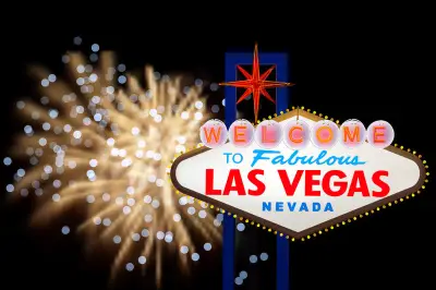
After a brief stop, we continued toward Las Vegas. After nearly seven hours of driving (including breaks for shopping and meals), we arrived in the glittering Las Vegas. Known as the "Entertainment Capital of the World" and "Wedding Capital of the World," Las Vegas is truly a paradise in the desert. All hotels are super luxurious with very attractive prices. During the day, Las Vegas is hot with few pedestrians on the streets. The real Las Vegas belongs to the night.
As the lights came on, we walked along both sides of the Las Vegas Strip. The scenery on both sides was stunning: fairy-tale castles, Egyptian pharaohs, large fountains, volcanic eruptions... Each hotel had its own unique landscape design, dazzling to the eyes.
When planning, we had planned to go to the Grand Canyon the next day. But since the Grand Canyon has no safety railings beside its deep cliffs, considering the child's safety, we had to give up.
[Time]: June 11th - June 12th
[Location]: Salt Lake City
[Attractions]: Temple Square, Utah State Capitol
Due to the schedule, we only stayed one night in Las Vegas. Reluctantly, on the morning of June 11th, we left the gambling city for Salt Lake City. Salt Lake City is the capital and largest city of Utah, named for its proximity to the Great Salt Lake. Salt Lake City was founded in 1847 by Brigham Young leading a group of followers of the Church of Jesus Christ of Latter-day Saints (Mormons) to pioneer this area. Since then, the church's headquarters have been in Salt Lake City. Today, more than half of the local population are members of this church. After nearly eight hours of driving (including rest stops), we arrived in Salt Lake City at sunset.
On the morning of June 12th, we visited the famous Salt Lake City attraction—Temple Square. The entire square was quiet and solemn. Temple Square is located in downtown Salt Lake City, a complex of buildings belonging to the Mormon Church headquarters, including the Salt Lake Temple, the Salt Lake Tabernacle, the Assembly Hall, the Seagull Monument, and two visitor centers, covering 10 acres and surrounded by walls.
After visiting Temple Square, we paid a visit to the Utah State Capitol, then turned around and headed west toward West Yellowstone. The car sped on the highway, and the scenery on both sides became more varied. In the distance were majestic snow-capped mountains, and on both sides were large grasslands and forests. However, the temperature outside dropped sharply. Although it was midsummer, we had to put on thick jackets.
[Time]: June 13th - June 14th
[Location]: Yellowstone National Park
[Attractions]: Lower Geyser Basin, Grand Prismatic Spring, Norris Geyser Basin, Mammoth Hot Springs, Yellowstone Canyon, Upper and Lower Falls, Hayden Valley, Old Faithful, West Thumb Geyser Basin, Yellowstone Lake
After a 5-hour drive, we arrived in West Yellowstone. After checking into the hotel, we quickly drove into Yellowstone National Park to see the "true face" of the world's first and largest national park.
Yellowstone National Park is the world's first and largest national park, proudly called "the most unique and magical paradise on Earth" by Americans. Yellowstone is so attractive because of its rich variety of scenery: lakes, streams, hot springs, snow-capped mountains, canyons, waterfalls, grasslands, flower seas, snow, birds, and animals...
Yellowstone is divided into five areas: the Mammoth Hot Springs area in the northwest features limestone terraces, also known as the hot terrace area; the Roosevelt area in the northeast retains the old Western landscape; the canyon area in the middle offers views of the Yellowstone Canyon and waterfalls; the Yellowstone Lake area in the southeast is mainly about lake and mountain scenery; the west and southwest are the geyser areas, full of geysers, hot springs, steam vents, hot pools, mud pots, and fumaroles. The park has convenient transportation, with a ring road over 500 kilometers long connecting the main attractions.
The attractions in Yellowstone are distributed in a "figure-8" pattern, requiring two full days to complete. Considering Yellowstone's changeable weather, after arriving in West Yellowstone that afternoon, while the weather was good, we hurried to explore the lower part of the figure-8. Shortly after entering the park, we saw pastoral scenes of green grass and babbling streams; a bit further, it was like an oil painting of lush trees and blooming flowers. Along the way, the views outside the window changed with every step, captivating us.
After an hour's drive, we arrived at the Fountain Paint Pot, which is the Lower Geyser Basin, the largest geyser basin in Yellowstone. The Fountain Paint Pot is also called the "Soy Milk Pot" because mud continuously erupts from underground, resembling soy milk. This attraction features an 800-meter boardwalk loop, all flat, which takes about half an hour to walk.
During the walk, snow suddenly began to fly in the sky. It was the first time in my life I had seen such abnormal weather—snow in June. Snowflakes danced in the air with rain, and the temperature dropped to 7°C, but it didn't dampen our spirits. We drove to another famous attraction—the Grand Prismatic Spring.
The Grand Prismatic Spring is one of the most famous geysers in Yellowstone, the largest hot spring in the U.S. and the third largest in the world. Named for its colorful appearance, it displays blue, green, yellow, orange, and red colors from the center outward, earning it the reputation of "the most beautiful earth surface." There is a boardwalk around the spring, which takes about 40 minutes to complete. On the third day, when the weather was good, we walked it again.
After visiting the Grand Prismatic Spring, it was getting dark, so we headed back to the hotel. On the way back, there were all kinds of wildlife on both sides of the road. These creatures, used to big crowds, showed no fear of us. On the contrary, we were afraid they might run onto the road and damage our car. Fortunately, we coexisted peacefully—they foraged in their kingdom, and we returned to our hotel to rest.
On the morning of June 13th, although it was cold, the weather was good. Today's task was to visit all the attractions in the upper part of the figure-8. There weren't many attractions, but the driving distance was quite long.
First, we went to Norris Geyser Basin. Located on the west side of Yellowstone, Norris is the most unstable series of geysers in the park, with rich colors: clear blue-green, milky blue-white, and orange or green channels formed by bacteria. The scenery was very beautiful. At this spot, we met a family of Westerners—a couple with three children, the youngest in a stroller. Seeing these blonde, blue-eyed kids eating cold sandwiches in the cold wind, we admired their "steel stomachs."
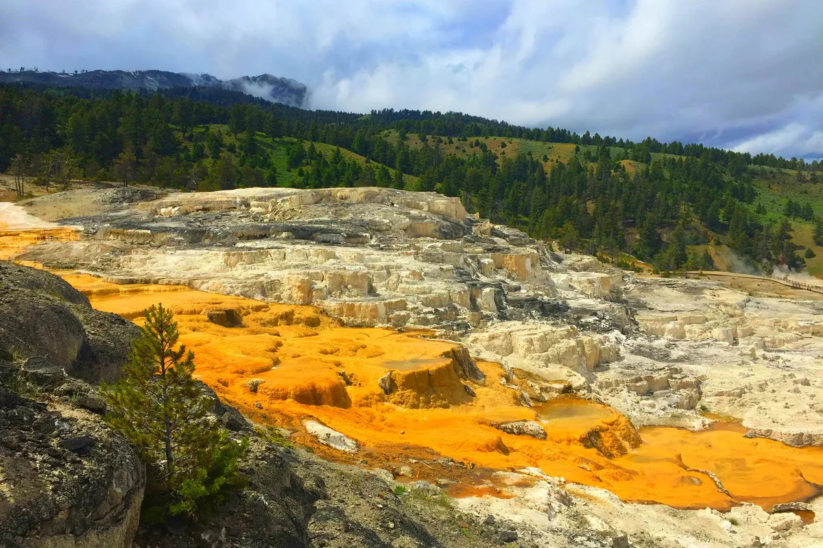
Leaving Norris, we drove to another famous Yellowstone attraction—Mammoth Hot Springs. Located in the northwest, Mammoth Hot Springs is the largest known carbonate-depositing hot spring in the world. This is also the headquarters of the Yellowstone Park administration, so facilities are relatively complete. The landscape mainly consists of limestone terraces, once rich in color, but now most springs have dried up, causing a large number of microorganisms to die and lose their color. The dead bacteria turned into gray-white powder, remaining on the dry terraces, forming a unique landscape.
After a simple lunch at Mammoth Hot Springs, we drove to the next attractions—Upper and Lower Falls and the Grand Canyon of the Yellowstone. Since it had snowed the previous night, we passed large areas of snow-covered ground, everything white as if we had jumped from summer into winter. Little Bean even got out of the car to play in the snow for a while.
After driving over two hours, we arrived at the Grand Canyon of the Yellowstone, one of the most famous landscapes in the park. You can see both the deep, majestic canyon and the plunging waterfalls. In good weather, a rainbow can be seen across the canyon. There are two waterfalls: Upper Fall and Lower Fall. Lower Fall has a greater drop and is more spectacular. Long-term erosion by the river has created colorful rock walls in yellow, orange, brown, etc., which the Indigenous people called "Yellowstone."
After visiting the canyon, we continued forward. Soon, we reached Hayden Valley. This is a wetland area with a large number of American bison grazing on the grassland—a typical prairie scene.
After finishing Hayden Valley, we intended to continue to Yellowstone Lake. But after half an hour of driving, we came to a fork. Due to very weak cell phone signal in the park, GPS stopped working. We didn't dare to continue. So we turned around and drove back. Once we got a signal, we navigated back to the hotel. Taking the middle road of the figure-8, it took only 1 hour and 15 minutes to return from Hayden Valley. A full day of scenic highlights ended perfectly.
On the morning of June 14th, the sky was blue with white clouds, clear weather. After checking out, we set off immediately. Today, we continued along the lower part of the figure-8. Since the weather was only average on the first afternoon, we revisited the Soy Milk Pot and Grand Prismatic Spring. After visiting the same spots as the first day and driving for nearly two hours, we arrived at Old Faithful Geyser.
Old Faithful is named for its consistent, regular eruptions, currently occurring about every 93 minutes. At the start of an eruption, there is a rumbling sound underground, then the sound of water hitting the ground, and finally, it bursts out. Each eruption lasts four to five minutes, with water columns reaching over 40 meters, spectacular and never ceasing.
After Old Faithful, we continued to the last group of attractions planned for Yellowstone—West Thumb Geyser Basin and Yellowstone Lake. Located in the southeastern part of the park, the hot springs in the lake are the highlight here. Water bubbles up from the lake floor in colors of dark black, transparent green, and sapphire blue. Besides the colorful geysers, the nearby Yellowstone Lake and distant snow-capped mountains complement each other. On a clear day, it's a rare beautiful scene. Yellowstone Lake is as wide as an ocean, the "largest high-altitude lake in the United States." Its water is clear and transparent, with beautiful lake and mountain views reflecting the distant snowy peaks.
After visiting Yellowstone Lake, we had basically checked off all the key attractions of Yellowstone. One full day and two half-days of touring were only hasty. Yellowstone is too large with too many attractions. To slowly explore and appreciate it, four days would be more reasonable.
[Time]: June 14th
[Location]: Grand Teton National Park
[Attractions]: Jackson Lake, Oxbow Bend Turnout
Starting from Yellowstone Lake, we exited through the south gate directly into Grand Teton National Park. The road into Grand Teton was very good, with beautiful scenery on both sides—clear lakes, towering snow-capped mountains, lush pine forests, blooming wildflowers... Grand Teton is actually very beautiful, but because it's adjacent to Yellowstone, its status in the eyes of tourists pales in comparison.
After about an hour's drive, we arrived at Grand Teton's iconic attraction—Jackson Lake. The wide lake shimmered under the sun, and the snow-capped mountains in the distance looked even whiter under the sunlight. Since it was afternoon backlight, we didn't see the beautiful reflection of the mountains in the lake.
Leaving Jackson Lake, we continued forward. Little Bean started her broadcast, adapting the story of the "Hippo Dentist" into a series, telling each episode vividly. Her two loyal listeners were very engaged.
About an hour later, we arrived at another famous Grand Teton spot—Oxbow Bend Turnout. Located near Jackson Junction, it is considered the best place to view and photograph Mount Moran. The Snake River makes a big bend here, forming a wetland. The wetland is lush with vegetation, and the calm Snake River reflects Mount Moran in the distance, creating a beautiful scene.
After enjoying the scenery for a while, the sun began to sink westward. Due to time constraints, we needed to continue driving to our destination for the day—Idaho Falls. Exiting Grand Teton, we arrived in Jackson Town, a very Western-style town famous for cowboy culture. It has the famous Elk Antler Arches Park and traces of cowboy activities. Unfortunately, we couldn't stop.
[Time]: June 14th - June 15th
[Location]: Idaho Falls
[Attractions]: Snake River Banks
After driving through mountains and valleys for three hours, we arrived in Idaho Falls. After settling in, we went to a nearby Walmart for supplies.
Idaho Falls, named after the falls, is the third-largest city in Idaho. Although the town is beautiful, we couldn't really see any impressive waterfalls. Instead, there were many ducks on the Snake River, and the banks were full of duck droppings. Walking along the riverbank, you had to watch your step to avoid stepping on them.
[Time]: June 15th - June 16th
[Location]: Twin Falls, Elko
[Attractions]: Shoshone Falls in Twin Falls
On June 15th, we got up early to see the falls along the Snake River in Idaho Falls. No falls, only the Snake River Dam. So we quickly drove to our next destination—Shoshone Falls in Twin Falls.
Majestic Shoshone Falls, located on the Snake River in Twin Falls, Idaho, is sometimes called the "Niagara of the West" because of its impressive power. It is one of the most photogenic waterfalls in the U.S. and is listed among the world's top ten waterfalls. Shoshone Falls is 64.7 meters high—14 meters higher than Niagara Falls—and over 300 meters wide. It is a must-visit attraction in Twin Falls, Idaho, and even the U.S.
When approaching Shoshone Falls, we crossed the Perrine Bridge, an iron bridge with a historical story. At the bridgehead, there is information about its construction. Our little family saw a golden expanse of land here, so we got out to explore. Under the iron bridge was a deep canyon. Fortunately, there was a wire fence to keep us safe.
Leaving the bridge, we passed many farms and saw herds of cows. Arriving at Shoshone Falls, there weren't many tourists, and we hardly saw any Asian faces. We were very lucky—the water flow of Shoshone Falls was immense, with a thunderous force. The scene was breathtaking. There was also a patch of green lawn for visitors to rest.
After resting on the lawn, we continued to another less-known spot—Thousand Falls. After driving on a bumpy road with no cell signal, we finally found it through effort. But in my opinion, it wasn't a thousand falls; there were just a few small streams. Still, the scenery was acceptable.
After visiting the main attractions of the day, we drove toward our destination—Elko, Nevada. Elko is also known as the "Gold Town." We arrived in Elko as the sun was setting. The evening glow reddened half the sky over Elko. In the sunset, Elko was quiet and charming.
[Time]: June 16th - June 17th
[Location]: South Lake Tahoe
[Attractions]: Mt. Rose Highway, Crystal Bay, Emerald Bay
On the morning of June 16th, the weather was still clear. We set off from Elko, speeding along Interstate 80. After 4.5 hours, we arrived in Reno. Exiting the highway at Reno, "Big White" was moving slowly when suddenly there was a loud noise from behind—a foreigner's car bumped into the rear of "Big White." My heart sank; the Lake Tahoe trip might be ruined. Getting out, "Big White"'s sturdy body seemed unfazed, as if nothing had happened. Mom was still worried about returning the car, so she drove to the McDonald's parking lot to inspect carefully and confirmed it was fine. We had a quick lunch at McDonald's and continued toward Lake Tahoe.
Soon after leaving Reno, we turned onto the Mt. Rose Highway, known as a "National Scenic Byway." This mountain road is extremely winding, with steep uphill sections from Nevada toward Lake Tahoe. Although the scenery on both sides was beautiful—snow mountains, forests—we had no time to enjoy it; we had to drive carefully. Mom kept reminding me to go slow. After a cautious climb, we finally reached the summit. Although it was scorching hot at the base, it was still snow-covered at the top. We stopped the car to relax and catch our breath.
After a rest, we descended to Lake Tahoe. Lake Tahoe, located on the border between California and Nevada in the U.S., is the largest alpine lake in North America, with a depth of 501 meters, making it the second deepest lake in the U.S. Surrounded by peaks, with crystal clear blue water, it's a heavenly alpine lake, almost unreal. Mark Twain called it one of the most beautiful places in the world. As he said, "If you want to breathe the air of angels, go to Lake Tahoe. One side touches the sky, the other touches the soul."
Our first stop was Crystal Bay. It was afternoon, the sun warm, the lake breeze gentle, very comfortable and peaceful by the lake. It's a leisure spot for locals, with a large parking lot and a sandpit for children. Many residents were on the shore, either sunbathing or doing various water sports.
After playing for a while, Little Bean took off her shoes and started enjoying herself fully, playing in the sand, splashing in the water, teasing the ducks, throwing pebbles into the lake... We stayed until the sun was almost down, then packed up and headed to our hotel in South Lake Tahoe. On the way, the sunset over Lake Tahoe was breathtaking—rays of golden light, purple clouds. Mom couldn't stop taking photos on her phone.
After checking in, we quickly looked for a restaurant. According to Google Food, we found a Thai restaurant. While driving there, at an intersection we needed to turn left. We waited for several cycles but there was no left-turn light, and there was a camera. What could we do? As law-abiding citizens, we had to turn anyway. Fortunately, we didn't get a ticket later.
On the morning of June 17th, we checked out and continued driving slowly along the south shore of Lake Tahoe. We passed a yacht club, with many yachts and speedboats leaving white wakes in the water.
Continuing on, we arrived at the most famous attraction of Lake Tahoe—Emerald Bay. Emerald Bay gets its name from the deep green water caused by an abundance of algae. Originally, Emerald Bay was not connected to Lake Tahoe, but over thousands of years, the flow of water between the two lakes carved through the shore, making it part of Lake Tahoe. The scenery here is extremely beautiful, a must-stop for photos.
[Time]: June 17th - June 18th
[Location]: San Francisco
[Attractions]: Mt. Rose Highway, Crystal Bay, Emerald Bay
We took countless photos at Emerald Bay, wanting to capture all these beautiful scenes in our camera and imprint them in our memory. Lake Tahoe was so beautiful. Due to time, we only stayed one day at Lake Tahoe. I hope to come again in the future.
Leaving Emerald Bay, we continued driving along the lake for a while. The deep blue lake slowly faded from view. We got back on Interstate 80, heading toward San Francisco International Airport. The sun was blazing, blindingly bright, and the temperature outside reached 40°C. OMG! We had planned to visit the California state capital—Sacramento—but time didn't allow, plus the heat, so we had to skip it and head straight to San Francisco.
At around 5 p.m., we arrived at the Courtyard by Marriott near San Francisco International Airport. After checking in and settling our luggage, we filled up the car with gas and found a Chinese restaurant nearby. Enjoying familiar sounds and familiar flavors, our wonderful Grand Western Loop came to a perfect end.
On the morning of June 18th, we drove to San Francisco International Airport. Following the car return signs, we smoothly reached the drop-off spot. The staff checked the fuel gauge and printed a receipt with a handheld device. Returning the car was that simple—done in five minutes.
As the plane slowly ascended into the sky, goodbye beautiful San Francisco, goodbye stunning American West Grand Loop! We would continue our journey to the eastern United States for the next leg of our road trip—next stop: New York City, the capital of the world!
Travelogue Index:
1. Why America?
2. Cold San Francisco
3. Blue Highway 1
4. Joyful Los Angeles
5. The City That Never Sleeps – Las Vegas
6. Quiet Salt Lake City
7. Colorful Yellowstone National Park
8. Deputy Grand Teton National Park
9. Misnamed Idaho Falls
10. Gold Town Elko
11. Heavenly Lake Tahoe
12. Back to San Francisco
Travel Information:
Hotel Index / Guide Index / Ticket Index / Website Navigation / Travel Index / Cruise Index / Corporate Travel Index / Join Cooperation / Distribution Alliance / Friendly Links / Enterprise Gift Card Purchase / Insurance Agent / Agency Cooperation / Hotel Partnership / Destination & Scenic Spot Cooperation / More Partnership / About Ctrip / Ctrip Hot Topics / Contact Us / Careers / User Agreement / Privacy Policy / Business License / Security Center / Ctrip Content Center / Intellectual Property / Trip.com Group / Algorithm Explanation