The Bleak, an Unspeakable Beauty: A Seven-Day Self-Drive Tour of the Southwest United States
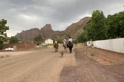
Every year we go to Las Vegas because it's my parents' favorite, especially during the Chinese New Year when it's most festive. Every hotel has special Chinese New Year decorations and lights, which helps make up for their inability to return to China for the holiday. In the past, we only ate, drank, and strolled along the Las Vegas Strip. This year, coinciding with Zhou Shen's world tour concert here, we planned a ten-day self-drive itinerary.
On February 26, we flew to Las Vegas and rented a fiery red SUV as our warhorse for the entire trip. The next day, we went to Valley of Fire State Park, just over an hour from the hotel. We didn't expect such an exciting attraction so close to the casino city. The fiery red rock formations seemed to have fallen from the sky, standing abruptly amidst the surrounding barren gravel plains and bare gray-black mountains. We drove all the way to the innermost part of the scenic area, the White Domes Loop Trailhead, and hiked for about an hour. The first section was soft sand, where my parents could walk with us for a while. After taking photos, they turned back, and we continued. The later part was a bit rugged, with no shade along the way. It's only suitable for winter visits; even at around 20°C, we were sweating from the hike, but the rich colors of the rocks along the way were amazing. At noon, we had our packed lunch under the shade shelter at the trailhead, then drove along the scenic road to the Fire Wave Trail. We spent about an hour there; the scenery was even more beautiful. Walking on the rock trail felt like stepping on colorful water ripples, with red and white stones twisted into graceful shapes. Finally, we wanted to see Windstone Arch, but after asking some returning visitors who said it would take another half hour to get there, we gave up for fear of making my parents wait too long. Besides, there would be countless more arches to see later. That day was a comfortable outing, totaling only about three hours of walking with no steep slopes. We returned to Las Vegas by a little after five for dinner, and my parents went back to gambling. In the evening, we celebrated my dad's 92nd birthday early at a restaurant facing the Bellagio fountains. The service and food were commendable.
On February 28, we strolled along the Strip with my parents, went for dim sum at noon, and rested in the afternoon. We conserved our energy for Zhou Shen's concert in the evening. As a top-tier singer in the Chinese music scene, Zhou Shen's concert tickets are extremely hard to get. My sister had done her homework early, waiting at the computer before the presale started. She queued up and got to position 87, securing front-row seats in the highest tier. The $200+ tickets quickly sold out to over $600, and she regretted not buying more to scalp. The MGM Grand in Las Vegas only has 5,000 seats, far smaller than the usual 10,000-20,000-seat venues in China, but the sound system was decent, and Zhou Shen's singing was impeccable. A singer with such strong skills, versatile style, and high emotional intelligence is rare. I've been a fan since his performance of "Huan Yan" on "The Voice of China," and he's one of the few singers I'm willing to pay to see.
On March 1, after seeing my parents and son off on their flight home, Michelle and I began our freest self-drive trip. Our first stop was the town of Page, about a four-hour drive. We stayed there for two nights. After arriving at the hotel and resting a bit, we headed to Horseshoe Bend, just a 20-minute drive from the hotel. We parked, bought tickets, and walked for about ten minutes. The sun was shining brightly, but we could see small dust devils kicking up sand near the cliff edge. By the time we arrived, it was early evening, but there were still quite a few tourists. Some brave ones even climbed to the top of the rocks. Despite the strong winds and hazy sunset, the horseshoe bend below was clearly visible. Except for a small viewing platform with a railing, most areas had no protection, with uneven rocks and yellow sand making it nerve-wracking. But the view was indeed beautiful. We eventually left reluctantly when the wind and sand became too much.
March 2 was the highlight. We had booked the 11:30 AM slot for Upper Antelope Canyon, as the light is said to be best around noon. We took a designated tour vehicle from town, bouncing for half an hour to the entrance, where a Navajo guide led us inside. I've seen countless photos of Antelope Canyon and always thought it was a single cave, but it turned out to be a long tunnel, taking about 40 minutes to walk from the entrance to the end. All those photos I'd seen were not artificially enhanced; even a casual shot with a phone produces a cinematic effect. Sunlight streamed through narrow cracks in the ceiling, creating magical light and shadow on the wave-like walls, producing dreamlike colors. Halfway through, it even started drizzling, like a light veil drifting into the cave, but soon the sun was out again. We took many photos along the way; I couldn't put down my phone. Every angle offered a different beautiful shot. The guide specially pointed out a few spots where you could see patterns like a chief, a heart, and a hummingbird. It was truly a visual feast.
We finished Antelope Canyon a little after one, then drove to the nearby Beehive Trail for a hike. We couldn't find any obvious trail markers, so we parked by the roadside and started climbing up the rocks through a gravel area. Once on top, the view was expansive, with only a handful of other visitors. We felt like ants wandering across the wilderness. The surrounding rocks looked like giant layer cakes, with horizontal striations that were astonishing. The wind was still strong, and dark clouds rolled in, adding to the desolate and mysterious atmosphere. We explored for over an hour before coming down and heading straight to Glen Canyon National Park. We stopped at the visitor center first, where we saw the impressive dam on the Powell River. Suddenly the sun came out, making us look forward to the afternoon. Not far from the visitor center, we entered the vast park. Our first stop was Navajo Mountain Viewpoint, overlooking the Powell River. The second was Wahweap Viewpoint, which offered the widest view of the water and distant boats. We then drove to Lone Rock Beach, a wide sandy beach facing a solitary rock in the middle of the river, a great spot for camping and viewing. Around five, the sun came out again, so we drove back to Wahweap Viewpoint to wait for sunset. There were no other tourists at that spot. We parked with the window facing the water, set up the phone's time-lapse mode, and sat comfortably in the car eating snacks and enjoying the view. Outside, the wind howled, clouds drifted slowly across the sky, and the scenery alternated between light and shadow as clouds changed, until the sun disappeared behind the last dark cloud. The time-lapse video turned out great, and Michelle, who had just started using this feature, became obsessed with it for the rest of the trip.
After staying two nights in Page, we set out on the 4th for Moab, the base for Arches National Park and Canyonlands National Park. After about two hours, we reached Monument Valley Navajo Tribal Park, a lesser-known tourist spot that turned out to be fantastic. We parked at the visitor center and intended to hike the Wildcat Trail, but strong winds drove us back. Instead, we drove the scenic road within the park. The road was rough, entirely gravel, but the raw desolation of the wilderness and the majestic solitude of the giant rocks were awe-inspiring. It was another stretch with almost no other visitors. We parked anywhere we liked, strolled on soft sand and among shrubs, and touched the rough, strange rocks freely. I really loved this feeling of being alone in the wilderness. In that sense, America is a great place for travel: it provides certain services while fiercely protecting the natural primitive ecology. On this trip, we two women drove thousands of miles across vast deserts, and most scenic spots were not crowded. We never felt unsafe, only experienced harmony between humans and nature. After leaving the park, we passed by "Forrest Gump Point," where in the movie Forrest Gump stopped running and turned back home. The long road had very few cars, and a group of young people were mimicking Forrest's run and taking photos. I like that movie too, mainly because of the actor. A great actor indeed makes a classic.
In the afternoon, we drove another two hours and arrived in Moab town in the evening. It's the only hotel and service area for visiting Arches and Canyonlands. We booked Best Western in the town center, surrounded by many restaurants and small shops. The room was spacious and even had two sinks—very satisfactory.
On March 5, after a hearty free breakfast, we packed apples, snacks, and water and headed to Arches National Park. The scenery outside the window already excited us: fiery red rocks near us contrasting with snow-capped mountains in the distance. Our first stop was Devils Garden Trail, a challenging 9+ km trail. Wisely, we only walked the flat part at the beginning. The first arch we saw was the famous Landscape Arch, the fifth longest arch in the world (the four longest are in China, though I'm not sure where). It spans 88 meters, with the thinnest part only a meter or so thick. In 1990, a rock fall occurred, and more have fallen since, so visitors are not allowed under the arch. We could see freshly fallen rock with clearly new colors. Next was Tunnel Arch, which seemed ordinary compared to other famous arches. Then we reached Pine Tree Arch at the end of the trail, with very few visitors. We could touch the arch up close, take various photos, and ate our packed lunch there. Throughout this trip, we had lunch at scenic spots every day, finding a nice, secluded place to drink our own hot tea and enjoy snacks—how delightful! After lunch, we drove to Sand Dune Arch Trail, a very pleasant trail flanked by huge rocks, narrow in some places requiring sideways passage. Underfoot was pink fine sand that had fallen from the rocks over eons due to wind and erosion. Sand Dune Arch is hidden among giant rocks, shaped like two kissing dolphins, very cute. Sunlight shone on the surrounding rock walls, reflecting soft light like a light panel, perfect for photos.
According to plan, in the afternoon we set out to conquer the Delicate Arch Trail. This is the most famous arch in the park, but the trail requires climbing over 500 meters of rocky mountain, taking about an hour with absolutely no shade. At the trailhead, a sign warned hikers to bring enough water, as people had died from dehydration on this trail—so think twice! For once, no one held us back or dampened our spirits. We eagerly set off. The first twenty minutes were boring, relatively flat gravel path. Then we entered a vast slope of bare rock, not very steep but completely exposed, with only a few weeds growing in the cracks. The temperature was below 10°C that day, but after a while, we were so hot we had to take off layers. In summer, it would be like roasting on a griddle. After the rock slope, we entered steep rocky terrain with large boulders and thorny bushes. Without frequent trail markers, we would surely have gotten lost. We were panting, and our one bottle of water was soon gone. But other hikers passing us seemed much more at ease. One man even had a toddler of two or three, and his pregnant wife was carrying a camera—foreigners are incredibly tough. The higher we went, the narrower and steeper it became. Finally, we saw people sitting ahead enjoying the view, and we knew we had arrived. I recorded the moment the delicate arch came into view on my phone. It was thrilling: the huge arch stood alone on the cliff edge, below it a desert and grassland, red rock layers, and distant snow-capped mountains. The majestic backdrop made it appear exquisitely delicate and clever, no wonder it got such an elegant name. Everyone went under the arch to take photos, while many sat around quietly appreciating the rare wonder. All the climbing was worth it in that moment. Unfortunately, the weather was bad; clouds thickened, and it seemed unlikely we would see the sunset. Many people left reluctantly, but some stubbornly stayed. I wonder if they eventually saw it. Going downhill, our legs were trembling, but hiking poles helped a lot. As darkness fell, we drove back to the hotel, had dinner at a Vietnamese restaurant, and then returned to our room to look at photos and make videos. Since I started using Miaojian, I've enjoyed making videos; they make travel records more dynamic and allow me to add favorite music. Every day, I selected and made videos, then deleted the many photos and videos from my phone—otherwise, it's overwhelming.
On March 6, we set out for Canyonlands National Park, just half an hour from Moab. The wind was still strong, and temperatures hovered around freezing. A hooded down jacket became our constant battle gear. We drove straight to Grand View Point Overlook. When we arrived, it was overcast and even snowing lightly. But by the time we parked and reached the cliff edge, strong winds blew the clouds away, and soon we had blue skies and white clouds. Michelle set up her tripod and pointed it at the canyon below, shaped like a giant footprint. The clouds above raced like horses, while the dark canyon below sat solemn and quiet, with towering stone pillars rising from it—a magnificent scene! According to the information, you can hike in the canyon, but you need a special permit with limited availability, probably to protect the unique landscape. Next was Mesa Arch. After parking, we only needed to walk about ten minutes. This arch once appeared in Microsoft's earliest screensaver. Through the arch, you can see unique stone pillars in the canyon below. It's said to be most beautiful at sunrise when the light hits the perfect angle. On our way out, it started to snow lightly, hitting the car window with pitter-patter. But we had already gotten used to such sudden changes. At the next spot, Upheaval Dome, it was still snowing lightly, but we still climbed up. We took the wrong path and had to backtrack. This spot is a big crater with green rocks at the bottom. Scientists believe it was caused by a meteorite impact. The view was average, not worth the effort. Then we turned back and stopped at Green River Overlook, where we could see the river in the canyon. A passing tourist smiled and said, "Great view, but too much wind!" Indeed, fierce winds howled there. We just took a photo and fled back to the car. After eating something in the car, we decided to return to Arches National Park to see the remaining sights.
After a 40-minute scenic drive, we returned to Arches and stopped at the first trail near the entrance: Park Avenue Trail. When we started walking, there was a little snow, but soon the sun was shining. The trail ran through a valley between huge slab-like rock walls. The rocks had beautiful patterns and rich colors. I once saw a sign in the park explaining the formation of Arches' landscape: the huge rock layers were first squeezed by internal earth forces, creating parallel cracks. Over eons, these cracks expanded under sunlight, rain, and other external forces. Layers gradually peeled off and thinned, and some parts with cracks in the middle slowly formed arches; most, of course, collapsed into vast canyons. We walked through this moment in the long history of geological change. The sun broke through the clouds and shone on the rocks, giving the reddish walls a golden glow. On the open ground, we saw a rock formation resembling a giant hand of Buddha, and the famous Three Gossips looked like three chatting sisters. This trail is 3.2 km; we probably hiked most of it before turning back, planning to see the last few sights at sunset.
On the way, we briefly stopped at Balanced Rock. This rock really looked like it was standing on tiptoe, as if a gust of wind could topple it. With the fierce wind blowing, I nervously stood on the side opposite its fall direction. With a little time left before sunset, we continued to Two Windows Trail. The soft light of the setting sun shone on the nearly empty road; the scenery was incredibly beautiful. Throughout the drive, we played an audiobook of a high-IQ crime novel. Listening to stories while enjoying the view was the ultimate joy of self-driving. Our last stop was Double Arch, two arches crossing each other, a unique feature in the park. By then, the sun had set, and the sky showed twilight through the dark clouds. The clouds were high and thick, the land vast, and the arches stood proudly in the wilderness—a magnificent evening!
In the evening, we ate at a Thai restaurant. For our Chinese stomachs, having rice is essential. We didn't expect to find such good food in this remote place. The Vietnamese, Thai, and Korean restaurants here all had decent flavors. Tomorrow we would leave Moab and drive over four hours to Zion National Park, stay one night, then return to Las Vegas. Originally, we planned to play Bryce Canyon along the way, but the weather forecast predicted a storm closing the park, so we had to skip it.
On March 7, we spent the four-plus hours driving while listening to audiobooks and stopping at a few viewpoints. We didn't feel bored. We crossed a high mountain covered with snow at the peak—perhaps the same snowy mountains we saw from Canyonlands. After descending, the weather improved. By the time we neared Zion National Park, the roadside scenery had changed: trees were covered with white pear blossoms and pink peach blossoms, and the rocks had different colors. Green cedar trees grew from rock crevices. After many days without seeing large patches of green, it lifted our spirits. We checked into Zion Lodge, the only hotel inside Zion National Park. Although the town of Springdale just outside the park is only a ten-minute drive from the entrance, staying inside the park means stepping right into beautiful scenery—my ultimate requirement for travel accommodation. The hotel had only one restaurant; when we checked in, they suggested we reserve dinner. I ordered a steak for just over twenty dollars, and it turned out to be delicious.
The hotel was beautiful and charming. After dropping our luggage, we put on our backpacks and set out for the afternoon. The park has a free shuttle bus. We rode all the way to the last stop, Temple of Sinawava, and started the Riverside Walk. This is a flat, scenic trail along the Virgin River, suitable for all ages. At the end of the trail, shallow water blocked the way. Across the river, a group of tourists were wading through—they were participating in the famous The Narrows hike, which requires wearing chest-high waterproof suits and using anti-slip poles. It's a popular route in summer, but not comfortable in winter. Two Chinese-American parents came toward us with several children. When they emerged from the water, they celebrated with each other, "You did it!" From there, we took the shuttle to stop 4 and walked the Watchman Trail. I really enjoyed this trail, especially with the evening light shining softly on the rocks. The sandy path was soft, wild grass grew along the trail, and a couple was taking wedding photos—very romantic. The trail could have led all the way to our hotel, but other hikers told us the bridge to our hotel was under construction, requiring a long detour. Seeing that it was getting dark, we turned back and took the shuttle to stop 5, our hotel, to rest well for a more challenging hike the next day.
On March 8, the last day of our trip, we booked a flight out of Las Vegas at 9 PM to avoid wasting time. Around 8 AM, we packed our luggage into the car and started the Emerald Pool Trail. This trail has three sections: lower, middle, and upper, totaling 4 km of mountain hiking. We climbed slowly along the rugged mountain path. Below, the Virgin River reflected the orange mountains illuminated by the morning sun, sparkling. It was still early, so we encountered only a few hikers as we climbed. We huffed and puffed, stopping occasionally to enjoy the view. The scenery was beautiful—colorful mountains, rocks covered with green moss. Before we knew it, we reached Middle Emerald Pool, just a shallow puddle in a smooth rock depression. We paused briefly and continued upward. After about an hour, we reached the end of the trail, a large pool surrounded by rocks, with a small waterfall cascading from the high rocks. A group of young people who had passed us earlier were already playing there; one of them was swimming naked in the pool, while we were still wearing down jackets—truly a different species. We stayed at the top for about ten minutes before descending. On the way back, we finally found the side trail to Lower Emerald Pool, where most tourists go. From above, we slowly descended through a narrow path under red rocks, where a waterfall fell like a gauze curtain. Three hours later, we reached the foot of the mountain, feeling too exhausted to tackle another trail called Angel's Landing. So we ate lunch by the river and then slowly walked back to the hotel along the river. This was a flat, peaceful, scenic path. As we walked, we planned that next time we come to Las Vegas, we could bring my parents here.
After returning to the hotel, we drove to our last destination: Canyon Overlook Trail. It took half an hour from the hotel, passing through a long tunnel. Parking was tight. I thought if we couldn't find a spot, we'd skip it. But we unexpectedly found a good spot, so we had no excuse. We mustered our energy to climb the last scenic spot. The sun was strong after noon, and there was hardly any shade along the way. The half-hour climb was strenuous, but reaching the top offered a panoramic view of the valley—a perfect finish.
At 3 PM, we drove back to Las Vegas from Zion National Park, a two-hour-plus drive. After arriving, we had dinner, then drove to the airport to return the car. Before departure, our once bright red ride was so dirty it was hard to look at—thankfully it wasn't our car. Once everything was done, fatigue hit us immediately. The week of excitement, thrill, and lack of sleep finally caught up, and our bodies felt drained. This was the first time my sister and I traveled alone without family. We really are birds of a feather, enjoying freedom. My mom always says travel should be comfortable and enjoyable. But honestly, comfort is best at home. Travel is about exploring the unknown and experiencing a different world. This loop around the Southwest allowed me to fully appreciate the desolate and magnificent primitive scenery of the American West. Nature has exquisite masterpieces in every corner of the earth, every one worth seeing.