The Bleak and Magnificent National Highway 315: A Road Even More Beautiful Than the Sichuan-Tibet Highway, Known as China's Version of Route 66
When you think of China's most beautiful self-driving highway, which one comes to mind? Some friends might recommend the 318 National Highway (Sichuan-Tibet Highway), known as the shrine of self-driving tours. It's a very popular tourist route, crossing many snow-capped mountains and glaciers, passing by numerous lakes—truly beautiful. Other friends might recommend the Duku Highway in Xinjiang, a major transportation artery connecting southern and northern Xinjiang, where gobi deserts, hills, canyons, snow mountains, grasslands, rivers, and lakes alternate, offering breathtaking scenery.
But here, I want to recommend National Highway 315. It is by no means inferior to the Sichuan-Tibet Highway or the Duku Highway. Although it is far less famous than those two, and there aren't many tourists driving here yet, the attractions along its route are truly dense and mesmerizing.
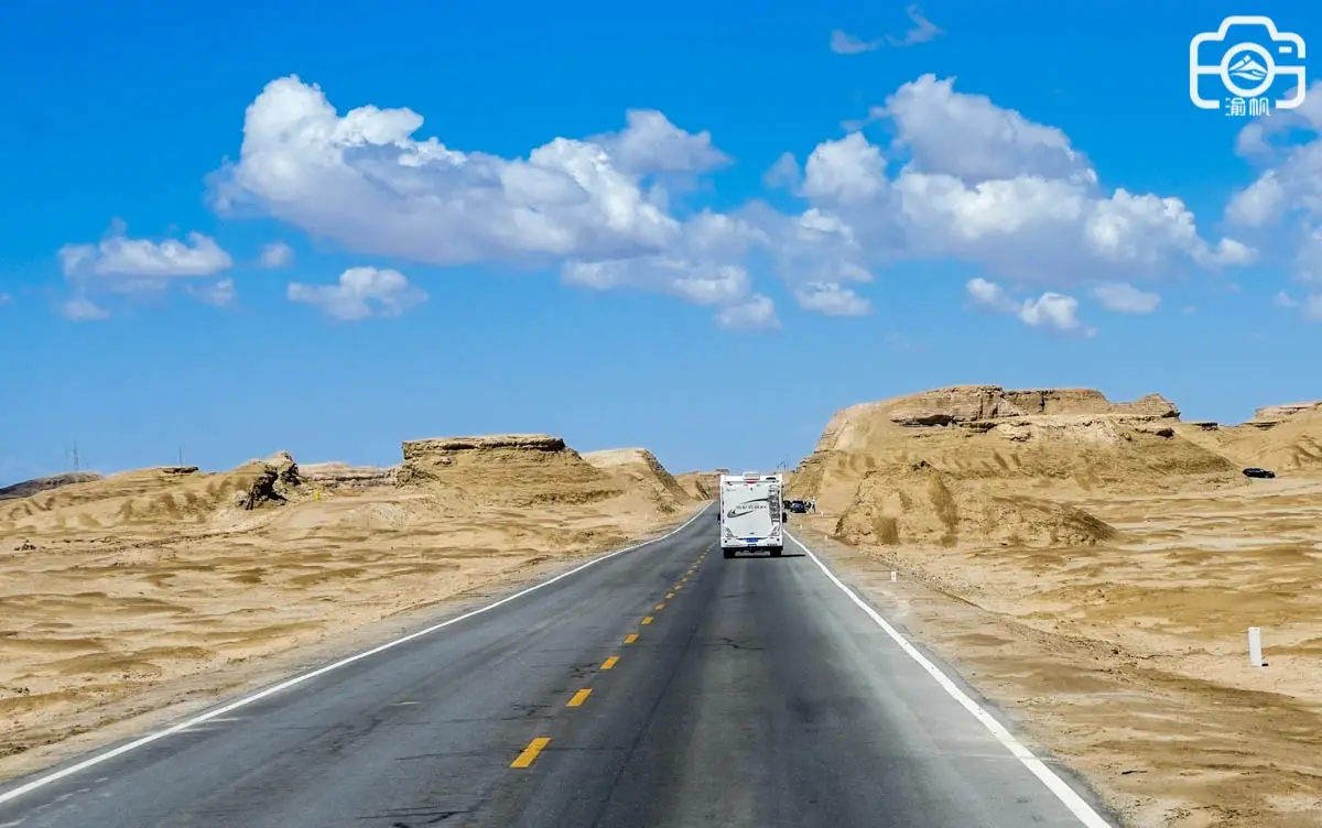
National Highway 315 starts from Xining West, the capital of Qinghai Province in the east, and extends west to Shache County in Kashgar, Xinjiang. Hence, it is also called the Xisha Line. With a total length of 3,063 kilometers, the road stretches along the edge of the Taklamakan Desert at the foot of the Kunlun Mountains, crosses Lop Nur, traverses the Altun Mountains, crosses the Qaidam Basin, and skirts Qinghai Lake. Like a black ribbon, it strings together deserts, gobi deserts, saline-alkali flats, saltwater lakes, and other unique natural landscapes. The scenery along the way is picturesque and endlessly beautiful.
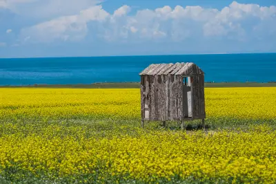
This national highway connects Qinghai and southern Xinjiang, stretching from the Qinghai-Tibet Plateau deep into southern Xinjiang. Along the way, you not only see the towering Kunlun Mountains and boundless gobi deserts, but also the Taklamakan Desert, the uninhabited Altun Mountains region, and the magical Qaidam Basin. Attractions are scattered along the route: Kumbum Monastery (Tar Temple), Qinghai Lake, Water Yadan, Delingha Alien Ruins, Harihatu, U-shaped Road, West Taijinar Lake, Jade Lake (Feicui Lake), Water Yadan, Devil's Eye, Dachaidan Lake, and more.
We haven't traveled the entire route, but we did drive the section from Golmud to Mangya in Qinghai. There were many beautiful sights along the way. Here are some representative attractions to share with you:
**Qarhan Salt Lake** is not far from downtown Golmud, right beside National Highway 315, located in the southern Qaidam Basin. The salt lake stretches over 160 kilometers from east to west and 20–40 kilometers from north to south, with a salt layer thickness of about 2–20 meters. Covering an area of over 5,800 square kilometers—almost 56 times larger than Caka Salt Lake—it is China's largest natural salt lake and the largest soluble potassium-magnesium salt deposit. Its salt reserves could feed the entire human population for 1,000 years. The lake water is as green as jade, making it an excellent spot for photos.
On the way from Golmud to West Taijinar Lake, at the 757-kilometer mark of G315, there is a "U-shaped" road. In recent years, it has become wildly popular, gaining fame as Qinghai's most beautiful internet-famous road. Especially when shot with a telephoto lens, the road appears like a U-shape.
Because so many people stop to take photos here, several traffic accidents have occurred. Now, parking on the road for photos is strictly prohibited. To capture the charm of this road, we tried using drones. Unfortunately, during the flight, Yu Fan's drone collided with a friend's drone in midair. The friend's drone fell onto the road and shattered. Although my drone fell into sandy soil and could still fly, it got filled with sand and had to be sent for repair afterward.
**East Taijinar Lake**
Continuing past the U-shaped road for about an hour and a half, we arrived at East Taijinar Lake, one of Qinghai's hottest attractions in the last two years. Due to its high copper content, the lake water appears mint green, sometimes showing a sophisticated Tiffany blue. Regrettably, when we arrived, this beautiful scenery had disappeared. What we saw was an endless gobi desert. Only by flying a drone could we see a blue lake in the far distance.
**Tai Ji Nai Er Wild Luxury Town**
Beside East Taijinar Lake, there is a wild luxury town called Tai Ji Nai Er, featuring projects like the Lonely Star Gobi Wild Luxury Hotel and the Utopia International Self-Driving Camp. It is said to be a key cultural tourism project introduced by Qinghai Province, with an investment of 2.6 billion yuan. It includes salt lake Yadan villas, dome starry rooms, luxury RVs, and wild luxury tents, serving as the best transit hub and rest stop in the area.
Continuing onward, you reach the world's only water Yadan landform—**Wusute Water Yadan**. This place is unique, mysterious, fantastical, and magnificent. It is said that there was no water here originally, but later, heavy rains caused mountain floods, diverting the Narin Gol River, which originates from the Kunlun Mountains. The floodwaters submerged this area, forming the current water Yadan landform.
The small islands on these lakes take on various shapes—some resemble animals, others look like ships. From a distance, they seem like thousands of horses galloping or thousands of ships setting sail—truly magical. Seen from above, it presents another beautiful scene, like a Qinghai version of the Maldives.
**West Taijinar Lake**
Not far from Water Yadan and East Taijinar Lake, there is a large salt lake. G315 cuts through it, forming a 3-kilometer-long water highway that splits the lake in two. Amazingly, the water on one side is blue, and the other is green, clearly distinct and completely different. People jokingly call it "half sea, half flame." This is the famous West Taijinar Lake.
**Mangya Jade Lake** is located in Mangya City, Haixi Prefecture, Qinghai, not far from the city center of Huatugou, right beside G315. It is a large man-made salt lake covering over 40 square kilometers. The lake water is a verdant green, like jade, hence its name. It leans against the Kunlun Mountains in the south and the Altun Mountains in the north, and has become a popular self-driving destination.
**Devil's Eye Aiken Spring**
Aiken Spring is not far from Jade Lake, also under Mangya City, specifically in Mohe'erbuluke Village, Huatugou Town. It is called the "Eye of the Earth" or "Devil's Eye." It is a geothermal spring shaped like an ellipse. The surrounding area is barren, forming a reddish-brown circle, with gushing water resembling a giant eye. When I visited, it wasn't popular yet, and I didn't have a drone, so I only took photos from the ground.
**Qimantag Desert**
This desert is located at the foot of the Qimantag Mountains, a remote branch of the Kunlun Mountains. It takes about two hours by car from Huatugou to get there. Because it is rarely visited, even local friends couldn't name it. We call it the Qimantag Desert for now. In the vast gobi of the Qaidam Basin, having some desert isn't unusual. What is unusual is that this desert is flanked on one side by the lush Chekrik Grassland and on the other by the towering snow-capped Kunlun Mountains, lying right between the grassland and the mountains.
National Highway 315 is long, and Yu Fan hasn't traveled its entire length. There are still many places I haven't been to. Even so, the attractions mentioned above are all desirable destinations. So it is no exaggeration to say that this highway can rival the Sichuan-Tibet Highway and the Duku Highway as China's most beautiful self-driving road. If you have a chance, you should really come and experience it yourself.