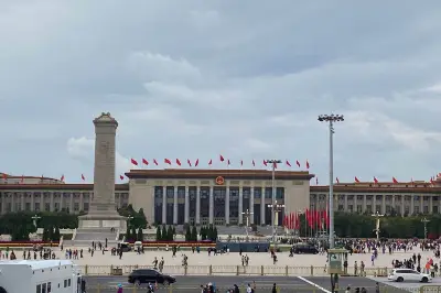
Fifteen-Day Self-Driving Tour of Hebei
When planning a self-driving tour of Hebei, there were initially two options: one was a full self-driving trip, the other was to first join a tour group and then fill in the gaps by renting a car to visit the remaining attractions. After contacting several travel agencies, except for one that couldn't start on time due to insufficient registrations, there were almost no group tours covering the whole of Hebei. Therefore, I had to design the route myself. I set the duration to fifteen days, striving to include all the major attractions in Hebei. With the agreement of three other travel companions, we officially started the full Hebei self-driving tour on May 13.
(May 14) After a 17-hour journey, train K234 arrived at Handan Station at 4:17 AM. After arranging accommodation, the car rental company delivered the car to the hotel on time. The first attraction today was Congtai Park, but the air quality in Handan was worrisome, always feeling hazy. Yet checking the air quality index showed it was excellent. I wonder if the forecast was wrong or if it was just morning mist.
The main attraction of Congtai Park is the Wuling Congtai, built during the reign of King Wuling of Zhao in the Warring States period. It was originally a high platform used for reviewing troops and enjoying music and dance. After more than two thousand years, it has remained a historical and cultural site and is one of Handan's landmarks.
Opposite Congtai is the Handan Stele Forest. The most memorable piece there is a huge epitaph, said to be the largest of its kind. It was originally commissioned by a military governor of the late Tang Dynasty, illustrating the power of regional separatist regimes at that time.
Today, Congtai is a comprehensive park and a leisure spot for Handan residents. May is the season when a hundred flowers are in full bloom.
Not far from the park is Xuebu Bridge (Learning to Walk Bridge). As an ancient city with 3,100 years of history, Handan has given rise to many idioms: "Learning to Walk in Handan," "Golden Millet Dream," "Returning the Jade Intact to Zhao," and so on.
After lunch, we drove 26 kilometers to Guangfu Ancient City. Located in Yongnian County, Handan, it is a 5A scenic area. The ancient city was first built in the late Sui and early Tang dynasties. It served as the capital of the Xia Kingdom when Dou Jiande proclaimed himself emperor, then declined but remained a prefecture-level city for 545 years during the Ming and Qing dynasties.
The ancient city is surrounded by water on all sides (actually situated in a low-lying area), making it the only dry-land water city in the north.
The city is large and still under renovation. We took a sightseeing car to the first attraction, Guangping Prefecture Office. It was rebuilt on the original site, covering 53,000 square meters with 5,600 square meters of buildings, 19 courtyards, and over 160 rooms. When we arrived, a film crew was shooting a scene.
The second attraction was Guangjun Sanwu (Three Martial Figures of Guangjun), the best-preserved Qing Dynasty building complex in the city, with three entrances and four courtyards. "One prefecture produced three jinshi scholars and two Hanlin academicians." The exquisite architecture, precious exhibits, and profound cultural connotations left a deep impression.
After visiting the ancient city, we went to Hongji Bridge nearby. Built in the Sui Dynasty, it is contemporary with the famous Zhaozhou Bridge. It is now protected and requires an entrance fee.
(May 15) We stayed overnight in Handan. Early the next morning, we drove 90 kilometers to the Memorial Hall of the 129th Division of the Eighth Route Army in She County, located at the eastern foot of the Taihang Mountains. After the visit, we followed General Ridge to the former site of the 129th Division Headquarters to continue our tour. Unfortunately, the weather was uncooperative, and heavy rain began as we arrived at the scenic area, forcing us to use our phones for photos.
From 1937, when they established the Taihang Mountain Anti-Japanese Base Area, until 1947, when they advanced into the Dabie Mountains, Liu Bocheng and Deng Xiaoping lived and fought here for nearly ten years—a considerable time. Coinciding with the 100th anniversary of the founding of the Communist Party, many visitors came to pay respects. We managed to avoid the large crowds by using a clever time gap.
After lunch in a small town near the former site, we went to another 5A scenic area nearby: Wahuang Palace (Palace of the Goddess Nuwa), a place of beautiful legend. According to legend, in ancient times, Nuwa created humans from clay and mended the sky with melted stones here. Over 8,000 years, Nuwa culture was born, leaving relics from the Northern Qi stone carvings, Tang Dynasty inscriptions, Song Dynasty brick walls, and Ming and Qing Dynasty buildings. It is one of China's five major ancestral pilgrimage sites.
At the foot of the mountain was a giant statue of Nuwa in the square.
Xiao Yang and I opted to skip the cable car and hike up the Eighteen Bends trail to the top.
There were many temples at the foot of the mountain, and pavilions stood tall on the peaks.
Northern Qi stone-carved Buddhist scriptures.
This building is known as the "Living Hanging Temple," fixed by nine iron chains; when you climb to the highest point, the structure shakes.
Descending via the Butian Valley Ecological Scenic Area offered beautiful scenery.
(May 16) We stayed overnight in She County. In the early morning, the town's air was fresh, with the sun just emerging. After breakfast at the hotel, we drove to Dongtaihang Scenic Area in Wu'an.
Dongtaihang Scenic Area is a new tourism project in the Taihang Mountains invested by CITIC Group with billions of yuan. Online hype focused only on the glass skywalk, but "if you don't see it, you won't know; once you see it, you'll be amazed." The beauty of the Taihang Mountains and the completeness of the tourist facilities rival the "Five Finger Peaks" in the north. We took the cable car up and down and spent four hours hiking and photographing without fully exhausting the area.
The glass skywalk on the mountain was temporarily closed due to a directive from the provincial culture and tourism bureau.
The mountain body here is made of red quartz sandstone formed 1.4 to 1.8 billion years ago, characterized by Zhangshiyan landform—a natural scenic area that combines majestic, spectacular, precipitous, and steep features. Walking here was thrilling at every step, a great delight.
The mountain body exhibits feather-like cross-bedding.
Dongtaihang Mountain offers three tour routes: Route A (3 hours), Route B (4 hours), and Route C (5 hours). We chose Route A.
Red cliffs and cinnabar-colored walls—a feast for the eyes.
Cloud-walking plank paths aided by elevators.
Small scenes, big surprises.
"Tianji Lansheng" (Ridge of Heaven Overlooking the Scenery) was only viewed from afar; we did not set foot on it (Route C).
Around 3 PM, we met at the visitor center, then drove to the nearby Jingniang Lake Scenic Area. After mountain sightseeing, water view was a must!
Jingniang Lake is named after the story of Song Dynasty founder Zhao Kuangyin escorting Zhao Jingniang a thousand miles. The scenic area is essentially a dam built in a canyon, forming a reservoir similar to the Three Gorges. With high cliffs, deep valleys, a high gorge and peaceful lake, green water and red cliffs, the scenery is extraordinary.
The scenic area can be divided into water tours, island tours, and dock leisure tours. Due to time constraints, we chose to take a boat first, then disembark and walk back to the dock along the lakeside plank path.
(May 17) Since we had to return to Handan in the evening to change the car (due to an air conditioning malfunction), we had to leave Jingniang Lake early. In the morning, we drove another 150 kilometers to Zhaozhou Bridge Scenic Area in Zhao County, Shijiazhuang. This marked the end of our Handan area tour.
The desire to visit Zhaozhou Bridge stemmed from elementary school textbooks; with a long-cherished wish, I naturally included it in the itinerary. Unfortunately, today's Zhaozhou Bridge is a reconstructed version.
Many inscriptions from successive dynasties record and praise the bridge.
After visiting Zhaozhou Bridge, we went to Baodu Village in Luquan District, Shijiazhuang, about 65 kilometers away. It is a famous mountain and ancient stockade combining history, culture, and natural scenery, rising from the North China Plain and connecting to the endless Taihang Mountains in the west. The flat summit has over 600 mu of fertile farmland, earning it the titles "Unique Stockade Under Heaven" and "Blessed Land of Baodu."
We first took a box cable car (40 yuan) to the Southern Heavenly Gate, then walked along the long city wall to Jinquan Palace, then to the House of the Cowherd and Weaver Girl, through the woods, and back to the Southern Heavenly Gate.
The main attraction of Baodu Village is the stockade wall winding along the cliffs, about 2 kilometers long. From the top, you can overlook the land of Yan and Zhao.
The stockade wall meanders along the precipitous cliffs, looking extremely steep from a distance.
According to records, in 204 BC, Han Xin defeated the Zhao army here with his back against the river, giving rise to the idiom "burning one's boats." Zhang Sanfeng, founder of Taoism, also once stayed here.
With this visit concluded, we originally planned to go to Cangyan Mountain today, then stay in Shijiazhuang to prepare for Xibaipo the next day. But it was getting late, so we decided on the spot to stay nearby (Luquan District) and visit Cangyan Mountain early tomorrow, then go to Xibaipo and later to Zhengding to see the night view. Thus, Deming Ancient Town stepped from behind the scenes to the forefront.
Deming Ancient Town is not really ancient! The government aims to create a new model and new format that embodies Yan-Zhao culture, attracts high-end artistic talent, and fosters innovation. Therefore, the architecture draws from various sources, condensing the essence of different periods, forming a new place for eating, clothing, housing, shopping, and entertainment. Located in Changqing Tourism Area of Shijiazhuang, it is naturally very popular.
(May 18) Cangyan Mountain Scenic Area is located in Jingjing County, 50 kilometers southwest of Shijiazhuang. It is a national scenic park with temples, academies, stele pavilions built on dangerous cliffs, deep valleys, and steep walls, blending with the surrounding mountains, pines, and ancient cypresses. The scenery is beautiful, and many films and TV shows have been shot here.
Setting out from Luquan, we drove along the eastern section of the "Taihang Sky Road" for over an hour. We first took the cable car to the top, then hiked down. Everyone was delighted and felt we had gained a lot.
Leaving Cangyan Mountain, we drove another hundred kilometers to the red-education holy land of Xibaipo on a smooth expressway. Xibaipo was the last headquarters of Mao Zedong and the Party Central Committee on the eve of national liberation. Although they stayed only for a little over ten months, it was a turbulent period in the Chinese revolution. Every event that occurred here has historical value.
We first visited the Xibaipo Memorial Hall, then toured the former sites of the Party Central Committee, Mao Zedong's former residence, and the site of the Seventh Plenary Session of the Second Central Committee. We paid tribute to the great achievements of our predecessors and received further education in the red revolution.
Site of the Second Plenary Session of the Seventh Central Committee.
That day, we rushed to Zhengding, took a taxi to the Hutuo River (Zhengding has restricted driving zones), and then to the South Gate. As the sun set, the city wall towers were lit up with lanterns. Zhengding's beautiful night view finally satisfied our long-cherished wish.
Compared to twelve years ago, Zhengding has undergone a complete transformation, reborn from the ashes. We had dinner at the night market and stayed at Hanting Hengshan West Road Hotel.
(May 19) Today we entered the third leg of our Hebei self-driving tour—Baoding. In the morning, we drove 103 kilometers from Zhengding to Ranzhuang Tunnel Warfare Memorial Hall in Baoding.
Ranzhuang is located in the central Hebei plain. Starting in 1938, tunnels were dug, eventually forming a network of 4 main lines and 24 branch lines, totaling 16 kilometers, radiating in all directions and crisscrossing at different levels. Using the tunnels, they fought 157 battles against the enemy, killing or wounding over 2,100 enemy soldiers, and were awarded the title "Tunnel Warfare Model Village."
From the memorial hall, we directly entered the tunnels and emerged from the village. The visiting route was well arranged.
The old locust tree at the village head is the best witness to the battles.
Crossfire network that once caused the enemy regiment commander's death.
Tunnels below, blockhouses above.
Shooting holes everywhere.
Photo with the son of the old anti-Japanese village head. Ranzhuang is also the filming location for many movies and TV shows, such as "Tunnel Warfare," "Plain Guerrilla Unit," and "Lao Zi Ying Xiong."
From Ranzhuang to Baiyangdian, we had to take this 76-kilometer road. Baiyangdian consists of many lakes, islands, and waterways, a densely water-netted, reed-covered area, and a land of fish and rice. During the anti-Japanese war, the Yanling (Wild Goose Feather) Detachment was formed, growing from over 30 to over 100 members, fighting more than 70 battles, with only 8 sacrifices, yet killing or capturing nearly 1,000 Japanese and puppet soldiers, composing a magnificent epic.
Online, Baiyangdian Scenic Area was shown as closed, but there is always a way. We paid 100 yuan per person to charter a boat, entered the scenic area (two islands), then cruised the lake surface and entered the reed marshes. At least this trip wasn't in vain, fulfilling a long-held wish.
Once at Baiyangdian, Xiongan New Area was not far (we planned to drive through the new area and see the construction). But the new area is huge, so we only targeted the newly opened Xiongan High-Speed Railway Station. That night, we stayed at Pistone Business Hotel in Zangang Town, Xiong County.
(May 20) The Baoding region is rich in tourism resources. Considering factors like license plate restrictions, we adjusted our itinerary. Today we directly visited the Western Qing Tombs. Yesanpo, Zhili Governor's Office were postponed to the return trip.
The Western Qing Tombs are located in Yi County, northwest of Baoding, about 87 kilometers from Baoding. They house four Qing emperors, complementing the Eastern Qing Tombs in Zunhua. The scenic area is large, and the distance between tombs is considerable. Although there are shuttle buses, due to the interval and off-season factors, we chose to drive our own car.
Tailing (Yongzheng)
Muling (Daoguang)
Chongling (Guangxu)
Changxiling (Jiaqing)
After visiting the Western Qing Tombs, it was already noon. We encountered a traffic jam on Jinghuan Road in Xiongan, which cost us nearly an hour. To save time, we had a quick meal. From the Western Qing Tombs to Baishi Mountain was about 79 kilometers. We arrived around 2:30 PM, but due to hailstones on the mountain, the cable car was suspended, so we had to take a bus, wasting more time.
Baishi Mountain is located 15 kilometers south of Laiyuan County, Baoding City, Hebei Province. It towers at the northernmost end of the 800-mile Taihang Mountains, with the highest peak, Foguangding, at 2,096 meters. The scenic area integrates peak forests, strange rocks, precipices, canyons, forests, sea of clouds, Buddha's light, and the Great Wall, making it the top mountain in northern China.
It is also a UNESCO Global Geopark, with many geological wonders.
Fortunately, by evening, the weather improved, and we finally witnessed the awe-inspiring beauty of northern China's premier mountain.
Baishi Mountain is vast and beautiful, with two entrances and three cableways. Due to time constraints, we only saw a part of it.
(May 21) That day, we rushed to stay in Yuxian County (GreenTree Inn Bus Station Branch). Yuxian, anciently called Yuzhou, was first built in the second year of Daxiang of the Northern Zhou Dynasty. The current ancient city was rebuilt in the tenth year of Hongwu of the Ming Dynasty. The ancient city is rich in cultural relics and historic sites, and is now a famous historical and cultural city in Hebei Province.
Yuzhou Government Office (rebuilt in 2011)
Yuzhou Ancient Castle is 10 kilometers from the ancient city. Its predecessor was a military garrison and has been preserved; no entrance fee is required. The newly built Nuanquan Ancient Town is speculated to be used for performing "Tree Flower Fire display."
From Yuxian, we drove two hours to Dajingmen Scenic Area in Zhangjiakou. This is a pass of the Great Wall and a gateway to protect Beijing, as famous as Shanhaiguan, Jiayuguan, and Yulin. High mountains stand on both sides, with the Great Wall winding along them, truly a place where one man can hold the pass against ten thousand. We didn't linger in Zhangjiakou but headed directly north to the important northern town of Zhangbei County to stay (Hanting Zhangbei Branch).
Zhangbei County's landmark—Lansheng Gate.
(May 22) Zhangbei County is one of the first batch of national pilot cities for new urbanization. The streets are clean and orderly, with a fresh city appearance. During a conversation with a restaurant owner, they expressed high hopes for Zhangbei's future. The eastern entrance of the "Grassland Sky Road," comparable to Route 66, is at Yehu Ridge in Zhangbei, and the exit is at Huapi Ridge in Chongli, with a total length of about 89 kilometers. Built in 2011, the road has an average altitude of 1,400 meters, winding and undulating, presenting northern grassland scenery, highly favored by self-driving enthusiasts.
Wind turbines everywhere.
Not far from Huapi Ridge is Chongli County town, and then soon is the 2022 Winter Olympics skiing venue—Taizicheng. The high-speed rail station and expressway have been completed and opened, and the Olympic Village and some venues are in interior decoration.
To prepare for the Jinshanling Great Wall tomorrow, we moved our planned accommodation to Changping, Beijing. Along the spacious and new Jingchong Expressway, we arrived in about an hour and checked into the 7 Days Inn Changping Metro Station branch. We had lamb soup and meat pies on the street.
(May 23) From Changping, it took about 2 hours (150 kilometers) to drive to Jinshanling Great Wall. After parking and buying tickets, we took a battery car to the cable car station. We agreed to go left after arriving at the top, then turn back to form a "T" shape, finally meeting at the mountain base visitor center.
The weather was bad—moderate pollution!
Jinshanling Great Wall connects to Gubeikou Great Wall in the west and Simatai Great Wall in the east. It stretches for over ten kilometers, with 5 passes, 67 enemy towers, and 3 beacon towers. The entire scenic area features undulating mountains. Climbing high and looking far, the Great Wall looks like a dragon winding above the mountain peaks—very spectacular and desolate.
Jinshanling Great Wall is located in Luanping County, Hebei Province. It was first built in the first year of Hongwu of the Ming Dynasty under the supervision of General Xu Da. In 1567, the famous anti-Japanese general Qi Jiguang, as the commander of Jizhen, continued and modified it. It is now a well-preserved Ming Dynasty Great Wall.
By 2 PM, we were done at Jinshanling. We drove to nearby Gubeikou to find accommodation. A young woman recommended a place. Actually, Gubeikou had been transformed into Gubei Water Town (entrance fee 180 yuan). We stayed at her house, which had been relocated by the government and turned into a B&B, large-scale and quite nice.
She mentioned that the nearby "Ancient Imperial Path" is worth a visit, and the night view of Gubei Water Town is beautiful, so we could go there in the evening. After a short rest, we visited Ancient Imperial Path Village and the Great Wall Anti-Japanese War Memorial Hall.