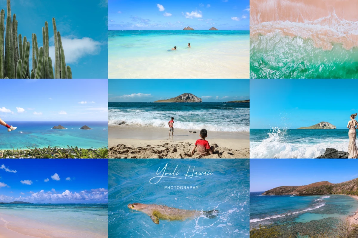
Hawaii Travel Guide: Oahu's Southeast Coast Day Trip Itinerary and Attractions
Due to the late volcanic activity on Oahu being primarily concentrated along the southeastern coast, this region still retains noticeable traces of volcanic activity. These unique terrains and landscapes are favored filming locations for many Hollywood movies and TV series. The southeastern coast of Oahu offers scenic viewpoints and hiking trails, and it is home to some of the best sandy beaches on the island and even in all of Hawaii. Sunny weather is the best time to visit the southeastern coast of Oahu; the various colors of the sea will keep you mesmerized, and in winter, there's a chance to see whales in the ocean. The southeastern coast receives less rainfall and is relatively arid, so the vegetation and weather differ greatly from other parts of Oahu. Additionally, two of Hawaii's prestigious upscale residential areas are located on Oahu's southeastern coast.
Based on years of experience, I have divided the southeastern coast of Oahu into five areas in order: ① Diamond Head & Kahala; ② Hanauma Bay & Koko Head; ③ Makapuu; ④ Waimanalo; ⑤ Kailua & Lanikai. Below, I will provide a detailed introduction to each area, which covers almost all the attractions along the southeastern coast of Oahu.
If you enjoy natural scenery, flowers and trees, and love outdoor activities, you can spend two days or more deeply exploring the southeastern coast of Oahu. If you only want a quick tour, one day is sufficient. You can follow the order I listed as a self-driving day trip route around the island, mainly along scenic roads such as Kalakaua Avenue, Diamond Head Road, Kahala Avenue, Kalanianaole Highway, and Pali Highway. When driving around the island, remember to go counterclockwise for easier access to attractions and parking.
Tips: 1. Apply sunscreen; the sunnier it is, the more beautiful the seawater will be. 2. Do not leave valuables in the car, and do not hide anything on the vehicle. 3. Stay safe; be cautious of cliffs, rocks, and waves at the beach. 4. Swim or snorkel in areas with lifeguards when possible. 5. Wear non-slip, comfortable athletic shoes for hiking, bring enough drinking water, and do not engage in illegal hiking activities. 6. Follow traffic rules; do not take photos on the road or park in the middle of the road—be responsible for others and yourself.
I. Diamond Head & Kahala
1. Lookout and Beach at the Foot of Diamond Head
Rating: 3 stars
From Waikiki, drive east along Kalakaua Ave, then onto Diamond Head Rd. After passing a luxury residential area and a lighthouse, there are three small lookouts by the roadside. On Google Maps, you can navigate to the middle lookout, Amelia Earhart's Marker. From here, you can overlook the narrow beach below the cliffs and the nearby beachfront mansions. Amelia Earhart was the first female pilot to fly solo across the Atlantic Ocean and the first to fly solo from Hawaii to the U.S. mainland. Unfortunately, she disappeared in 1937 while flying from Hawaii to Australia. A small monument stands beside the lookout to commemorate this outstanding woman. The lookouts have parking spaces, and there are parking spots along Diamond Head Rd.
The narrow beach below the cliffs includes, from right to left, Diamond Head Beach Park, Kuilei Cliffs Beach Park, and Cromwell's Beach. Due to rocks and waves, this area is not suitable for swimming and sees fewer visitors, but it is a paradise for surfers. The beach is long and narrow with three main access points: you can reach the beach via a paved path from the first lookout; there is a shower facility at the entrance by the road. Note that although the beach is called a beach park, there are no lifeguards, toilets, or changing rooms. Currently, the shower at the end of the path below the cliffs is out of service, so the only shower in this area is at the entrance by the road. You can also access Diamond Head Beach Park via the end of Beach Rd, a short dead-end street where you can park but the road is narrow. Alternatively, you can enter Cromwell's Beach via the end of Kulamanu Pl, but you cannot park on that street; parking is available on adjacent Kulamanu Street. There are also some unofficial trails from the lookout down to the beach, used by many surfers as shortcuts.
Diamond Head Beach Park is located below the lighthouse, mainly a rocky beach. You might encounter illegal sunbathers or homeless people camping on the cliffs. However, there is a large tidal pool here, great for photos. Many Japanese models have taken photos on this beach. Kuilei Cliffs Beach Park has green sand that sparkles in sunlight due to calcite crystals. British sailors once mistook these sparkles for diamonds, giving Diamond Head its name. Cromwell's Beach has white sand, adjacent to multi-million-dollar mansions. The homeless on the cliffs behind Diamond Head Beach Park enjoy the same ocean breeze and views for free. This area lacks shade, so be mindful of sun protection, and swimming is not recommended.
2. Diamond Head Summit Trail
Rating: 5 stars
Diamond Head, located on the southeastern coast of Honolulu, Oahu, is one of Hawaii's most famous natural landmarks, adjacent to the Waikiki hotel district and a must-visit attraction. The summit offers 360-degree views of the ocean, mountains, and cityscape. Diamond Head is a volcanic tuff cone formed by an eruption, now an extinct volcano, about 300,000 years old. Its name comes from British sailors in 1825 who mistook calcite crystals on the beach for diamonds. Its Hawaiian name is Le Ahi, meaning "tuna" in Hawaiian, because its ridge resembles the dorsal fin of a tuna.
You can drive through a tunnel into the crater; the tunnel now has traffic lights for one-way traffic. Before the tunnel, there is a lookout called Kahala Lookout with a few parking spots, overlooking the neighboring Kahala affluent area. Because Diamond Head is very popular, vehicles often line up to enter the parking lot, especially on weekends and holidays. It is recommended to park outside the park or on nearby residential streets and walk in.
In 1906, the U.S. military established one of Hawaii's earliest forts at Diamond Head, and the trail to the summit was built in 1908. Remains of lookout posts, tunnels, bunkers, and gun batteries can still be seen. Be careful going up and down, especially on the steep stairs near the summit and the dark, narrow tunnel. The round trip from the parking lot to the summit is 1.3 km, elevation 171 meters, taking about 2 hours. Unless you can go everywhere in flip-flops like me, you'll need comfortable athletic shoes. The trail is hot and dry; bring sunscreen and plenty of water. There is a snack bar, food truck, and restrooms at the visitor center near the parking lot. Note that there are no restrooms on the trail or at the summit.
Admission: $5 per person for non-residents of Hawaii; parking $10 per car; credit cards only. Open from 6:00 AM to 6:00 PM, but the trail closes at 4:00 PM. Currently, Diamond Head is closed every Wednesday, Christmas, and New Year's Day.
3. KCC Farmers' Market [Saturdays only]
Rating: 5 stars
Hawaii's most famous farmers' market is held in the parking lot of Kapiolani Community College, just a few minutes' drive from Waikiki. Although most food in Hawaii is imported, you can find fresh local fruits, vegetables, and agricultural products here, as well as food from many renowned local restaurants. Locals love it, and tourists, especially Japanese visitors, flock here, sometimes making it crowded. Located near Diamond Head, it's a great place to eat before hiking or to grab a cold drink after hiking. Market hours: Saturday 7:30 AM – 11:00 AM. Free parking available. Due to heavy traffic and pedestrians, police direct traffic at the intersection on Saturday mornings. There are also good restaurants along nearby Monsarrat Avenue.
4. Beaches in the Kahala Neighborhood
Rating: 3 stars
Waialae Beach Park is located in one of Hawaii's premier luxury residential areas, adjacent to the Kahala Resort Hotel. Access via Kahala Ave. The park has parking, but spaces fill up on weekends and holidays; you can also park along Kahala Ave. Facilities include restrooms, changing rooms, picnic tables, pavilions, and showers. A small stream flows into the sea here, sometimes forming a small sandy beach perfect for photos. Swimming is not recommended due to many rocks underwater, even though waves are small and water is shallow. Adjacent Hunakai Beach can be accessed via small entrances on Kahala Ave.
II. Hanauma Bay & Koko Head
1. Two Hidden Spots in the Luxury Residential Area
Rating: 4 stars
Note: Cliffside, dangerous.
China Walls and Spitting Cave are hidden behind the Hanauma Bay Nature Preserve, within the residential area, and are not well-known. The entrance to China Walls is at Koko Kai Beach Mini Park on Hanapepe Place. Although called a beach park, there is no beach; it's a tiny park. You cannot park on Hanapepe Place; park on the nearby Hanapepe Loop. You can walk along the cliff from China Walls to Spitting Cave, but this is very dangerous and not recommended. The entrance to Spitting Cave is at the end of Lumahai Street; you can park on the street. A short downhill dirt path leads to a stunning view. But be careful—the fine sand on the path can be slippery.
Both China Walls and Spitting Cave are part of the extinct Koko Head volcano, formed by lava flows tens of thousands of years ago, resembling a layered cake. These unique geological features have attracted many Hollywood films and TV shows, such as "Lost" and "Journey 2: The Mysterious Island." You might see Hawaiian monk seals swimming or sleeping on rocks, and green sea turtles are almost always present.
Spitting Cave's cliffs are much higher than China Walls, making them very dangerous; stay far from the edge. The name "Spitting Cave" comes from a hole in the cliff where waves shoot out like spitting. The origin of "China Walls" is unknown; some think the cliffs reminded early namers of the Great Wall of China.
Few tourists visit these spots, but on weekends, they become a paradise for locals fishing, swimming, cliff jumping, and surfing when waves are big. The cliffs at China Walls, though lower, still pose danger when large waves crash, creating huge splashes. Stay back! In "Journey 2: The Mysterious Island," the Nautilus submarine escape scene was filmed below China Walls.
2. Hanauma Bay Nature Preserve
Rating: 4 stars
Hanauma Bay, on Oahu's southeastern coast, is one of Hawaii's most famous snorkeling destinations. "Hana" means bay, "uma" means curved, referring to the shape of ancient Hawaiian canoes. It is not related to dinosaurs; the Chinese name "Dinosaur Bay" comes from the shape of the hills resembling a dinosaur lying in the sea. Hanauma Bay is a dormant volcano, about 32,000 years old, eroded by the sea forming the bay. From the lookout by the upper parking lot, you can overlook the beach and bay. To go down to the beach and snorkel, you need to buy tickets.
After purchasing tickets, you must watch a 10-minute environmental education video before heading to the beach. There are exhibits on the bay's unique geology and ecology. If you cannot walk, a shuttle is available: $1 downhill, $1.25 uphill, paid on site. The beach has lifeguards, restrooms, changing rooms, and showers. Currently, snorkel gear rental and lockers are closed. Bring your own gear, towel, change of clothes, and reef-safe sunscreen. Stay within designated safe areas. No food stalls on the beach; you can bring your own food and drink, but do not feed marine life. There is a snack bar and gift shop near the upper parking lot, now open.
Hanauma Bay is closed every Monday and Tuesday, as well as Christmas and New Year's Day. Non-residents: $12 per person, children 12 and under free. Parking $3 per car (refundable if under 15 minutes). Only 300 parking spaces; once full, staff will not allow more vehicles. You can park on nearby Nawiliwili Street and walk in. Do not park or turn around on the highway—very dangerous, even if you see others doing it.
Due to COVID-19, only 720 tickets are available per day. Open 6:45 AM, beach closes 3:15 PM, park must be vacated by 4 PM. Tickets must be booked online; they become available after midnight.
3. Two Lookouts on the Scenic Coastal Highway
Rating: 4 stars
Lanai Lookout and Halona Blowhole Lookout are located along the coastal highway on Oahu's southeastern coast, not far apart. The winding Kalanianaole Hwy, with its unique volcanic geology, blue water, and rough waves, is one of Hawaii's most scenic drives. Many films and TV shows have been shot here, including "Pirates of the Caribbean: On Stranger Tides," "Jurassic World: Fallen Kingdom," "Lost," "Pearl Harbor," and "Journey 2: The Mysterious Island."
Both lookouts are formed by volcanic eruptions, part of the extinct Koko Head volcano, about 30,000 years old. Koko Head is one of Oahu's youngest extinct volcanoes, hence retains obvious volcanic traces visible in the rocks.
Lanai Lookout is named after the island of Lanai. On clear days, you can see Lanai and Molokai in the distance, two of Hawaii's eight main islands. "Lanai" means balcony in Hawaiian. If you climb over the wall next to the parking lot for a better view, be careful; the rocks are slippery with fine grit. Do not get too close to the ocean—waves are powerful and dangerous, living up to the movie title "On Stranger Tides." Police may or may not stop people from climbing over the wall.
Halona Blowhole Lookout is very busy, with large tour buses stopping. To the left, you can see Sandy Beach and surfers. When waves are strong, water shoots up from a hole in the rocks below, a spectacular sight. "Halona" means lookout in Hawaiian. To the right, below the cliff, is a small cove with a sandy beach, where the mermaid scene in "Pirates of the Caribbean: On Stranger Tides" was filmed. A lava tube that can lead to the other side of the road is nearby; in "Journey 2: The Mysterious Island," the characters used a similar tube to reach the island. You can take an unmarked trail from the parking lot to the cove, but be careful. In winter, you have a good chance of seeing whales off the southeastern coast.
4. Surfing Beach
Rating: 3 stars
Sandy Beach is a popular local surfing spot, adjacent to Wawamalu Beach Park. It has parking, restrooms, changing rooms, showers, benches, and sparse shade trees. Waves are large and dangerous year-round; lifeguards prevent swimming. Watch the surf show. Sometimes people fly kites on the grass. On weekends and holidays, food trucks sell drinks and food. The Wawamalu Beach Park side is mainly rocky with tidal pools—explore but be careful on rocks and stay away from waves.
5. Crater Botanical Garden
Rating: 4 stars
Koko Crater Botanical Garden is located in the arid Koko Crater, featuring cacti, palms, plumeria, bougainvillea, and other endangered plants from Hawaii, Africa, and Madagascar. The plumeria and bougainvillea are beautiful in bloom. Don't miss this garden if you like cacti. Free admission. Entrance at the end of Kokonani St on the right; parking and a caretaker. Open sunrise to sunset, closed Christmas and New Year. No restrooms inside; only portable toilets at entrance. Nearest restrooms at Sandy Beach. Trails are unpaved; wear athletic shoes and bring water. Pick up a map at entrance or download online to avoid getting lost. The full loop takes 1.5–2 hours; you don't have to do it all. The bougainvillea and plumeria groves are near the entrance, and the popular cactus area is just a 10-minute walk one way.
III. Makapuu
1. Shoreline Trail
Rating: 3 stars
Kaiwi Shoreline Trail is at Makapuu, the southeasternmost tip of Oahu. There are two trailheads. One at Makapuu Lighthouse Road, sharing parking with the lighthouse trail. The lighthouse trail is paved uphill; the shoreline trail is a gravel path towards the sea, leading to a small cove with sand where people play. The other trailhead is at Kaloko Beach near Wawamalu Beach Park, an easily missed beach because rocks separate sand from sea, so few visitors come. Parking at Kaloko Beach is tricky; the lot is bumpy and may scrape your car. The shoreline trail from Kaloko Beach offers beautiful scenery, two hidden, quiet coves, and you can see mangrove trees and other unique coastal plants. Great for hiking and photos. A photo book by Kyoko Fukada includes shots from this area. Bring sunscreen, plenty of water, and athletic shoes. The southeast coast is dry and hot.
2. Lighthouse Trail
Rating: 5 stars
Makapuu Point Lighthouse Trail is located at the easternmost tip of Oahu, a very popular hiking trail, about 1.6 km one way. The trail is paved, smooth, and gently sloping, easy enough for strollers. The scenery is magnificent; on clear days you can see Molokai and Lanai islands. In winter, it's an excellent whale-watching spot with high chances of sightings. "Makapuu" means "bulging eyes" in Hawaiian.
At the summit, you get breathtaking views of Oahu's southeastern coast and a lighthouse built in 1909, but the lighthouse and surrounding land belong to the Coast Guard; the short path to it is closed. There are remnants of bunkers and military posts. No admission fee. The gate at the entrance of Makapuu Lighthouse Road opens at 7 AM and closes at 6:45 PM. Parking is available along the road and at the end. On weekends and holidays, spaces fill up. Little shade; bring sunscreen, plenty of water, and athletic shoes. No restrooms on the trail or at the summit.
3. Best Roadside Lookout
Rating: 5 stars
Makapuu Lookout on Kalanianaole Hwy at Oahu's easternmost point is arguably Hawaii's most beautiful roadside lookout. Do not miss it. View of a beach park, two offshore islands, and ever-changing seawater colors define a stunning coastline. The view here surpasses any painting. Nearby are remnants of bunkers from the Pacific War, with windows facing the beach to prevent Japanese landings. The two uninhabited islands are Kaohikaipu (small) and Manana Island (big), also called Rabbit Island because of its shape like a rabbit head. (Makes me miss Chengdu's rabbit heads!) Rabbits were introduced in the late 19th century but eradicated due to ecological damage. Both islands are late-stage extinct volcanoes; now bird sanctuaries with tens of thousands of seabirds and many monk seals. Landing is prohibited without permission from the Hawaii Department of Land and Natural Resources. Note: The parking lot has a time limit; you may get a ticket if overstaying.
4. Easternmost Beach Park
Rating: 4 stars
Makapuu Beach Park is the easternmost beach park on Oahu, a surfing spot with strong waves year-round. "Makapuu" means "bulging eyes." Parking, restrooms, changing rooms, picnic tables, showers available. Lifeguards on main beach; swimming not allowed. Besides the main beach under the right cliffs, there are two small beaches called Kaupo Beach on the left, with rocks. These are often overlooked and have no lifeguards. The middle beach has very strong waves and deep water; do not swim there. Little shade; only sparse shrubs and a few coconut trees. Large rock areas form tidal pools, great for photos but be prepared for sharp rocks; be careful.
Nearby are two uninhabited islands: Kaohikaipu (small) and Manana Island (big), also called Rabbit Island (shaped like a rabbit head—makes me miss Chengdu's rabbit heads!). Rabbits were introduced in the late 19th century but were removed due to ecological damage. Both are late-stage extinct volcanoes, now seabird sanctuaries with over 100,000 seabirds and many monk seals. No landing without permission.
Along the road, you can see special coastal plants like Hawaiian sandalwood (Santalum ellipticum), a type of sandalwood exported to China in the early 19th century. The Hawaii Marine Life Park is next to Makapuu Beach Park; the male lead in the movie "50 First Dates" worked there.
5. Marine Research Pier
Rating: 3 stars
Makai Research Pier on Oahu's southeastern coast belongs to the University of Hawaii's Marine Center, open to the public. Many locals fish here. A few parking spots outside the gate. The area under the pier is a popular photo spot, especially on Instagram, visited by many Japanese girls.
IV. Waimanalo
1. Best Beach for Swimming
Rating: 5 stars
Kaiona Beach Park is on Oahu's southeastern coast, together with neighboring Waimanalo Beach Park and Bellows Field Beach Park forming the longest beach on Oahu. "Kaiona" means "charming sea" in Hawaiian, and it lives up to its name; on sunny days, the sea is beautiful. Notable for remnant seawalls that block waves, creating clear, sandy pools perfect for swimming and relatively safe. These seawalls once enclosed ponds where chiefs raised sea turtles for food. Park has parking, restrooms, changing rooms, picnic tables, showers, and plenty of shade trees, but no lifeguards. Few visitors on weekdays; on weekends and holidays, locals fill the area, making parking tight. A mansion being built behind the seawall will be the future home of Barack and Michelle Obama.
2. Best Beach in the USA
Rating: 5 stars
Waimanalo Beach Park on Oahu's southeastern coast, together with Bellows Field Beach Park (left) and Kaiona Beach Park (right), forms Oahu's longest beach. The sand quality is excellent, like white sugar. The water is beautiful, blue even on cloudy days. The park has large groves of ironwood trees (often mistaken for pines; they are actually Casuarina, native to Australia, also called Australian pines). Plenty of shade.
Waimanalo Beach Park is divided into two main areas. First area is near Kalanianaole Highway, adjacent to Kaiona Beach Park, with two adjacent parking lots, restrooms, changing rooms, picnic tables, showers, and lifeguards. There is also a campsite available for reservation, but conditions are not ideal; homeless tents can be seen nearby. The second area is near Bellows Field Beach Park, accessible by driving through a forest. It also has parking, restrooms, changing rooms, lifeguards, picnic tables, showers, and a better campground. Waimanalo Beach was once named one of America's best beaches but is less known among tourists, so fewer crowds except on weekends and holidays. Great for a day of surfing (bring your board) and BBQ.
Historical note: On December 8, 1941, the day after the attack on Pearl Harbor, a Japanese midget submarine ran aground in the bay due to damage. A unconscious ensign, Kazuo Sakamaki, washed ashore and was captured, becoming America's first POW of WWII. After the war, he worked for Toyota until his death in 1999.
Adjacent Bellows Field Beach Park is located within an Air Force Base and Marine Corps training area. It has parking, restrooms, changing rooms, showers, lifeguards, picnic tables, vacation rentals, and campsites with plenty of ironwood shade. It's perhaps the best and safest beach camping on Oahu, but it is not open to the public; access requires a military ID.
V. Kailua & Lanikai
1. Obama's Vacation Beach
Rating: 5 stars
Kailua Beach Park is in the affluent Kailua community on Oahu's southeastern coast, known for windsurfing and kiteboarding. "Kai" means sea, "lua" is short for "elua" (two), referring to two rivers entering the sea at both ends of the beach. Three parking lots, restrooms, changing rooms, showers, picnic tables, benches, lifeguards. Sand is fine like flour. Many ironwood and coconut trees for shade; perfect for picnics and BBQs with family and friends. Kailua is also a popular kayaking spot; many kayaks are stored in the park. You can rent kayaks and paddle to nearby Popoia Island or further to Mokulua Islands off Lanikai Beach.
Since Kailua Beach is long, there is another entrance at Kalama Beach Park in the middle, between multi-million-dollar homes, with parking, restrooms, changing rooms, showers. During his presidency, Obama often rented a beachfront home in Kailua for Christmas. Kailua Beach has also been named one of America's best beaches. Due to its fame and nearby Lanikai Beach, crowds flock especially on weekends and holidays, causing severe traffic and parking issues that annoy residents. Avoid on holidays.
2. Bunker Hike
Rating: 5 stars
Lanikai Pillbox Hike, also called Kaiwa Ridge Trail, is in Lanikai, Kailua community on Oahu's southeastern coast, a popular hiking route. Only about 20 minutes one way to the summit, but the trail is unpaved, with some sections steep and close to cliffs, and the fine sand can be slippery. Use caution. At the top, two remaining bunkers (pillboxes) from WW2 Oahu defense system. If you don't mind heights, sitting on top makes for great photos. The summit offers 360-degree views: ocean, mountains, Lanikai Beach, the two offshore islands, and the Koolau Range. Little shade; bring sunscreen, plenty of water, and wear non-slip athletic shoes. Trailhead is on the left before a community gate on Kaelepulu Dr; it's hidden but easy to find by following hikers. No parking; find street parking in Lanikai, being careful not to park illegally.
3. World's Best Beach
Rating: 5 stars
Lanikai Beach in Lanikai, Kailua, Oahu. "Lanikai" means "heavenly sea" in Hawaiian. This half-mile beach is often ranked as one of America's best beaches and is the only U.S. beach to be named one of the world's best. No lifeguards, restrooms, showers, or public parking. Park on nearby streets, but watch for illegal parking; fines are high. Access via narrow walkways between mansions. Weekdays are relatively uncrowded; weekends and holidays become lively, with very limited parking and heavy traffic. Lanikai Beach has fine, white sand and gentle waves, perfect for swimming, snorkeling, and kayaking. Two offshore islands: Mokulua and Moku Iki; both are seabird sanctuaries. Only Mokulua has a beach you can land on by kayak. Lanikai is a great spot for sunrise and full moon views. However, the beach is shrinking due to erosion from seawalls built by adjacent mansions; it has reduced from one mile to half a mile.
It took me a month to finally finish this travel guide. My knowledge is limited, and writing is hard work. Although I wrote a similar guide about Oahu's southeast coast six years ago, consider this an upgraded Plus version.
Please do not steal my photos, text, or rewrite without permission. Reprinting must be with my consent and attribution. Thank you!


