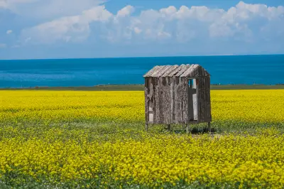
Self-driving Trip on G318 into Tibet and G109 out of Tibet in August 2021
In August 2021, my spouse and I drove a Mazda 6 sedan from the southern route of G318 Sichuan-Tibet Highway into Tibet and exited via the G109 Qinghai-Tibet Highway, passing through Ya'an, Luding, Kangding, Xinduqiao, Yajiang, Litang, Daocheng Yading, Batang, Zuogong, Basu, Bomi, Nyingchi, Lhasa, Nagqu, Tanggula Mountain Town, and Golmud, completing the self-driving trip along the G318 into and G109 out of Tibet in 15 days. Due to special circumstances, there were very few self-driving cars and cyclists on the G318 line. We didn't encounter the rainy season of the G318 Sichuan-Tibet Highway, no landslides or mudslides. Overall, the road conditions were good, and there were basically no traffic jams along the way. A few sections on the G318 line, such as Haitong Gully, Jueba Mountain, and Bomi, were under construction, with poor road conditions in some places, making it difficult for a sedan to pass and easy to scrape the undercarriage. The entire G109 Qinghai-Tibet Highway is above 4,000 meters above sea level, with many large trucks, long stretches through uninhabited areas, and poor road conditions in some places, making it difficult for a sedan. My speed was generally around 40-50 km/h; if I wasn't careful and drove too fast, the bottom would scrape. Both the G318 Sichuan-Tibet Highway and the G109 Qinghai-Tibet Highway wind through high mountains and ridges, with high altitudes, many curves, narrow roads, and numerous ups and downs. Driving requires extreme caution, overcoming long-distance driving fatigue and potential altitude sickness. When meeting oncoming vehicles, you must slow down, and never overtake in areas with poor visibility like curves and slopes. On long trips, it's essential to develop the habit of regularly checking the vehicle's condition, especially the tires. Previously, we read online guides about self-driving trips on the Sichuan-Tibet and Qinghai-Tibet highways and planned a route. Later, due to the impact of the mask mandate, we didn't follow the original plan entirely. We got tested in Daocheng County, Zuogong County, Basu County, Lhasa City, and Golmud City. From Hanzhong to Ya'an, we passed through the Qinling Mountains, with many tunnels on the highway. Ya'an Covered Bridge, with the Qingyi River below. A patchouli fish restaurant near Ya'an Covered Bridge. The entrance to Luding Bridge scenic area. Observation deck halfway up Zheduo Mountain (after paying, you can get hot water and use the restroom). Overlooking Zheduo Mountain. Climbing a short slope from the white pagoda at the edge of the parking lot, the view from the hillside is excellent. This is the first mountain above 4,000 meters on the way into Tibet, a chance to acclimate to the plateau climate. Parking lot at the top of Zheduo Mountain. Originally planned to stay overnight in Batang County. Since Yajiang County didn't require test reports, we checked online in advance and found that Batang County also had no requirement for test reports, assuming both Yajiang and Batang were in Sichuan Province, we planned to get tested in Batang. Around 3 PM, we arrived at the checkpoint in Batang County and were told we couldn't enter without a test report. We had to return to Litang County. Many cars turned back to Litang. Litang only conducts tests in the morning, not in the afternoon. Going to another city was too far, and time was short, so we had to stay overnight in Litang at an altitude of 3,900 meters. That night, I suffered from altitude sickness with symptoms like headache, dizziness, nausea, and shortness of breath. It was very uncomfortable. Fortunately, I drank some hot water and porridge, took some medicine, added warm clothes, and slowly got through it. By the next day, the symptoms were largely gone. We brought a 10-liter oxygen tank (a friend who had been to Tibet lent it to us, worrying about our altitude sickness) and bought four small portable oxygen cans. I insisted on not inhaling oxygen, and later on the trip, I didn't have altitude sickness again and didn't use oxygen. Observation deck at Jianziwan Mountain. Observation deck at Xiongzongka. Observation deck at Nimagong Holy Mountain. Observation deck at Kazila Mountain. Distant view from Kazila Mountain observation deck. West gate of Litang County. A lonely cyclist. Since I had altitude sickness at 3,900 meters in Litang the previous day, and my spouse didn't, we decided to first go to Daocheng Yading, which is at a slightly lower altitude, to acclimate to the plateau climate. The Daocheng Yading scenic area didn't require a test report either. We arrived at Shangri-La Town in Daocheng County from Litang County around noon. After lunch and arranging accommodation, we drove about 20 minutes to Daocheng Yading Scenic Area. The ticket is valid for 2 days. That afternoon, we took the short route, visiting Xiannairi, Pearl Sea (Zhuomulacuo), and Chonggu Temple. Shangri-La Town was very lively at night, with restaurants, shops, pharmacies, and hotels all available, allowing for supplies and rest. Observation deck at Tu'er Mountain. Entrance to Yading Scenic Area. From here, it takes over an hour by scenic area bus to reach the core area. Xiannairi Holy Mountain and Pearl Sea (Zhuomulacuo). Today, we continued to visit the long route of Daocheng Yading Scenic Area. In the morning, we took the bus from the scenic area entrance for over an hour to inside the area, walked for a while to Chonggu Grassland below Chonggu Temple, then took an hour-long battery car to Luorong Cattle Farm. From there, we could choose to ride a horse or hike 3 kilometers. The horse ride is paid and only one-way for 3 kilometers (no return trip). Then, we needed to climb about 2 kilometers to reach Milk Sea and Five-Color Sea at about 4,700 meters above sea level. The final 2-kilometer climb above 4,200 meters is a test of everyone's physical strength and willpower. The 5-kilometer return journey also requires walking. Only after covering this 10-kilometer distance can one truly understand the saying, 'Eyes in heaven, body in hell.' After entering from the scenic area gate, the bus makes a brief stop at a parking area where visitors can get a distant view of Xiannairi Holy Mountain or overlook Yading Village. Chonggu Grassland. In the distance is Yangmaiyong Holy Mountain. From here, take the battery car for an hour to Luorong Cattle Farm. (Be sure to buy a round-trip ticket for the battery car; walking is too far.) Chonggu Grassland. In the distance is Yangmaiyong Holy Mountain. Luorong Cattle Farm. The lower left corner is the battery car boarding point; in the distance is Xiannairi Holy Mountain. In the distance is Yangmaiyong Holy Mountain. In the distance is Yangmaiyong Holy Mountain. Warm reminder from the scenic area. The horses rest in the afternoon. Visitors heading to Milk Sea and Five-Color Sea must endure a test of physical strength and willpower while climbing above 4,200 meters. In the morning, we went to Daocheng County Hospital for testing. The hospital said results would be out around 6 PM, available in both paper and electronic versions. Since the results could be checked online, we didn't wait for paper results and continued to Batang County. The road from Litang County to Batang County was very good, with beautiful scenery on both sides, but there were many speed limit points with interval speed detection along the roadside, so it was important to control speed. There were many yaks along the way. On the road to Batang. Distant view of Sister Lakes from the Haizi Mountain observation deck. That day, we traveled through high mountains and canyons, a long and tiring journey. Leaving Batang County, near the Jinsha River Bridge, there was a section under construction that was very difficult to drive on, making it hard for a sedan to pass. Haitong Gully was still under construction, with a long stretch of gravel road. Overall road conditions were good, and traffic was light. The Jueba Mountain section was very treacherous, always driving on a high mountainside with no visible bottom, many turns without guardrails, narrow roads making it difficult to meet oncoming vehicles, very few and basic rest areas, and some sections under construction that were very hard to drive. However, we saw tunnels being built in many places, so driving this section in the future should be less dangerous. Heading from Batang County towards Mangkang County, not far ahead is the Jinsha River Bridge. This section was under construction, very difficult for a sedan to pass. Observation deck at Dongda Mountain. A self-driving tractor traveler entering Tibet. Passing through high mountains, grasslands, and rivers, the scenery was beautiful all along. The 72 turns of the Nujiang River connected to the 99 turns of Yela Mountain. There were many turns along the way, with several sections severely damaged, making it difficult for a sedan. Shopping and dining in Basu County were very convenient. Observation deck at Yela Mountain. Observation deck at Yela Mountain. Many yaks and sheep on the grasslands along the way. Distant view of the 72 turns of the Nujiang River. In August, the water of Ranwu Lake was earth-yellow and somewhat murky, not the emerald green seen online, but still beautiful in its own way. Since we learned that the road from Lulang to Nyingchi would be closed for a day, to avoid delaying our itinerary, we decided to skip stops in Bomi and Lulang, drive over Sejila Mountain overnight, and reach Nyingchi City that night. It seemed everyone knew this news, as the road suddenly became congested, with many vehicles coming and going. There were brief traffic jams at a few places with poor road conditions due to construction, giving us a taste of traffic jams on the G318 line. At this point, the off-road capability of SUVs became evident; it was very difficult for sedans on rough roads. After a journey of rushing, traveling under the stars and moon, and facing many dangers, it was very tough and somewhat frightening. I reminded myself: for future long trips, always follow the truth of not driving at night. Pass at Anjula Mountain. Self-driving tractor traveler entering Tibet. Ranwu Lake self-driving campsite. Ranwu Lake self-driving campsite. Originally, we planned to enter Lhasa City via the Mila Mountain Pass, which is 5,013 meters above sea level on the G318 line. Departing from Nyingchi City on the Linzhi-Lhasa Highway, we got off at Gongbujiangda Town to take G318 towards Mila Mountain Pass. It was drizzling when we left Nyingchi. Along the G318, the weather alternated between clear and rainy. As we neared Mila Mountain Pass, dark clouds suddenly gathered, and hail the size of rice grains fell, reducing visibility to less than 30 meters. For safety, we decided to turn back slowly and continue on the Linzhi-Lhasa Highway. Later, we passed through the Mila Mountain Tunnel on the highway. It was a pity we didn't see the Mila Mountain Pass. After the tunnel, the weather gradually cleared, and by the time we reached Lhasa, it was sunny. The plateau weather is truly changeable. Lhasa checkpoint on the Linzhi-Lhasa Highway. Entering Lhasa City after passing the checkpoint. Yamdrok Lake is in Shannan City. To get there, you need to cross high mountains with many curves and heavy traffic. Pay attention to driving safety. After passing the Shannan area checkpoint, there is a ticket office on the right side of the scenic area, charging 60 yuan per person (this can be saved; later, at several parking area observation decks, no tickets were checked). You can go straight to Yamdrok Lake without entering. Observation deck at the Yarlung Zangbo River Valley. This is an observation deck inside the scenic area, requiring a ticket to enter. Distant view from the observation deck inside the scenic area, requiring a ticket to enter. Ahead is Yamdrok Lake and snow-capped mountains. You can follow the road to Nagarze County. This parking area is free; you can go down to the lakeside to take photos. Entered the first gate of the Potala Palace. Book tickets online and exchange for paper tickets at the ticket office. There are multiple ticket offices inside to exchange for paper tickets. Distant view of the Potala Palace. Observation deck at Medicine King Mountain. Potala Palace Square. Distant view of the Potala Palace. Chongsaikang pedestrian overpass. Visitors on Barkhor Street. Visitors on Barkhor Street. Entrance to Namtso Park; buy tickets nearby, then drive over an hour to reach the scenic area parking lot. Welcome Stone (also known as Couple Stone). Tanggula Mountain Pass monument. Memorial at Tanggula Mountain Pass. Distant view of Tibetan antelopes by the roadside. Hoh Xil uninhabited area. Kunlun Mountain Geopark. Boundary marker between Tibet and Qinghai. Starting from Ya'an, Sichuan, in early August, we took the G318 route into Tibet. The 15-day trip from Sichuan into Tibet and out via Qinghai felt a bit rushed. We were on the road every day, driving about 8 hours daily. Fortunately, the scenery was along the way, with stops for photos and check-ins, leaving many wonderful memories. Our trip from Sichuan into Tibet and out via Qinghai went very smoothly. The weather was clear, there were few cars and people along the way, and accommodation, dining, and shopping were very convenient. For us, this trip was unique and unforgettable. Travel log directory: 1. Day 1: Hanzhong City to Ya'an County, driving 9 hours on highways and G318. (Stay in Ya'an County, altitude 1,500 m) 2. Day 2: Ya'an County to Yajiang County, passing through Luding, Kangding, Zheduo Mountain, Xinduqiao, driving 10 hours on G318. (Stay in Yajiang County, altitude 2,500 m) 3. Day 3: Yajiang County to Litang County, passing through Tianlu Shiba Wan, Jianziwan Mountain, Kazila Mountain, driving 7 hours on G318. (Stay in Litang County, altitude 3,900 m) 4. Day 4: Litang County to Daocheng Yading Scenic Area, passing through Daocheng County, Daocheng White Pagoda, Tu'er Mountain, driving 6 hours on G227. (Stay in Shangri-La Town, altitude 2,900 m) 5. Day 5: Daocheng Yading Scenic Area. Visited Luorong Cattle Farm, Xiannairi, Yangmaiyong, Xianuoduoji, Five-Color Sea, Milk Sea, taking 11 hours. (Stay in Shangri-La Town, altitude 2,900 m) 6. Day 6: Daocheng Yading Scenic Area to Batang County, passing through Litang County, Haizi Mountain Observation Deck, Sister Lakes, driving 12 hours on G318. (Stay in Batang County, altitude 2,700 m) 7. Day 7: Batang County to Zuogong County, crossing Zongla Mountain, Lawu Mountain, Jueba Mountain, Dongda Mountain, driving 9 hours on G318. (Stay in Zuogong, altitude 3,759 m) 8. Day 8: Zuogong County to Basu County, passing through Bangda Town, Yela Mountain, 72 Turns of Nujiang River, 99 Turns of Yela Mountain, driving 7 hours on G318. (Stay in Basu, altitude 3,260 m) 9. Day 9: Basu County to Nyingchi City, passing through Ranwu Lake, Bomi, Tongmai, Lulang, Sejila Mountain, driving 12 hours on G318. (Stay in Nyingchi City, altitude 2,900 m) 10. Day 10: Nyingchi City to Lhasa City, passing through Mila Mountain Tunnel, driving 7 hours on G318 and Linzhi-Lhasa Highway. (Stay in Lhasa City, altitude 3,650 m) 11. Day 11: Lhasa City to Yamdrok Lake, round trip driving 8 hours on G349. (Stay in Lhasa City, altitude 3,650 m) 12. Day 12: One-day tour in Lhasa City, visiting Potala Palace, Jokhang Temple, Barkhor Street. (Stay in Lhasa City, altitude 3,650 m) 13. Day 13: Lhasa City to Nagqu City, passing through Nagenla Mountain Pass, Namtso, driving 11 hours on G318 and G109. (Stay in Nagqu City, altitude 4,450 m) 14. Day 14: Nagqu City to Tanggula Mountain Town, passing through Amdo County, Tanggula Mountain Pass, driving 10 hours on G109. (Stay in Tanggula Mountain Town, altitude 4,543 m) 15. Day 15: Tanggula Mountain Town to Golmud City, passing through Yangtze River Environmental Protection Monument, Wudaoliang Protection Station, Hoh Xil Tibetan Antelope Observation Deck, Kunlun Mountain Pass, driving 8 hours on G109. (Stay in Golmud City, altitude 2,780 m) Travel information hotel index guide index ticket index website navigation travel index cruise index corporate travel index join cooperation distribution alliance friends link corporate gift card procurement insurance agency agency cooperation hotel joining destination and scenic area cooperation more joining cooperation about Ctrip about Ctrip hot spots contact us careers user agreement privacy policy security center Ctrip content center intellectual property Trip.com Group algorithm disclosure