Northwest China | Qinghai Haixi Internet-Famous Attractions Loop
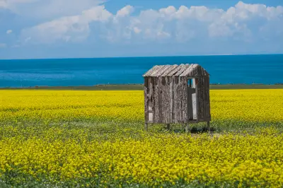
Last year, U-shaped Highway, Mars Camp, Demon's Eye, Emerald Lake... these new attractions from Qinghai flooded my social feed... Just back from Gansu, I was already planning to go to Qinghai again next year... After two years, I finally completed the Gansu-Qinghai Grand Loop (so moved as a working person T_T). This was another solo trip. Since I departed during National Day, high prices for flights and hotels were expected... But what troubled me was that the Northwest is so vast, and I needed to visit so many places in limited time... Solo car chartering was expensive and risky. So, I finally chose a 2-8 person tour group with drone photography on a certain travel platform... And it turned out to be incredibly hassle-free... The whole group had only 3 people including me, and the driver's drone footage was absolutely amazing!! The Northwest with drone aerial photography is truly the icing on the cake... 1. In October, the Northwest is already in autumn with large temperature differences between day and night, so a down jacket or windbreaker is essential. 2. This trip includes places above 3800m altitude; oxygen bottles or altitude sickness medication are needed. 3. If possible, definitely bring a drone for aerial shots; the Northwest from God's perspective is truly different... Absolutely fantastic! Below is the route map of this trip: D1: Xining -- Geometry Bookstore -- Moji Street D2: Xining -- Riyue Mountain -- Qinghai Lake -- Chaka Salt Lake -- Delingha (stay) D3: Delingha -- Xiao Chaidan Lake -- U-shaped Highway -- Wusute Water Yadan -- Mangya (stay) D4: West Taijinar Lake -- Mars No.1 Highway -- Mars Camp -- Aiken Spring (Demon's Eye) -- Huatugou (stay) D5: Huatugou -- Mangya Emerald Lake -- Chaerhan Salt Lake -- Golmud (stay) D6: Golmud -- Yuzhu Peak -- Hoh Xil -- Golmud (fly back to Xining in the evening) D7: Xining -- Zhuhai On the first day, I arrived in Xining around 10 a.m. I planned to visit the Dongguan Mosque, but unfortunately it was under renovation... So I chose to visit Xining's internet-famous bookstore, Geometry Bookstore... Xining's Geometry Bookstore is said to be China's largest independent bookstore... It's easy to get attracted by various handmade workshop cultural experience projects: Thangka, incense tablets, silverware, painting, fragrance blending, planting, woodworking, leather crafts, pottery, Lego... everything you can imagine... A must-visit for bookstore enthusiasts! The Northwest has many lakes, but they are all located in the Gobi. Only Chaka is backed by snow-capped mountains and grassland. It is as big as over a dozen Hangzhou West Lakes, and can reflect the entire sky... It is also called China's 'Mirror of the Sky' by travelers. Chaka Salt Lake, also known as Chaka or Dabsan Nur, is a natural crystalline salt lake and one of the four major salt lakes in the Qaidam Basin. 'Chaka' is Tibetan meaning 'salt pond', i.e., salt of Qinghai; 'Dabsan Nur' is Mongolian, also meaning salt lake. For me, Chaka was a second visit... I had been to Chaka once in 2016. This time I found the scenic area had changed a lot... Now Chaka is divided into two scenic areas: one is 'Mirror of the Sky' which I visited, and the other is 'Sky No.1'. Moreover, the ticket office is now far from the scenic area... Visitors must take the scenic shuttle bus to enter, and after getting off, they still need to walk 8-10 minutes to reach the salt lake... To take beautiful reflection photos in 'Mirror of the Sky', I can only say weather is important... Last time I went in August with good weather and was lucky to get reflection photos... This time, although the weather was okay and not overcast, the lake on the backlight side was dry... I had no desire to go in and shoot again... Mangya Emerald Lake is a magnesium sulfate subtype salt lake with a salt rock layer at the bottom. The lake is rich in lithium, potassium fertilizer, mirabilite and other salt compounds. It is a large mining pit formed after years of salt lake mining. The salt fields are cut by neat roads, and the squares inside look like Hami melon patterns. The color of Emerald Lake is formed by light reflecting off minerals in the lake. The salt ponds vary in depth and shape, scattered like mirrors, pure and translucent, like emeralds embedded in the Gobi, a true emerald lake. The colors range from emerald green to mint blue; every shot is a masterpiece. And it has no entrance fee and is little-known... Mangya Emerald Lake was a pleasant surprise... It truly interprets the word 'emerald'... The beauty of Mangya Emerald Lake is a brilliant mirror bestowed by heaven, like emerald gems set in the earth. Under sunlight, the clear lake sparkles with shimmering light... It is recommended to bring a drone; from a high altitude, you will get more unexpected surprises. Chaerhan Salt Lake is the largest salt lake in China and one of the most famous inland salt lakes in the world. Chaerhan Salt Lake does not require an entrance fee, but you need to take a 30-minute scenic bus to reach the site, passing salt fields and salt factories along the way, round trip 100 yuan... After getting off the bus, there is an electric cart to the core area of the salt lake (all internet-famous spots are here). To save time, it's best to take the scenic electric cart... After finishing, walk back slowly while taking photos. Both sides of the lake are white salt crystals, and the lake water is transparent with a green tint... On sunny days, the surrounding scenery, sky, and white clouds are reflected in the lake, making it an excellent photography spot... Please keep it clean and protect this beautiful salt lake. After Chaerhan, no other salt lake is worth seeing... Once, Qinghai was an ocean... Later, crustal movements uplifted it into the Qinghai-Tibet Plateau... Minerals hidden underground formed today's Chaerhan Salt Lake. 'Chaerhan' means 'king of salt'. Indeed, Chaerhan's green is absolutely comparable to Jiuzhaigou's water... After Jiuzhaigou, no other water is worth seeing; after Chaerhan, no other salt lake is worth seeing. Qinghai Lake, called 'Cuo Wenbu' in Tibetan (meaning 'blue sea'), is the largest inland saltwater lake in China and an important water body maintaining the ecological security of the northeastern Qinghai-Tibet Plateau. On the first day of the trip, we passed Qinghai Lake... But the weather was not good, so I didn't see the blue lake... This was my second visit to Qinghai Lake. Last time in August, the lakeside was full of yellow rapeseed flowers... The distant lake was navy blue... The sky was blue with white clouds... But this time in October, Qinghai had entered autumn; rapeseed flowers were mostly harvested, with only a few remaining along the road for tourists to take photos... And the weather that day was bad, so I couldn't capture the beauty of Qinghai Lake under blue sky and white clouds. However, I encountered groups of fat sheep along the way... The experience was still good. Wusute Water Yadan: Yadan landform, also known as wind-eroded ridges, is a typical wind-eroded landform. Due to wind abrasion, the lower parts of small mounds often suffer stronger erosion and gradually form concave shapes. The largest Yadan landform group is in the Qaidam Basin in Qinghai, mainly distributed in the northwest of the basin: Da Chaidan, Lenghu, and Mangya in Haixi Prefecture. Wusute Water Yadan is southwest of Wutumeiren Grassland and north of the Northern Hills Natural Area, surrounded by desolate endless desert. It is said that there was no water here originally. One year, the Narin Gol River flooded, diverting water to this vast area, forming beautiful Yadan scenery while also causing damage to oil pipelines... Because it lies between two saltwater lakes, the lake water is slightly salty, with abundant aquatic plants attracting many water birds; people also call it 'Hundred Birds Thousand Island Lake'. Blue lake water, incredible Danxia landforms, ducks and geese calling in the sky, sparkling water, orange sunrise clouds, sand dunes and lakes form a beautiful and moving picture, golden Yadan reflections on waves, incredibly beautiful... Climbing onto an earth mound, looking down... rows and piles of rock piles, unrelated yet interconnected, like indispensable stars... like ships, like sculptures, like a thousand islands... With drone shooting, the scenery would be unbeatable. West Taijinar Lake: Also known as Two-Color Lake, there is a road (called Salt Crust Highway) between the two lakes, creating completely different scenery on both sides... One side is a freshwater lake green as emerald, quiet and hazy, with turbid water containing high copper ions, bottom invisible; the other side is a saltwater lake blue as the sky, with very high salt content, reflecting the sky, water and sky merging. The two lakes form a clear-cut landscape due to the road... There are many wild ducks and seagulls on the lake; if you just pass by, they ignore you completely... If you want to take photos or get close, bring some bread or biscuits to feed them. They will flutter and fly together when they see food... If you toss small pieces upward, they will catch them agilely in the air, creating spectacular flying scenes. Tips: Must bring a drone! Drone! Drone! Aerial shots are needed to show the different colors of the two lakes! Aiken Spring (Demon's Eye): Also known as 'Demon's Eye', 'Earth's Eye', 'Mangya's Eye'. There is a large stone at the entrance inscribed 'Angel's Eye', perhaps considering the name more auspicious, but actually 'Aiken' in Mongolian means demon... The earliest record of Aiken Spring is from Russian explorer and traveler Przhevalsky, who introduced Aiken Spring in the Gas Basin in his book 'Towards Lop Nor' written during his 1883-1885 expedition through Qinghai and Xinjiang in the Qing Dynasty. Aiken Spring lies at the foot of snow-capped mountains on vast land with open views... Viewed from above, the area around the spring eye has formed diverse and beautiful patterns due to long-term sulfur deposition, nature's uncanny workmanship is breathtaking... Since there is no comprehensive, detailed, and reliable investigation of Aiken Spring yet, this geological wonder is shrouded in mystery... Aiken Spring appears as just a small pool up close, but with a drone it becomes breathtakingly beautiful... From above, the spring eye, gushing water, and dark red ring-like deposits on the surrounding ground form a peculiar pupil shape, like an eye embedded in the earth... Riyue Mountain has historically been an important passage on the 'Qiangzhong Road', 'Southern Silk Road', and 'Tang-Tubo Ancient Road'. During the Northern and Southern Dynasties, due to the blockage of the Hexi Corridor Silk Road, the 'Southern Silk Road' was opened, passing through Riyue Mountain, Qinghai Lake, and the Qaidam Basin to the Western Regions... Riyue Mountain is the actual boundary between the Tang Dynasty and Tubo, and also the dividing line between the Loess Plateau and the Qinghai-Tibet Plateau. In a romanticized legend, the 14-year-old Princess Wencheng shattered her sun-moon mirror here, bid farewell to her hometown, and resolutely entered Tibet. It is a scenic spot with dual legends of history and geography. U-shaped Highway, also known as Internet-Famous Highway, is located on G315 National Highway in Golmud City, Haixi Mongolian and Tibetan Autonomous Prefecture, Qinghai Province. The road undulates with the terrain as if pointing straight to the sky, called 'China's Route 66', a must-visit internet-famous spot in Qinghai... The safest photo spot is at the kilometer marker of G315... Take photos and leave quickly. Tips: The U-shaped Highway is not a tourist road but a main road connecting Qinghai and Xinjiang; many heavy trucks pass by, posing high risks. Moreover, this area is deep in the Qaidam Basin, nearly 300 km from the nearest hospital. In case of an accident, rescue would be extremely difficult. Sitting in the middle of the road for poses is an illegal act and an extremely foolish life-threatening behavior. A safe and happy trip is far more important than a single photo... Mars No.1 Highway & Mars Camp: Mars No.1 Highway is the only route to Mars Camp, 95 km long... Surrounded by the world's largest Yadan landform group, the place most like Mars on Earth. Along the way are magnificent Yadan landforms; the entire land is barren and vast... Mars No.1 Highway is a gravel road, bumpy all the way, poor road conditions, so you must slow down and enjoy the scenery outside the window. Sometimes the most beautiful scenery may not just be the destination; the scenery along the way should not be ignored. The destination is Mars Camp. We entered from the south gate of Mars No.1 Highway. The south gate is located on G315 National Highway (between kilometers 977 and 978 towards Da Chaidan, Water Yadan, Mangya direction). From afar, you see a lone astronaut sitting on the gate, and the gate beneath him is the door from Earth to Mars... Walking through, you see desolation everywhere, barren land, giving a sense of desolate beauty; walking out, you return to Earth's vitality... Hoh Xil region is a vast geographical unit, divided by province boundaries into four parts: Tibet's Qiangtang Nature Reserve, Xinjiang's Altun Mountain Nature Reserve, Qinghai's Three Rivers Source Nature Reserve, and Qinghai's Hoh Xil Nature Reserve... We set off from Golmud in the morning for Hoh Xil... The distance was long, and I worried about lunch, so I prepared some snacks. The first stop was the Kunlun Mountain Taoist temple Wuji Dragon and Phoenix Palace dedicated to the Three Goddesses... Then we continued to Kunlun Mountain Pass and Sonam Dargye Protection Station (on the way we could see the clear and clean Yuzhu Peak). When I was in school, I watched the movie 'Hoh Xil' and knew about Hoh Xil in western China... When I stood on the land of Hoh Xil, I felt a little excitement. Snow-capped mountains stretch endlessly, wild grass is sparse; no civilians live here, only People's Liberation Army soldiers guard this place. I pay high respect to the soldiers on duty... The beauty of Hoh Xil cannot be appreciated by a cursory glance; one must be as devout as a pilgrim, talk to every plant and stone, and submit one's desires to nature to feel the holiness and resilience of the highland under its strong heartbeat... In fact, on this youngest and most vast wilderness on Earth, Tibetan antelopes are just a small part. Not only is it a vibrant wildlife paradise, but it also contains China's densest lake groups and youngest mountain ranges... Actually, our itinerary ended at Kunlun Mountain Pass, but our driver drove another fifty or sixty kilometers to let us see Tibetan antelopes... The further we drove towards Tibet, the colder it got. When we saw the antelope herd, it was already minus 2-3 degrees Celsius... The grass on the ground was covered with frost, but that didn't dampen my enthusiasm. I got out of the car to experience this untouched land... I ran towards the antelope herd, but to avoid scaring them, I could only watch from a distance... Speaking of Northwest cuisine... What I miss most is probably yogurt... A bowl of yogurt topped with butter... Also, on this trip in October, I encountered the fattest season for Northwest sheep. As a person from Guangdong who doesn't usually eat lamb, I eagerly ate Northwest lamb without any gamey flavor (lamb hotpot, hand-grabbed lamb, lamb offal...). The Northwest people's dedication to lamb cooking made me discover so many parts of a sheep can be eaten. I think the Qinghai Haixi loop is a fantastic route. Not only are the scenic spots beautiful, but the scenery along the way is also beautiful. The experience was fantastic... Considering recent events, I think... The meaning of travel is not to compete over how many places one has visited or how remote they are... Travel makes me cherish my current life more... I don't want to be a workaholic only focused on making money and climbing the ladder... Nor do I want to travel without taking social responsibilities... I like my lifestyle. I am who I am, love life, love travel. Travelogue Table of Contents: 1. Travel Preparation 2. Itinerary 3. Geometry Bookstore 4. Chaka Salt Lake, Mangya Emerald Lake, Chaerhan Salt Lake 5. Qinghai Lake, Water Yadan, West Taijinar Lake, Aiken Spring (Demon's Eye) 6. Riyue Mountain, U-shaped Highway, Mars No.1 Highway & Mars Camp 7. Hoh Xil & Yuzhu Peak 8. Food on the Road 9. Last Travel Info Hotel Index Strategy Index Flight Index Website Navigation Travel Index Cruise Index Corporate Travel Index Franchise Cooperation Distribution Alliance Friendly Links Enterprise Gift Card Purchase Insurance Agency Agency Cooperation Hotel Cooperation Destination and Scenic Area Cooperation More Franchise Cooperation About Ctrip Ctrip Hot Topics Contact Us Careers User Agreement Privacy Policy Business License Security Center Ctrip Content Center Intellectual Property Trip.com Group Algorithm Announcement