2020 Autumn Trip (Part 4): A Colorful Hidden Gem (New Track Map Added)
What stays in my mind from this leg of the journey is a riot of colors: the ochre-red Aiken Spring, the emerald green Cuoka Lake, the vast Genie's Eye, and the pure white Baishui Terrace. All these colors, accompanied by the golden brightness of autumn, are as magical as a kaleidoscope.
Traveling on National Highway 315, crossing the Altun Mountains out of Xinjiang, to Mangya in Qinghai, a distance of 412 kilometers.
In 2019, when I traveled on National Highway 315, I turned off to Dunhuang at the Wusute Water Yadan, so this time I could make up for that missed experience.
Walking in the Gobi, the altitude keeps rising.
Aiken Spring: Not far from National Highway 315, the road turns into a dirt track, mostly flat and straight, and it takes about an hour to reach Aiken Spring. The spring is over 10 meters in diameter. According to the sign, it is also a resonant spring: the louder the human voices, the stronger the spring flow. The spring eye bubbles like boiling water, constantly surging upward. Sulfur minerals around the spring eye have precipitated over time, creating colorful patterns. Seen from above, the spring eye, the gushing water, and the deep red ring-shaped deposits on the surrounding land form a peculiar pupil shape, like an eye embedded in the earth. That's why people call it the "Eye of the Earth" or "Demon's Eye."
Taking Provincial Highway S303 across the Qaidam Basin to Golmud, a distance of 468 kilometers.
Mangya Emerald Lake is larger than Dachaidan Emerald Lake. Driving counterclockwise around it, various shades of green come into view. The salt pools vary in depth and shape, pure and translucent, like emerald jade embedded in the Gobi—truly a jadeite lake.
The salt lake is still being mined.
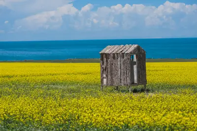
Crystallized salt looks like lace.
The famous T-shaped catwalk.
Entering Golmud city, we had lamb.
Ascending the plateau again, we had the Donggecuona Lake all to ourselves, a distance of 598 kilometers.
After turning onto the Dema Expressway from Xiangriman, a large body of water appeared before us, along with the iconic red grass beach. That was Donggecuona Lake. Almost no tourists were around the entire lakeshore; the lake was calm. The red aquatic plants by the lake were short and unassuming, yet so brilliantly red, as if the ground were covered with an embroidered carpet.
Donggecuona Lake is very close to Huashixia. The rocks on the mountaintop are completely different from those at the foot, resembling flower petals, which seems to match the place name well.
Leaving Qinghai Province, we entered Sichuan Province via National Highway 548, a distance of 482 kilometers.
The guardian spirit of Maqin.
Since Jiuzhi's Nianbao Yuze was closed, we changed our plan to go through Dari to Banma before leaving Qinghai.
We crossed several passes above 4,000 meters in altitude, with snow covering the mountain tops and green trees at the foot.
We arrived in Sertar, Sichuan, at nearly 6 p.m. Stupas under the setting sun.
No track recorded today. From Sertar, we took County Road 6983 (over the Nailong Snow Mountain), then National Highway 317 and National Highway 227 (through the Yalong River Grand Canyon section) to Xinlong County, about 240 kilometers.
In Sertar's square stands a huge prayer wheel.
Sertar is not just about the Buddhist Academy; there is also Donggar Monastery. Donggar Monastery was built in the early 16th century, over 500 years ago, and is a branch monastery of the Gelugpa Tashilhunpo Monastery, located on the Golden Horse Grassland.
Crossing mountains and ridges, at the highest point of the mountain road, there is a sign for Nailongshan Pass, with an elevation of 4,580 meters. After this point, the mountain road begins to descend.
The row of snow-capped mountains ahead should be the Shaluli Mountains.
Approaching the foot of the mountain, I vaguely saw what appeared to be caves and buildings on a small hill ahead. Zooming in, I confirmed it. Such mysterious structures are common in Tibetan areas. The small temple at the foot of the mountain, nestled by the mountains and rivers, is very scenic.
Heading towards Xinlong and Litang.
A red Tibetan village at the foot of the mountain.
A long Mani wall.
This is Xinlong's Bori Bridge, built during the Qing Dynasty. The piers look like two sturdy blockhouses from a distance, constructed by stacking round fir logs, cobblestones, and slate layers alternately. In the middle of each pier, 4–6 round logs are propped up in an arch shape, with the length of the logs gradually increasing from bottom to top, forming two cantilever arms. Then beams are laid on the arms, planks placed, and railings installed to form the bridge deck. The umbrella-shaped structure made of stacked slate on top of the pier is the bridge pavilion. The most remarkable thing is that the entire bridge uses no nails or iron; every joint is connected with wooden wedges, primitive yet practical.
All along the way, highland Tibetan scenery, plus the hidden gem Cuoka Lake, and then the Sky City—Litang, a distance of 181 kilometers.
Xinlong's residential houses are distinctly different from the Tibetan houses seen before. The ground floor is traditional rammed earth, with the building tapering from bottom to top, robust and rugged. What's unique is that they add 1–3 "Bengke" rooms on the second and third floors (in Tibetan, "Beng" means wood-framed, "Ke" means house; "Bengke" is a house made of wood frames). The door lintels and window frames are intricately carved with auspicious patterns and painted in different colors.
A steep mountain road of over ten kilometers.
Cuoka Lake: Spiraling up along the mountain col, a turquoise lake appeared before us, surrounded by scattered temples with golden roofs and red walls—that is Cuoka Lake. The lake is not very large, but the jade-like water is crystal clear, a natural mirror of the sky.
Cuoka Monastery on the lakeshore is exquisitely built.
There are no boats on the lake; it is very quiet and very pure, collecting the reflections of blue sky, white clouds, green trees, green mountains, and red temples like a kaleidoscope.
The altitude from Xinlong to Litang kept rising, and the vegetation changed noticeably.
Due to road construction, we arrived in Litang at 5 p.m. The Sky City—this was our third visit here. The county's facilities keep improving; this time the Holiday Inn Express had already opened.
After settling in, seeing the sky deep blue, we went to see Litang's Changqing Chunke'er Monastery. The magnificent monastery, with its brilliant murals all around, shimmered with golden light under the setting sun.
The local Tibetans happily chatted with us, posing for photos with arms around shoulders—happiness came smoothly.
Litang Genie South Route: Genie Snow Mountain, Genie's Eye, a distance of 188 kilometers.
To go to Genie's Eye, GPS navigation couldn't show the way. On the way, we encountered several unmarked forks with no one to ask for directions, so we had to stop and ask.
The ground was covered with rubble.
First, we passed the White Stupa Park, whose gate was closed. On the way back in the afternoon, we passed again and saw a note on the gate saying "Pull to open"—meaning it was accessible but required closing the gate behind us. The park has 119 small stupas surrounding the main stupa, forming a unique stupa forest. The 119 small stupas represent the 119 villages in the county. The main stupa is 33 meters tall, the small ones 2.5 meters, and there is a large prayer wheel. Against the blue sky, it is majestic.
In autumn, Genie has pure skies, golden grass, turquoise water, and colorful forests on the slopes—a vast scenic area.
Yaks also have their own charm.
Temples and white stupas at the foot of the mountain.
A drone is needed to capture the full view of Genie's Eye; from above, it looks like an eye.
The small pond nearby was equally photogenic as Genie's Eye.
After photographing Genie's Eye, we drove down a dirt road to a village. The river came flowing from the distant snowy mountains.
Hot springs—Tibetans were soaking their feet.
To Xiangcheng, bypassing the hugely popular Daocheng Yading, with scenery all along the way, a distance of 285 kilometers.
Rila Monastery, with its red, blue, and white exterior walls, belongs to the Sakya sect. The monastery lama led us on a tour; he had been studying there for three years, tall and slim with handsome features.
The road to Daocheng Yading is excellently built, with signs all along to ensure you don't miss any scenic spots.
Tu'er (Rabbit) Mountain has a peculiar terrain—on the barren peaks stand a rabbit's long ears.
Shihe (Stone River) Park is an ancient glacial landscape, with thousands of glacial erratics of all sizes, quite spectacular.
Daocheng Sangdui's red grass beach is small, about the size of one or two basketball courts. The red aquatic plants and the yellow leaves in the distance complement each other, creating a unique scenery.
After crossing several mountains, we were pleasantly surprised to see these low stone houses. Later we learned they were temporary shelters built by cordyceps harvesters who stay there during the season and leave after harvesting, returning the next year.
Entering Xiangcheng, the white Tibetan houses along the riverbanks are known as "White Houses."
White Tibetan villages nestled by mountains and rivers. On clear days, the valley resembles terraced fields dotted with white houses, casual and natural.
The east gate of Sangpiling Monastery—the gate pillars are two whole carved logs depicting the "Four Harmonious Animals" (elephant, monkey, rabbit, and bird), symbols of harmony and kindness in Tibetan belief. The gate beam is carved with the four auspicious beasts: tiger, lion, eagle, and dragon.
Sangpiling Monastery is filled with exquisite carvings and paintings, with various Buddha statues and animal figures in diverse postures. Columns, beams, and ceiling corridors are adorned with common auspicious patterns in Tibetan Buddhism.
Xiangcheng County's Qingde Township Zhongde Village—filming location for "I Belonged to You" (From Your Whole World Passing By). The prayer flag path and broadcast station are all presented.
The artistically designed guesthouses.
Ranwu Township hot springs—after soaking, our bodies felt smooth and relaxed.
Leaving Xiangcheng County in Sichuan and heading southeast, we took a newly built road through a large canyon not yet named on the map (temporary sign Z001), about 100 kilometers, a distance of 257 kilometers.
From Xiangcheng to Shangri-La in Diqing, Yunnan, we took a new highway, accompanied by a turquoise river along the way.
Secong Bridge—we drove across it and then on a zigzag mountain road. The terrain was steep, and driving made our feet sore.
Entering Napahai Lake, snow peaks reflected in the lake, and at the foot of the mountains, alpine pastures with herds of cattle and sheep presented a beautiful pastoral scene.
A long-established restaurant serving chicken soup—business was booming.
From Shangri-La town to Baishui Terrace, then to Hutiao Gorge town in the evening. Because the entire Shangri-La–Hutiao Gorge road was under construction, we could not take pictures of the scenery except at Baishui Terrace; most of the time we were dodging pits and eating dust. Distance: 198 kilometers.
Taking the Shangri-La eastern ring road to Baishui Terrace scenic area. The route goes up on the left and down on the right, surrounding the pure white Baishui Terrace, layered like a fairyland of jade pools.
The road from Baishui Terrace to Hutiao Gorge was under construction, muddy and uneven, with steep cliffs on one side and frequent encounters with oncoming vehicles. It was lucky to arrive safely at the hotel—the road was closed the next day.
From Hutiao Gorge town, bypassing Lijiang, we spontaneously decided to go to Shaxi Ancient Town. Crossing Jianchuan county town and going into the mountains for about thirty kilometers, we reached Shaxi Ancient Town, a distance of 115 kilometers.
At the Gongxili Hotel beside National Highway 214, classic and elegant in style, with a pleasant environment.
Lunch at Hutiao Gorge.
The view from the restaurant window.
Checked in at Shaxi Ancient Town.
Ancient lanes, ancient village gates, ancient temples, ancient stage, ancient bridge. Besides these cultural sights, accompanied by the century-old trees beside the horse inn and the lazy sofas outside the inn, time seemed to stand still.
The food in the ancient town also suited our taste. It was mushroom season, so we bought mushroom oil as gifts to bring back.
From Jianchuan we headed back to Guangdong. Looking back on the entire journey, two people and one car, 57 days, 18,000 kilometers. Every trip is about feeling it with your heart. The excitement of the most beautiful National Highway 317 and the irresistible allure of Highway 219 are still vivid in my mind. From time to time, on TV screens, we see familiar scenery and can proudly comment on it. I look forward to the next departure—the scenery is always on the road.
Travel log directory:
1. Day 40: Ruoqiang to Mangya
2. Day 41: Mangya to Golmud
3. Day 42: Golmud
4. Day 43: Golmud to Maqin
5. Day 44: Maqin to Sertar
6. Day 45: Sertar to Xinlong
7. Day 46: Xinlong to Litang
8. Day 47: Litang
9. Day 48: Litang to Xiangcheng
10. Day 49: Xiangcheng
11. Day 50: Xiangcheng to Shangri-La
12. Day 51: Shangri-La to Hutiao Gorge
13. Day 52: Hutiao Gorge to Jianchuan Shaxi Ancient Town
14. Day 53: Jianchuan Shaxi Ancient Town
15. Goodbye
Travel information, hotel directory, guide directory, ticket directory, website navigation, travel navigation, cruise directory, corporate travel directory, franchise cooperation, distribution alliance, friendship links, corporate gift card procurement, insurance agency, agency cooperation, hotel franchise, destination and scenic spot cooperation, more partnership cooperation, about Ctrip, about Ctrip, Ctrip highlights, contact us, jobs, user agreement, privacy policy, business license, security center, Ctrip content center, intellectual property, Trip.com Group algorithm disclosure