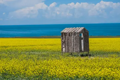
Colorful Qinghai ()
DAY16 (9.27) Qiemo – Mangya (640 km, 7 hours driving)
Departing from Qiemo, we soon got on the expressway. Passing through a drifting sand area with strong winds, sand blew onto the highway, so driving required caution. Upon arriving in Qinghai, it immediately felt different; no ID was needed to refuel. In Xinjiang, fuel controls were stricter than in Tibet—scan your ID at the entrance and again when filling up. Around 3 PM, we arrived at Mangya Emerald Lake. Wow, it was the first time I saw such beautiful lake water, like imperial green jadeite, more beautiful than Jiuzhaigou’s water. Jiuzhaigou’s water is darker here. Drones are allowed, and the view from above is even better. This scenic area far surpasses Chaka Salt Lake—truly a “Mirror of the Sky.” The entrance fee is cheap. This is my third time in Qinghai, and Mangya Emerald Lake deserves to be rated the best attraction in Qinghai.
At 5 PM, we went to Aiken Spring to see the “Demon’s Eye.” Under the setting sun, sunlight shone on the puddles, creating a golden glow. The water in the center of the Demon’s Eye churned constantly, but it didn’t look as terrifying as the name suggested.
A drone shot of Aiken Spring.
After visiting Aiken Spring, we headed to Mangya City. Mangya City is known as “China’s loneliest city,” with no other city within 200 kilometers. Its permanent population is only 18,800. It thrives on oil extraction and tourism. But its tourism resources are rich: Mars Town, Eboliang Yardang Landforms, Emerald Lake, Aiken Spring, Black Single Mountain, etc. Accommodation is convenient, and food includes Northeast-style, Sichuan-style, and Northwest-style cuisine, enough to meet the needs of tourists from all over the country.
DAY18 (9.28) Mangya – Golmud (via West Taijinar Lake, East Taijinar Lake, G315 U-shaped Highway, and Qarhan Salt Lake) 656 km
Today’s schedule was quite full, plus there were some speed checkpoints on G315, so we didn’t arrive in Golmud until 9 PM. We set out at 7 AM after refueling. Before reaching West Taijinar Lake, G315 truly felt lonely—few vehicles on the road, vast desert all around. The water of West Taijinar Lake wasn’t particularly beautiful; G315 cuts through the lake, with one half blue and one half green. But compared to Mangya Emerald Lake, the colors are far inferior. East Taijinar Lake disappeared for some reason in previous years, but in 2024, the lake reappeared, attracting many tourists. However, neither lake is a formal scenic spot. East Taijinar Lake has temporary management facilities, while West Taijinar Lake is completely unmanaged, with a fishy smell by the shore. The water color of East Taijinar Lake is a light blue with a hint of green. For some reason, it is very popular. Using a drone for an overhead view yields better effects, but it’s still not as good as Mangya Emerald Lake or Qarhan Salt Lake. Continuing along G315, we reached the famous U-shaped section around 2 PM. We drove through it several times from west to east and east to west. It felt steeper from west to east, with the road undulating like waves, making the vehicle feel like it was leaping. There were many large trucks on this stretch, so caution was needed. We didn’t go to the Emerald Lake near Delingha, first because we had already been to Mangya’s, and from pictures they look similar; second, we were pressed for time; third, tickets were hard to get. We arrived at Qarhan Salt Lake around 4:30 PM. It is known as China’s largest salt lake. We took a shuttle to the scenic area. Due to its large size, the colors of the various small lakes differ. To observe the best colors, we waited until sunset. When the golden light shone, the lake water became even more vivid. But we missed the opportunity to see the Ten-Thousand-Zhang Salt Bridge—by the time the shuttle reached it, it was already dark.
DAY19 (9.29) Golmud – Xining (via Qinghai Lake)
We got up early and first went to a 4S shop for car maintenance. The Haval H6 top trim, after more than three years, had already run 100,000 km. It had taken me to Everest, the Pamirs, and driven through national highways 318, 219, 109 (Qinghai-Tibet section), 314, and 315 without any breakdowns. The quality of domestic cars is completely trustworthy. Passing by Qinghai Lake, I noticed its area was much larger than six years ago, and its color was much more vivid. But be careful when taking photos by the roadside.
Summary: From Beijing through Xinjiang to Xining, we drove 9,900 km, experiencing the desolate beauty of the Northwest, enjoying the colorful Kanas, traversing the winding Yizhao Highway, Duku Highway, and Panlong Ancient Road, and viewing the Nalati Grassland. If you ask me which is the most beautiful, in Xinjiang it’s Kanas, and in Qinghai it’s Mangya Emerald Lake.