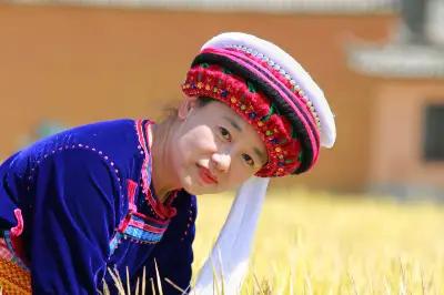
2021 Self-Drive Trip Across Yunnan: Diary Part 2
The plan originally set for spring 2020 was delayed an entire year by the COVID-19 pandemic. This was the full-circle journey across Yunnan, the 'South of the Colorful Clouds,' that we had long dreamed of. Our self-drive trip lasted 41 days, with total expenses for two people around ¥16,000, including nearly ¥3,000 in highway tolls, about ¥5,500 in fuel, and over ¥2,200 for entrance fees, scenic shuttle tickets, and cable car tickets (one person was a senior over 65, the other a person with a level-4 disability). Unexpected highlights included the Yuanmou Earth Forest and feeding black-headed gulls at Haigeng Dam. The trip's real standouts were the Luoping rapeseed flower sea, Xishuangbanna, Dehong, Tengchong, Nujiang, Dulongjiang, Diqing's Jinsha River Great Bend and Meili Snow Mountain, Jade Dragon Snow Mountain, Sanxingdui, and more. Naturally, we also had some regrets—places we didn't make it to, such as Jiulong Waterfall, Tengchong's volcanoes, the Degong Highway, Dali's Cangshan Mountain, Balagezong National Park, and the Upper, Middle, and Lower Tiger Leaping Gorge.
We set off from home on Tuesday, March 2, 2021, at 6:30 a.m. to begin our Yunnan road trip.
2021 Self-Drive Trip Across Yunnan: Diary Part 2
On March 21, we drove an hour in the morning to the Xishuangbanna Tropical Botanical Garden of the Chinese Academy of Sciences.
The Xishuangbanna Tropical Botanical Garden of the Chinese Academy of Sciences is a national 5A-level tourist attraction. Located in Huludao, Menglun Town, Mengla County, Xishuangbanna Dai Autonomous Prefecture, Yunnan Province, it is China's largest botanical garden in terms of area, with the richest collection of species and the most specialized plant zones. It is also a comprehensive research institution and scenic area combining scientific research, species conservation, and science education.
We bought a half-price ticket for 40 yuan; the ticket seller said shuttle bus tickets for the east section were sold at the east entrance.
We explored the west zone on foot, visiting the Hundred Flowers Garden, Hundred Bamboo Garden, Exotic Flowers and Rare Plants Garden, Banyan Garden, Cycad Garden, Palm Garden, Shade Garden, Hundred Fruits Garden, and Dragon Blood Tree Garden.
Around 11:45, we headed to the east zone. We saw people queuing but didn't know it was for the east shuttle bus stop. We assumed the shuttle bus boarding point was further ahead, so we kept walking further and further. Then we decided to just walk to the east zone scenic spots. On the way, we met a girl in her twenties who said she was walking there alone. I figured if she could do it, we could too.
We reached the Tropical Rainforest scenic spot fairly quickly, and walked its loop in about half an hour. After that, we headed to the Green Stone Forest, which was over 3 km away along a mountain road used by internal shuttle buses. Hot and tired, we finally got there. We mainly saw two sights: the giant plank roots, tree waterfall, and strangulation phenomena.
The Green Stone Forest was absolutely worth the visit.
At the Green Stone Forest, we bought two shuttle bus tickets at 50 yuan each and rode back to the west zone, getting off at the National Flowers and National Trees Garden. We then continued visiting the smaller gardens: the National Flowers & Trees Garden, the Celebrities & Famous Trees Garden, the Vine Garden, the Southern Medicinal Garden, and the Hundred Fragrances Garden. We walked through the Hundred Flowers Garden back to the main entrance. It was so hot we bought ice pops again. We decided to stay overnight in Menglun.
We booked a room at Cuixin Yuan Hotel on Ctrip for 76 yuan. We bought tomatoes, pears, and apples at a supermarket.
Our plan was to head to Mangshi the next day. Since we were taking national and provincial roads, we'd cover about 400–500 km per day. On the first day we'd stay in Gengma Town, and on the second day we'd reach Mangshi.
On the morning of March 22, we set off for Gengma. It was the first day of our trip with no scenic spots to visit.
We rested from 1:30 to 2 p.m. Around 4:30 p.m., we reached the intersection of National Highway 214 and Xiaocang Line. It would have been just another hour to Gengma, but a police checkpoint prohibited out-of-town vehicles from heading toward Gengma, citing a local outbreak and forcing us to detour to Lincang.
We had no choice but to detour, adding an extra hour or more. We found a hotel in Lincang before 6:30 p.m. Ctrip quoted 103 yuan, but the reception said they didn't accept Ctrip bookings. The Meituan price was 112 yuan. Because a group of guests from Chongqing checking in at the same time wanted six rooms, the hotel let us have the room for 100 yuan as we tagged along.
On March 23, we got going at 8 a.m. We refueled 30 liters. National Highway 214 was still easy to drive. Highway 357 was a bit worse. The most infuriating part was a section of mountain road after Baoshan where the downhill average speed limit was 30 km/h. Other cars didn't seem concerned about the 30 km/h limit, but I dared not risk it. Even without stepping on the accelerator, the car would coast at 40–50 km/h. I had to stop 2 km before the end of the speed-check zone to bring my average speed under 30 before daring to proceed. There were several stop-and-check points along the whole stretch.
We arrived at Mangshi Ming Shun Hotel around 5 p.m. Ctrip listed it at 118 yuan for a twin room with breakfast, but the hotel offered 108 yuan, so I paid directly at the front desk. It was another day of driving over 400 km with no sightseeing.
On March 24, the hotel provided a buffet breakfast with limited variety but enough to fill us up.
First we drove to Mengbana West Rare Treasures Garden. Half-price tickets were 20 yuan. Located in the southeast of Mangshi city, Dehong Prefecture, Yunnan, this national 4A-level scenic spot gathers a vast collection of rare ancient and famous trees, precious plants, exotic flowers and herbs, as well as world-rare silicified wood and jade. Its distinct features are rarity, uniqueness, antiquity, and strangeness, making it a gem of tourism highlights and a treasure trove of subtropical plant genes.
There were many tour groups. We followed the visitor guide in reverse. We saw a peacock displaying its feathers and a 300-year-old banyan tree.
The garden's value lies in showcasing numerous rare timbers and jade items. We spent 1.5 hours there.
We drove to the Tree-Embracing Pagoda. According to Dai historical records, in the 53rd year of the Qianlong reign (1778 AD), the 17th Tusi Fang Yuzhu of Mangshi built this pagoda to commemorate a victory in war, over two centuries ago. The pagoda, built of brick and stone, stands over ten meters high, octagonal in shape, with Buddha statues inside niches. The ancient pagoda has been enveloped by a banyan tree, forming the marvel of a tree embracing a pagoda. Today, the tree atop the pagoda has grown to over 30 meters, with a crown covering nearly 1,000 square meters. The site has become a free parking lot; we were in and out in 10 minutes.
Menghuan Grand Golden Pagoda sits on a small hill; you can drive up and there's a parking lot. It is located on Leiyarang Hill, beside Peacock Lake in the southeast of Mangshi, the capital of Dehong Prefecture. Amidst the green hills and clear waters, the pagoda gleams golden, dazzling and majestic, exuding an air of sacredness. It is a landmark of Mangshi and a holy site for the local Dai people. The Menghuan Grand Golden Pagoda is China's premier golden Buddhist pagoda and Asia's number one hollow Buddhist pagoda.
We strolled around the outside of the pagoda, taking in the panoramic view of Mangshi. We removed our shoes and walked twice around the main hall, where there were crystal Kwan-yin statues and jade Buddha statues. (Photography not allowed inside.)
After coming out, we went to Menghuan Silver Pagoda, just on the hill opposite the Golden Pagoda. Also called Menghuan Thousand Buddha Silver Pagoda, it is located in Menghuan Subdistrict, Mangshi, on the hilltop facing the Golden Pagoda. It is a modern Buddhist pagoda. When completed, the Silver Pagoda echoes the Golden Pagoda from afar, with all sculptures and structures rendered in silver—quite beautiful. They form a unique landscape and have become landmarks of Mangshi. We spent 40 minutes going up and down the hill.
We refueled 30 liters at a Sinopec station on the outskirts. Around 1 p.m., we took a 30-minute break en route to eat and nap.
At 2:40 p.m., we arrived at Mori Tropical Rainforest Scenic Area, half-price tickets 18 yuan. Cars can drive inside. The area features pristine tropical valley rainforest vegetation and waterfalls as its main landscapes, with over 1,500 wild plant species and 479 types of flowers and spices. It's hailed as an earthly paradise. Orchids growing outdoors were simply stunning!
In Mori Scenic Area, ancient trees soar skyward, dense forests blot out the sun, and walking through them brings cool breezes while scenting your clothes with floral fragrances. At the end of the gorge, a waterfall plunges from a 60-plus-meter cliff like a raging torrent. The area is surrounded by mountains on three sides, with a flat space of over ten acres. Just tens of meters from the gate, you'll see a hot pool, water crystal-clear and about a foot deep. Legend has it this was a bathing pool built by wild elephants for the Buddha. Near the hot spring stands an ancient, gnarled banyan tree, beneath which is a golden Dai-style pagoda pavilion. Inside lies a stone slab, and on its tilted surface is embedded a giant "footprint," toes and sole clearly visible—the renowned Buddha footprint revered in South and Southeast Asian Buddhism. It measures 96 cm long, 43 cm wide at the forefoot, 33 cm at the arch, and 52 cm at the heel. Devotees have applied gold powder, making it even more lifelike. Not far behind the pavilion is a large Buddhist temple; on Buddhist festivals, pilgrims stream in endlessly.
The scenic area nurtures a great number of orchids, very beautiful. We walked to the far end, the Mori Waterfall, in 50 minutes.
Leaving Mori Tropical Rainforest, we went to Dehong's One Tree Forest, located by the roadside near Mangling Village, close to the China-Myanmar border. This is an ancient banyan tree over 900 years old, with 31 roots standing on the ground, reaching over 70 meters tall and covering 120 square meters. Its branches and leaves form a living fence and a green barrier, a marvel in the rainforest that defies the saying 'One strand doesn't make a thread, one tree doesn't make a forest.'
Full-price ticket 15 yuan, half-price 10 yuan. There were Guo Moruo's inscription 'Ruili', two one-tree-forest banyans, a banyan that grew horizontally, and a peacock garden.
Ruili Zhongou Hotel, claiming four stars, cost 100 yuan for a twin room with breakfast, 18 yuan cheaper than on Ctrip.
We ate hand-grabbed rice and lemon salad on the street.
On March 25, after a buffet breakfast at the hotel, we drove to Hansha. We drove through the gate, but the gatekeeper insisted we scan a code. I said I'd park on the roadside; he refused and said some unpleasant things. I said we weren't going in, but he said we still had to scan. We scanned and left.
We went to One Village, Two Countries, buying 20-yuan tickets. The site is about 10 kilometers from Ruili city center, next to the famous China-Myanmar Border Marker 71. It's a classic geographical oddity where one village straddles two countries. The border divides a Dai village, with the Chinese side called Yinjing and the Myanmar side Mangxiu. Inside are sights like One Village Two Countries Well, One Village Two Countries Swing, a bridge spanning two countries, a pagoda blessing two countries, etc. But the border was fenced off with barbed wire and closed.
We headed to Da Denghan, but the road was closed and we couldn't enter the village, so we moved on to the next scenic spot, Yingjiang Tiger Leaping Stone.
At 1 p.m., we reached Yingjiang Tiger Leaping Stone. Looking out, two mountains stood less than 20 meters apart, with two giant boulders rising from the river, almost cutting the Daying River in two. The rocks were like a pair of massive doors left ajar, with a gap only 7.3 meters wide. Even more interesting, not far away in the river, another huge rock lay across the middle, but the water was low and we couldn't get close for photos. The waterfall cave was also inaccessible, so we ate and rested right by the hydropower station gate.
At 2 p.m., we drove to Hehua (Lotus) Hot Spring. It's located 28 km from Tengchong toward Lianghe in Hehua Township. When we reached the upper parking lot, a security guard told us we couldn't park there because it was for leaders, and directed us to the lower lot. We took a shuttle cart to the ticket office; the ticket price was 236 yuan per person. I had booked on Ctrip for 188 yuan each, total 376 yuan. The area covers over 300 acres, a forest hot spring zone featuring unique sulfur springs, kaolin springs, carbonic springs, sodium chloride springs, and various high-quality mineral springs, abundant and rich in trace elements beneficial to health. There are said to be 25 open-air forest hot spring pools. We soaked in all the small pools—rose, milk, aloe, etc. At 5:30 we had a buffet dinner, then soaked in a few more pools before leaving.
We went to Tengchong Tongluo Hotel, booking on Meituan for 100 yuan (Ctrip was more expensive!). The hotel staff told us the Volcano Park was closed because a hot air balloon accident had killed an employee. What a pity! We adjusted our itinerary: after Tengchong, go to Lushui, then Lijiang, and finally Dali.
On March 26, we drove to Heshun Ancient Town. Half-price tickets were 27.5 yuan. Heshun is located 4 km southwest of Tengchong city center, a famous trading, cultural, and tourist town along the ancient Southern Silk Road. With over 600 years of history, Heshun boasts profound cultural heritage where Central Plains, Western, Nanzhao, and border cultures blend, creating unique overseas Chinese and caravan cultures. Heshun has long upheld a tradition of valuing culture and education; during the Ming and Qing dynasties, it produced over 400 provincial and imperial exam graduates. The ancient town is blessed with beautiful natural scenery and ancient buildings scattered everywhere. It hosts China's largest rural library, Heshun Library, and is a well-known hometown of overseas Chinese in Southwest China, a living ancient town where over 7,000 residents still live harmoniously.
Heshun has won numerous honors, including China's Most Charming Town, a National Historic and Cultural Town, a National Environmentally Beautiful Township, and a National Cultural Industry Demonstration Base. In December 2020, the Heshun Ancient Town scenic area passed the landscape quality assessment for a national 5A-level tourist attraction and was officially included in the creation list. In the town we saw the Twin Bridges, the library with plaques inscribed by celebrities like Hu Shi and Guo Shaoyu, the Li Clan Ancestral Hall, Yuanlong Pavilion, the Grand Moon Platform, Wanlouzi, etc. Wenchang Palace was under renovation.
(Flowers grown by Heshun locals)
We spent a total of 2 hours and 21 minutes.
From the ancient town, we headed to the National Martyrs' Cemetery. The navigation said we had arrived, but we couldn't see the entrance. We turned into the Martyrs' Cemetery as the Amap navigation indicated, but it was closed. Walking further, we finally saw the gate of the National Heroes' Cemetery. Online reservation required. Tengchong National Heroes' Cemetery (Western Yunnan War of Resistance Memorial) was built to commemorate the fallen soldiers of the Chinese Expeditionary Force's 20th Group Army who recovered Tengchong in 1944. It was completed on July 7, 1945. The name is taken from the 'National Martyrdom' chapter of the Chu Ci. The cemetery covers 37,884 square meters. Its main structures include the gate, exhibition hall, memorial tower, and tombstone clusters with 3,346 tombstones for Tengchong campaign martyrs and 19 Allied soldiers, plus a 'Japanese Tomb'.
The cemetery is free. There are inscribed plaques by Chiang Kai-shek, Yu Youren, and others. We toured for 30 minutes.
By the time we reached the Rehai (Hot Sea) scenic area it was 12:25. Half-price tickets were 25 yuan. We walked the whole circuit in 1 hour 45 minutes. Yunnan is exceptionally rich in geothermal resources, with about a quarter of China's known hot springs, and Tengchong County is the most concentrated area. Tengchong is one of China's three major geothermal zones, with over 80 hot springs and boiling springs everywhere, among which Rehai is the most representative. It is China's second-largest geothermal field, featuring Hot Sea Stone, the Big Boiling Pot, Bath Valley, Pearl Spring, Beauty Pool, and more. The highest water temperature reaches 102 degrees, making it the premier geothermal health resort in China. The Rehai area centers on Huangguajing, Zaotang River, and Sulfur Pond, with numerous steam and hot springs, the most spectacular being the Big Boiling Pot.
As soon as we entered, we smelled a strong sulfur odor. Water gushing from the spring vents was scalding to the touch. Near the Big Boiling Pot, many people were soaking their feet. The Rehai hot spring pools are inside the scenic area but sealed off separately with an additional fee. Since we had already soaked at Hehua Hot Spring, we didn't go in this time.
We left the scenic area at 13:10 and drove toward Lushui. We rested briefly on the highway, got off at Lujiangba exit, refueled 30 liters, then rejoined the highway at Nujiang Grand Canyon exit. Lushui city is built along the river, with narrow streets and heavy traffic. Our car was filthy, so we washed it. We found a hotel but didn't like it, so we booked Jin Mian Hotel on Ctrip. On the way, Ctrip called to say the booking went through but the hotel had no rooms. They offered a nearby similar hotel; I had no choice but to accept, and they compensated me 19 yuan.
On the morning of March 27, we drove to Zhiziluo. From Lushui, we followed National Highway 219. Alongside the main road, a service road had been built for jogging, walking, or cycling, stretching dozens of kilometers; the next day we'd see a similar scenic road under construction in Gongshan, over 200 km long. Before climbing to Zhiziluo, Highway 219 switched from the west side of the Nujiang River to the east. The mountain road to Zhiziluo was in poor condition, winding almost to the mountaintop. I thought we had arrived, so I parked at the village committee to ask for directions and was told that Laomudeng Church was nearby, but the abandoned city was still 4 km ahead.
Nu Jiang Laomudeng Christian Church: Along the Nujiang Gorge, wherever there's a village, you can find churches built by French missionaries in the past, still used by villagers for worship. Although the gorge is home to Nu, Lisu, Bai, Han, and Tibetan ethnic groups, most share a common Christian faith. We first went to the church; it was closed, with road repairs underway outside.
Then we reached Zhiziluo Village. In the Lisu language, 'Zhiziluo' means 'a good place.' It sits on a ridge of the Biluo Snow Mountain at an altitude of 2,023 meters. It was once the capital of Nujiang Lisu Autonomous Prefecture and the former seat of Bijiang County. Over thirty years ago, it was the prefectural capital; twenty-some years ago, it was a thriving county town; today it's just Zhiziluo Village. From prefecture to county to village, it's often wistfully called the 'City of Memory' or 'Abandoned City,' even 'China's Saddest City.' In 1974, the prefectural seat moved from Zhiziluo in Bijiang County to Liuku Town in Lushui County, by the Nujiang River. Zhiziluo's appearance was frozen in the historical moment of 1986. We drove 20 km uphill from the Nujiang River to reach it. People still live there, though the county government moved away. Just before we left, a big bus unloaded a tour group.
(Looking across the Nujiang to the mountains opposite)
We started descending at 11:30, and it took half an hour to reach Highway 219.
We made stops along the way whenever we saw nice scenery to take photos. In the middle section of the Gaoligong Mountains, at an altitude of 3,300 meters, there's a huge karst cave formed in marble, over 100 meters deep, about 40 meters wide, and 60 meters high. Traveling north along the Nujiang, you can spot this cave, called 'Stone Moon,' from a hundred li away, with blue sky and white clouds shining through. At the Stone Moon rest area, we hoped to take a break, but a tour bus unloaded a crowd, too noisy to nap, so we left.
At 2 p.m., we reached Gongshan county town. The Amap navigation messed up, making us circle the town one and a half times without finding the road to Dulongjiang. We asked three times before finding the correct route. A local told us that entry to the Gong-Du Road would be closed after 4 p.m.
From Gongshan to Dulongjiang, the Gong-Du Highway crosses the Gaoligong Mountains. From October to May the next year, snow and ice often close the road, isolating Dulongjiang Township. Now, with a nearly 7 km tunnel, the road has been shortened to less than 80 km and is passable year-round. Surrounded tightly by the Gaoligong range, the road has an air of mystery, winding through cliffs, precipices, waterfalls, and dense forests, with one hairpin turn after another. Passing is difficult on most sections, and there were many places under repair.
On the Gong-Du Highway, we saw Dangdanlika Snow Mountain and stopped to take photos. Twice we were held up by roadworks—once for ten minutes, the second time for an hour. So we didn't reach Dulongjiang Township until nearly 8 p.m.
Unexpectedly, accommodation in Dulongjiang was in such high demand; 3 or 4 hotels were fully booked. Finally, a receptionist at an inn introduced us to Yana Inn for 140 yuan. The staff insisted on 150 yuan, though. Conditions were basic: the first room had a non-flushing toilet, so they switched us. We had dinner on the street; I misheard the hotpot price as 28 yuan, but when the bill came it was 88 yuan, and with odds and ends it came to 96 yuan.
Tourism in Dulongjiang roughly splits into two routes: north and south. The north route mainly goes to Longyuan Village to look for women with facial tattoos; the south route is longer, going all the way to Hapang Waterfall. We decided to take the south route the next day and see how things went.
On March 28, we set off at 7:30 a.m. for Hapang Waterfall. At 8:20, we reached the Hawksbill Leaf Monkey observation point, but large machinery was rumbling in the riverbed nearby. We waited over ten minutes, guessing the monkeys were scared off by the noise and wouldn't show up, so we left.
The water of Dulong River was especially clean and cool. We continued and decided to skip the villages and go straight to Hapang Waterfall. At this point, phone signal was poor and Amap navigation was useless, often giving wrong directions—telling us to go straight when we should turn, or turn when we should go straight. At a bridge, it directed us back along another road; after 6 km, we asked a construction worker who told us we'd gone the wrong way and had to go back 6 km to that bridge and turn left.
The road was tough: narrow, twisty, under construction, with many large trucks and machinery. When we finally got onto the correct road to the waterfall, we encountered a convoy of 7 or 8 cars, seemingly led by a mute driver. We followed them, stopping to take photos, all the way to Hapang Waterfall. Before the waterfall, there was a border checkpoint with no one on duty. Near the waterfall, there was a fire prevention checkpoint checking vehicles and pedestrians, allowing access only up to the waterfall; they wouldn't let us proceed to the boundary monument.
Hapang Waterfall is located in Maku Village, Dulongjiang Township, Gongshan Dulong and Nu Autonomous County. 'Hapang' means 'a great torrent plunging from a cliff of ten thousand zhang' in the Dulong language. The waterfall drops about 200 meters between steep peaks, a mighty column of water thundering down the cliff face into the Dulong River, sending up towering spray—a magnificent sight. The Dulong River flowing past the waterfall is also very beautiful.
At 13:45 we turned back and headed to Gongshan to stay overnight. Before 5 p.m., we reached Jincheng Hotel. The room was 90 yuan. The hotel parking lot was below a one-way street; I had to drive around town to refuel and then find the parking entrance.
On March 29, we bought breakfast on the street: fried dough sticks, soy milk, sweet cakes, buckwheat cakes, and scallion pancakes. After breakfast, we headed for Bingzhongluo, known as 'a paradise where humans and gods dwell together.' Bingzhongluo has three national 4A-level scenic spots: the First Bend of the Nujiang River, Stone Gate Pass, and Bingzhongluo pastoral scenery.
The First Bend of the Nujiang is south of Bingzhongluo, formed when the river is blocked by a hillside and makes a 270º turn. It's located near Ridan Village along the way to Bingzhongluo. As the Nujiang flows through, it encounters the massive cliff of Wangqing, forcing a direction change from north-south to east-west. After 300 meters, it's blocked by Danla Mountain and turns sharply from west to east again, creating a large semicircular bend.
Bingzhongluo Viewing Platform.
Stone Gate Pass lies at the north end of the Bingzhongluo terrace. Flanking the river, Gaoligong Mountain and Biluo Snow Mountain both rise sheer from the banks, soaring into the sky, forming a giant stone gate over 500 meters high and nearly 200 meters wide. The Nujiang River gushes out through the gate, thundering downstream. Locals call it Nanli Wall, and because of its landform, it's aptly named Stone Gate Pass. This is a must-pass route in and out of Yunnan and Tibet.
We spent 30 minutes visiting these three spots.
From Stone Gate Pass, it took 44 minutes to return to Pengdang Bridge, where we turned onto the Degong Highway but were stopped at a checkpoint and told we couldn't go to Deqin. A sign by the road indicated the road was closed from December 30, 2020, to March 31, 2021, due to snow and construction, with reopening subject to conditions. We had to adjust our plan and head for Dali. En route, there were multiple roadwork delays. We reached Lushui at 15:20, got on the highway, rested at the first service area until 4 p.m., and arrived at Qingqing Inn in Dali at 7 p.m. The room was nice, 97 yuan. We strolled the ancient town at night.
On March 30, after breakfast, we walked around Dali Ancient Town. First we went to the Christian church, took a photo outside, then the Confucian Temple, the Dali West Gate Mosque, and finally Shangshu Residence. Shangshu Residence was merely a plaque nailed to an outer wall. Only the Confucian Temple was open to enter; the rest we just viewed from outside. We saw a cute little mouse and then the flowers along Dali's streets. We drove to the East Gate 1 of Cangshan Scenic Area, but the gate was locked. We asked and learned that the cable car wasn't operating. They told us that for forest fire prevention, the gate was closed, the big cable car only ran halfway, and visitors could only go within a 50-meter radius—hardly worth it. They suggested we go to Gantong Temple and take the cable car from there, but warned we might have to queue if we were late.
When we arrived at the Gantong Temple scenic entrance, the ticket office was closed. Someone said the cable car was shut and no entrance fee was charged for going up. We walked behind Gantong Temple and then went back down in about 20 minutes. At 11 a.m., we reached Chongsheng Temple.
Chongsheng Temple faces Erhai Lake to the east and is backed by Cangshan Mountain to the west, about one kilometer north of Dali Ancient Town, at the foot of Diancang Mountain and the shore of Erhai. Historically, nine Dali emperors became monks at Chongsheng Temple. The temple was once famous for five great treasures (the Nanzhao Great Bell, the Rain Copper Kwan-yin statue, the 'Buddhist Capital' plaque, etc.), but all were destroyed by wars or natural disasters over the centuries. The Three Pagodas of Chongsheng Temple were listed among the first batch of national key cultural relics protection units. The temple also houses a Hall of 500 Arhats. Parking was 5 yuan, no time limit. We spent 2 hours visiting.
We drove to Butterfly Spring and spent 1.5 hours there. Butterfly Spring is located west of National Highway 214 in Dali city. The spring covers over 50 square meters and is 6 meters deep, surrounded by marble balustrades. On the west wall, the three characters 'Butterfly Spring' are carved in Guo Moruo's calligraphy. Beside the pool, a butterfly tree lies across the water like a blue dragon. The scenic area also includes Five Dragon Pool and Lovers' Lake.
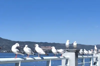
After Butterfly Spring, we drove an hour to Qianmo Inn in Wase Town. We were the only guests. We went to the street to enjoy the Erhai Lake scenery and photograph black-headed gulls. Along the road from Shuanglang to Wase, many brightly colored convertibles were for rent, and quite a few young people rented them to pose for photos. Since it wasn't tourist season, only a few restaurants and guesthouses were open in town.
On the morning of March 31, we left at 8 a.m. for Jizu Mountain. Also known as Jiuqu Mountain or Qingdian Mountain, it's located northwest of Binchuan County, Dali. In the Song Dynasty, monk Ciji practiced Buddhism on the steep rocks of Qingdian Mountain, and Buddhism began to flourish there. Jizu Mountain is an important scenic spot within the Dali national scenic area, a multifunctional tourist destination showcasing Buddhist culture and ecological landscapes, combining pilgrimage, Buddhist studies, sightseeing, and scientific research. It is a national 4A-level scenic area, a Buddhist holy place for South and Southeast Asia, and one of China's Ten Famous Buddhist Mountains.
At 9 a.m. we arrived and bought half-price tickets for 27.5 yuan, one-way shuttle bus tickets for 20 yuan each (two), and two cable car tickets for 90 yuan total. We drove 10 km from the gate to Zhusheng Temple parking lot. Zhusheng Temple's architecture strongly features Bai ethnic style. We viewed Yulong Waterfall, said to be ever-changing depending on the season. Inside Mou Ni Nunnery there's a 'one tree, three cypresses'—a very quaint and charming little courtyard surrounded by dense, emerald bamboo groves, exceptionally tranquil. (Tongwa Hall had a copper-tiled roof and nanmu wood beams.) Then we took the sightseeing bus to the lower cable car station, and after getting off, began climbing.
We visited Huashou Gate, hailed by Buddhists as the 'First Gate of China.' It is the most sacred place on Jizu Mountain, where Venerable Kassapa is said to have 'guarded the robe in meditation, awaiting the birth of the Buddha.' (From a distance, it looks like a sculpture of a human face.) After the Buddha's nirvana, Kassapa, following the Buddha's will, held the golden-threaded robe worn by the Buddha and entered meditation at Huashou Gate, waiting silently for the future Buddha, Maitreya. We climbed to Jizu Mountain's highest peak, Tianzhu Peak (Golden Summit), at 3,248 meters. Atop the summit stands a bronze golden hall relocated from Taihe Palace on Yingwu Mountain in Kunming's eastern outskirts, giving Jinding Temple its name. The temple also contains a Lengyan Pagoda.
At 12:47 we started walking down. Kassapa Hall enshrines a sandalwood statue of Kassapa carved by Ananda himself. (Descending from Kassapa Hall, there's a very steep and tall flight of stairs.) It's known as the 'First Temple on the Mountain' and the 'Ancestral Court of all temples on the mountain.' At 13:47 we reached the lower cable car station. We walked to Faguang Temple, which was undergoing major repairs. Located directly below Huashou Gate, it was one of the Eight Great Temples of Jizu Mountain during the Ming Dynasty. Because the famous 'Heavenly Pillar Buddha Light' often appears here, it was named Faguang Temple. We walked back to the lower cable car station, took the shuttle back to Biyun Temple around 3:30, and encountered a troop of monkeys.
We drove to Eryuan Jiutai Yuantong Hotel, 80 yuan. Eryuan was quite interesting: when we checked in, the staff told us there was an open-air hot spring nearby where you could soak your feet for free. Out of curiosity, after dinner we strolled over to see. We walked to Phoenix Town and watched locals soaking their feet by the roadside. In a cluster of buildings not far from the road was a small water channel. Since it wasn't time yet, only a few people were soaking their feet. We followed the winding channel about 500 meters to the source—a pipe gushing water from underground. Locals said the pump house starts drawing water at dusk. On our way back, we saw a courtyard that looked like a swimming pool; the gatekeeper said it was a hot spring, 20 yuan per person.
On April 1, we left Eryuan and drove toward the First Bend of the Yangtze River. It had started to rain, and by the roadside there was a large patch of white peonies. The navigation led us to the First Bend, about 50 km from Lijiang county town. It's in a parking lot and free to visit. Standing by the river, the First Bend looked unremarkable—just a big river bend. Not sure what drone footage would show. There are actually two 'First Bends' on this route: one is the 'First Bend of the Yangtze,' the other is the 'First Bend of the Jinsha River' (locally called the Great Bend of the Jinsha). Although the Yangtze First Bend is also on the Jinsha, the Jinsha First Bend is a different place altogether, with a distinct name and location. The Jinsha has many bends; what's called the Jinsha First Bend isn't really the first but rather the most precipitous, defined by its steepness. The Jinsha First Bend marks the border between Yunnan and Sichuan—on one side is Benzilan Town in Deqin County, Diqing Prefecture, Yunnan; on the other is Zigeng Township in Derong County, Sichuan. At this strategic pass, the river flows around the pyramid-shaped Rizhui Peak in a graceful 'Ω'-shaped curve, creating a world-class spectacle: the First Bend of the Jinsha River. It's part of the Baima Snow Mountain Nature Reserve and a component of the Three Parallel Rivers World Heritage Site.
From the Yangtze First Bend to the Jinsha Great Bend No. 1 viewing platform, I entered the address for the Jinsha Great Bend. The navigation (once again glitching) took us past Benzilan toward Derong in Sichuan. The more we drove, the more it felt wrong. We stopped to ask a passerby, who said we'd overshot and needed to backtrack. We drove back for over ten minutes, crossed a bridge with concrete bollards into Benzilan, and continued until we reached the Jinsha Great Bend No. 1 viewing platform right by the road. We could drive into the courtyard. Half-price tickets were 10 yuan. The view was indeed impressive; we spent about 20 minutes there. A notice said the peak season starts April 28.
Passing near Baima Snow Mountain, it began to snow. The ground was wet and foggy. After rounding a hill, the sun came out for a while. From Jinsha Great Bend No. 1 to Wunongding viewing platform, I made the same mistake—only entering 'Wunongding' without adding 'viewing platform,' and the navigation took us into Wunongding Village. I quickly corrected it. When we reached Wunongding viewing platform, it was great—sunny, but soon clouds filled the sky, so we didn't linger. Actually, there are hotels at Wunongding with rooms facing directly toward Meili Snow Mountain, offering unbeatable views. Unfortunately, we had already booked a hotel at Feilai Temple, so we had to press on.
At Deqin Dian-Zang Yuan Business Hotel, we had a yak meat hotpot to warm up. After dinner, from the hotel's fire escape stairs, we saw Meili Snow Mountain peeking through the clouds—really beautiful. We walked to Feilai Temple viewing platform to check it out and learned we could buy half-price tickets for 20 yuan, with the gate opening at 6:40 a.m. At the hotel, we met several motorcyclists warming themselves by the fire. I chatted with one from Daxing, Beijing, who said he had been riding alone and joined up with this group along the way.
Feilai Temple viewing platform is a key hub for entering Meili Snow Mountain or Yubeng, and one of the gateways to the Tibetan region. The platform faces directly towards Kawagebo, the main peak of Meili. At sunrise, sunshine bathes the peak, making the snow mountain radiate golden light—a magnificent sight.
On the morning of April 2, we went to Feilai Temple viewing platform for photos, capturing Meili Snow Mountain vaguely through the mist. Despite an altitude of only about 3,500 meters, we both felt some altitude sickness. Why didn't we feel anything at Everest Base Camp at 5,200 meters in 2018? On the descent, in the Baima Snow Mountain section, there had been overnight snow, and vehicles were driving cautiously under 40 mph. At a spot with thick snow, many cars stopped to play in it; two carloads of Guizhou people who rarely saw so much snow were having a great time. Ahead, the road was covered in churned-up slush, then further on it was dry. By the roadside, a patch of small mani stone piles was quite fun. I set the navigation to Balagezong National Scenic Area, but the navigation messed up, leading us all the way to Shangri-La City, and bizarrely showing a speed of 70 mph while our car's speedometer read 30. With all the speed limits, I didn't dare drive fast. Turning back to Balagezong would have been a 70-80 km detour, so we reluctantly changed course to Pudacuo National Park. The road was under construction, dirty and bumpy. Asking locals, we learned it was being built towards Baishuitai, but beyond that it was impassable, and to visit Baishuitai you'd have to return the same way. There wasn't enough time to go and return that day, so we decided to skip Baishuitai.
Pudacuo half-price tickets were 20 yuan, with shuttle bus tickets at 60 yuan per person. Pudacuo is famous in name but actually rather underwhelming. Only a small part of the park was open. Originally, the park consisted mainly of Bitahai Lake, Shudu Lake, and Militang alpine pasture, but now only Shudu Lake is accessible. You take a shuttle bus for a stretch, then walk a 3.3 km boardwalk loop around the lake for about an hour, and finally ride back to the entrance. Pudacuo's altitude ranges from 3,500 to 4,200 meters, so we still felt a bit dizzy from the altitude. Personally, I think it falls short of a 5A rating.
After Pudacuo, we returned to Shangri-La city and wanted to stay near Songzanlin Monastery's ticket office. I first found a Tibetan-style guesthouse on Ctrip at a bargain price of 32 yuan (unbelievably low). We switched rooms three times, dissatisfied each time (toilet problems, electric blanket issues). I requested a refund through Ctrip; the host agreed, and Ctrip processed it quickly (impressive). Across the street, at Zanbulinka Grand Hotel, we got a room for 100 yuan with electric blanket, floor heating, and woolen blanket—so warm! The advantage was being a 2-minute walk from Songzanlin Monastery; the downside was few restaurants (maybe due to the season, as it wasn't yet peak tourism in early April).
Ganden Songzanlin Monastery is the largest Tibetan Buddhist monastery in Yunnan Province and one of the famous monasteries in the Kham region. It is also a center of the Gelug tradition in Sichuan and Yunnan, holding a pivotal position throughout Tibetan areas. It is often called the 'Little Potala Palace.' Built against the mountainside, its shape resembles an ancient fortress, embodying the best of Tibetan plastic arts, and is acclaimed as a 'Tibetan Art Museum.' Also known as Guihua Monastery, it is a castle-like complex on the scale of an ancient town. Construction started in 1679 and was completed in 1681. The Fifth Dalai Lama personally bestowed the name 'Ganden Songzanlin.'
The next morning, April 3, we walked to the Songzanlin Monastery visitor center, bought a half-price ticket on WeChat for 27 yuan, and two one-way shuttle bus tickets at 20 yuan each. Inside the monastery, we visited several Kangtsens (subordinate monk bodies of the Zhacang) and the Zhacang Grand Hall, etc. It was a ten-minute walk back to the visitor center.
After checking out, we drove to Dukezong Ancient Town. Dukezong is China's best-preserved and largest cluster of Tibetan dwellings, an important town on the Ancient Tea Horse Road and the first stop for caravan traders entering Tibet. We strolled through Sifang Street, Guishan Park, etc., spending about 1.5 hours.
At noon, we finished our Shangri-La sightseeing and headed for Tiger Leaping Gorge, getting on the expressway. Before several tunnels, roadworks diverted us to the opposite carriageway. On the expressway, I started feeling drowsy again and drank a can of Red Bull. The moment I finished it, we reached Chongjianghe interchange and were all forced off the highway (and it was a free highway day!) onto National Highway 214. Sigh! My Red Bull was wasted! When we reached Tiger Leaping Gorge Town, a sign said the scenic area was closed due to construction. We stopped to ask and were told that Upper, Middle, and Lower Tiger Leaping Gorge were all inaccessible, likely not reopening until May. What rotten luck! Well, this trip to Yunnan already had several regrets: Jiulong Waterfall, Tengchong's volcanoes, the Degong Highway, Cangshan in Dali, Balagezong National Park, etc. My experience is that first visits always come with regrets; nothing is perfect.
Once again feeling frustrated, we continued driving to Lijiang. After crossing the Jinsha River Bridge, we got on the Xili Expressway. Around 3 p.m., we arrived at Jinjiang Inn, checked in, then drove to Black Dragon Pool Park. Lijiang's Black Dragon Pool was originally built in the second year of the Qianlong reign (1737). Parking was free, ...