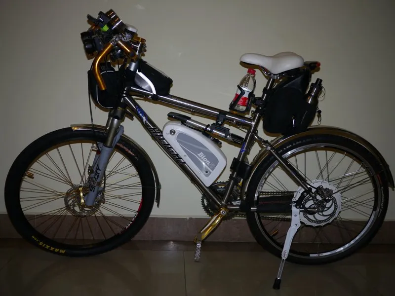
Cycling the Sichuan-Tibet Route in Late September 2012
1. After a winding journey, I reached the meeting point in Ya'an, surprised to be the first cyclist there (3 p.m.)! After stowing my luggage, I assembled the bike. One hour later, it was finally all set.
2. Day 2: As planned, ride from Ya'an to Luding, total 150 km, crossing Erlang Mountain (altitude 2170 m) and skirting the Dadu River. The difficulty was supposed to be moderate, but the entire road was under construction—pocked with holes and pits arranged in a matrix! As soon as I rode onto it, my bike turned into a bucking bronco, and the same for motor vehicles. Every time I got past a rough section and started to speed up, I'd hit a cluster of potholes, forcing me to brake. My body bounced up and down with the bike, wrists aching, butt sore. That's how I drained my energy! But there were small thrills: many stretches had one-way traffic controls because the other side was being paved. When I pedaled past the long queue of waiting vehicles with music playing, the astonished faces and exclamations gave me a real kick...
Breakfast in a town along the way:
But after 110 km of bone-jarring road, I reached the Erlang Mountain tunnel entrance completely exhausted. It was already 6 p.m. (12 hours since I set off at 6 a.m.). At the tunnel entrance, a girl from a tourist minibus came up to chat; they had been seeing me ride by all along (they'd been stuck in one-way queues at many spots). It turned out her whole tour group was also from Shanghai! After passing through the 4-km Erlang Mountain tunnel, it was an inevitable 33 km downhill. But by then, dusk was falling. Relying on my two powerful front lights, I finally escaped the dark, forested mountains and arrived at Dashuyu Hotel in Luding city. It was 8 p.m. Many companions behind me, unable to navigate the downhill switchbacks in the dark, had hitched rides and didn't arrive until after 9 p.m. That first day's ride was a harsh wake-up call for everyone who had been raring to go! Never mind having the energy to pull out a camera for photos.
Morning in Luding:
3. Day 3: From Luding to Kangding, 60 km all uphill, from 1330 m to 2395 m—a grueling day. Started at 8 a.m., rode six hours to Kangding. Again, I had no strength or scenic interest to take photos. But the consolation was soaking in Erdaoqiao Hot Springs in Kangding and eating stone-pot yak meat (an authentic local restaurant, a stone hot pot with yak offal). The big chunks of yak meat were incredibly delicious.
Photos leaving Luding:
Stone-pot yak meat: (The most delicious yak meat on the whole trip! Big cubes of meat, tender, fragrant, and juicy!)
4. Day 4: Kangding to Xinduqiao, 72 km, crossing Zheduo Mountain (altitude 4298 m). First 14 km up and down to Zheduotang village, then 22 km of pure climbing to Zheduo Mountain Pass. Many teammates set off at 6 a.m. (before dawn), but I really couldn't get up. I dragged myself out at 7 for breakfast (gruel and baozi—forced myself to eat even though they were barely edible). At 8, I hired a local minivan to take me and my bike straight to Zheduotang village. Along the way, I saw many cyclists (from our group and others) either crawling at a snail's pace or pushing their bikes... After reaching Zheduotang, I assembled my bike and started climbing Zheduo Mountain. The long, switchback mountain road was shrouded in thick fog. Each pedal stroke demanded full-body strength and heavy panting. I rested twice, eating two small pieces of naan and two bags of milk, plus a bottle of water brewed with American ginseng tea bags and a sports electrolyte drink. I gradually climbed two-thirds of the way and finally pulled out my camera at a bend to take a photo: looking back at the mountain road I'd traveled.
Pressing on toward the pass, when I reached 4000 meters, altitude sickness began to close in—breathing quickened, head started aching. I'd been maintaining a regular breathing rhythm with a steady cadence, but the smallest extra movement, like wiping sweat, would instantly send my heart racing and make me gasp violently. At times I got off and pushed, only to find walking just as exhausting. My emotions also began to swing inexplicably: while resting and drinking water, a cyclist who was taking five pedal strokes then stopping for ten seconds passed me and muttered, 'Only one more kilometer,' and I burst out laughing uncontrollably! When I got back on and rode another hour, I looked up at the endless zigzag road snaking into the misty sky and couldn't help but burst into tears! Later I thought maybe my brain was trying extreme actions to get more oxygen. Gritting my teeth, I finally pedaled to the 4300 m pass. Words can't describe my feelings then; ignoring the altitude headache, I grabbed my camera and snapped away.
Then started a 42 km downhill. From freezing cold to blazing heat (the scorching sun overhead). The Xinduqiao area truly is a photographer's paradise, but I just couldn't bear to brake while speeding downhill, so I didn't take many photos. Arrived at the destination at 4 p.m. and began the daily routine: adjusting or repairing the bike.
5. Day 5: Xinduqiao – Litang, 226 km, crossing Gaoersi Mountain (4412 m), Jianziwan Mountain (4659 m), and Kazila Mountain (4429 m). The whole team went by vehicle—I fully understood why en route: the entire road was under construction, full of mud pits, water holes, and rubble. Cycling was nearly impossible, let alone walking. Inside the car, we were tossed around like snowballs, still wearing helmets to protect our heads from hitting the roof... Over 200 km took 12 hours. Litang is where altitude sickness really kicked in—staying at 4000 m, even carrying luggage or repairing bikes made you pant and gave you headaches.
6. Day 6: Litang – Batang, total 185 km, crossing Haizi Mountain (4685 m). Right out of Batang was a roadwork section. We rode 20 km through bumps and dust, then my riding buddy had a flat tire. After fixing it, we found his rear wheel quick-release axle was bent and couldn't be ridden. We hitched a ride in a local minivan to Haizi Mountain Pass (4685 m). After the support vehicle arrived and we replaced gear, we started an 80 km downhill blast! At the beginning, I took some photos at the Two Sisters Lake scenic spot, then bombed all the way to the destination, passing through six dark, chilly tunnels and beautiful asphalt switchback roads (on the left, yellow-and-green mountains; on the right, a gurgling stream).
7. Day 7: Batang – Shengtian Hot Springs, 47 km with no mountain roads. An easy day. Lazy start at 9 a.m., cycling and snapping photos along the way, with sweeping views of the Jinsha River.
At the Jinsha River Bridge (the border into Tibet), I lingered for quite a while. After crossing, a checkpoint verified ID cards (foreign tourists are prohibited from entering Tibet). Then I pedaled nonstop to Shengtian Hot Springs. After lunch and room assignment, I stripped and soaked in the open-air thermal pool. Since it was all naked men, no photos.
8. Day 8: Shengtian Hot Springs – Markam, total 65 km, crossing Zongbala Mountain (4170 m). The whole ascent was on a terrible road, truck after truck, dust swallowing you whole. Then a 10 km downhill into Markam. Not much scenery, so I took few photos.
9. Day 9: Markam – Zogang, total 170 km, crossing Lawu Mountain (4338 m), Jiaoba Mountain (3930 m), Dongda Mountain (5008 m). The entire route was a wreck. We'd heard there was daytime traffic control, so on the evening of Day 8, we slipped out of Markam at 8 p.m. and rode a vehicle through the night to Zogang, finally sleeping at 3 a.m. A full day of rest and repairs.
10. Day 10: Zogang – Bangda, total 110 km. Ordinary rolling road, not too difficult. Took some photos of pastoral farmhouses.
11. Day 11: Bangda – Basum Hot Springs, total 119 km. Set off and immediately began climbing Yela Mountain (4658 m). It was 14 km to the pass, similar intensity to the earlier Zheduo Mountain, given my previous experience.
Then the famous 72 Turns came into view! A wild 42 km descent! I swept down to the Nu River in one go—wind howling, river roaring. It took over two hours, and I took many photos. After crossing the Nu River Bridge (guarded by soldiers, no photos allowed), I faced a 63 km gradual uphill into a headwind (more painful than the previous four hours). Arrived at Basum Hot Springs Hotel, soaked in the hot spring to wash away the day's fatigue, then caught a ride to the county town for dinner.
12. Day 12: Ranwu – Bomi, over 130 km, the most scenic section of the Sichuan-Tibet Highway. The early part, Ranwu Lake, resembled Kanas Lake, while the dozens of kilometers near Bomi were a green, tree-lined road through virgin forest on both sides—stunning. Although the altitude gradually decreased, the paved road wasn't a straightforward downhill; it was constant ups and downs, repeating endlessly, which was exhausting. Took many photos.
13. Day 13: Tongmai – Lunang, total 75 km. Crossed the Tongmai Bridge. If you don't come to Sichuan-Tibet, you'd never imagine a bridge like this exists: a steel frame covered with broken or rotting wooden planks, with gaps two fingers wide that let you see the raging Yarlung Tsangpo River below. The whole bridge was only wide enough for one large truck. Soldiers at both ends directed one-way traffic. Seeing us, they actually let us cross first! After the bridge, you enter the infamous 'Death Road'—on the left, sheer cliffs plunging to the roaring Yarlung Tsangpo; on the right, a mountain wall; underfoot, a potholed muddy path full of water-filled ruts and protruding stones. The road was just wide enough for a bus or truck; when two vehicles met, wheels almost hung over the cliff edge! To dodge a truck, I had to stop and flatten myself against the rock face, the truck's wheel passing within a centimeter of my body! The entire 25 km of terrible road was thrilling and terrifying, with ups and downs. To avoid holes and rocks, you had to be hyper-focused, weaving left and right while maintaining balance, and control speed on downhills so you wouldn't bounce off the road. In short, this stretch is well worth riding for mountain bikers, and biking is safer than riding in a vehicle.
This photo is borrowed from others:
This photo is borrowed from others:
This photo is borrowed from others:
This photo is borrowed from others:
This photo is borrowed from others:
Starting here are my Tongmai photos:
After exiting the rough road, there was a 50 km gentle uphill paved road all the way to Lunang, very draining. Checked into a Tibetan family guesthouse on the Lunang grasslands and ate yak meat—delicious.
14. Day 14: Lunang – Ba'i, total 74 km, crossing Sejila Mountain (4720 m). A ride that's bitter first, sweet later. First, 27 km pure uphill from 3600 m to 4720 m, torturing every near-broken rider. In the last 10 to 5 km, just walking left you gasping, let alone riding. At the pass, clouds and mist obscured everything, with rain, snow, and hail taking turns. On the ascent, you could snap some beautiful bird's-eye views of mountains and villages. Once over the pass, a glorious 33 km downhill! Lightning-fast speeds, wind roaring, averaging 40 km/h left my hands frozen, face wind-burned, legs weak—I had to stop often to rest and let the brake discs cool. The Nyingchi area truly deserves its nickname 'Little Jiangnan,' with its lush, tree-lined avenues a feast for the eyes.
15. Day 15: Ba'i – Gongbo'gyamda, total 135 km. A rather uneventful ride. With some effort, I could maintain 30 km/h—comparable to the difficulty of the Shanghai to Suzhou route. The scenery was decent; took a few photos.
16. Day 16: Gongbo'gyamda – Riduo Hot Springs – Lhasa, total 279 km. Crossing the final and highest pass on the Sichuan-Tibet line, the iconic Mila Mountain (5013 m), with difficulty similar to previous passes, just higher altitude, colder temperatures, and harder breathing. Took photos at the golden yak statue at the pass. In Lhasa, it was just the usual tourist snapshot stuff.
Famous Barkhor Street:
The end. Hope this account provides some reference and help for future warriors.


