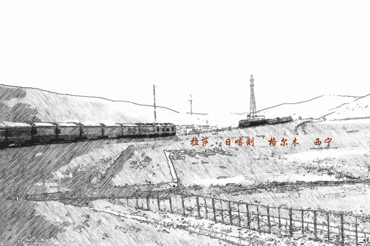
Traveling During the Pandemic in 2020: Experiencing the Qinghai-Tibet Railway, Visiting Lhasa, Shigatse, Golmud, and Xining
In August 2020, my summer escape was originally planned for the magnificent Xinjiang, but in mid-July Urumqi saw a cluster of COVID-19 cases, leading to tighter and tighter controls. Where would be better? I remembered my trip to Tibet at the end of last year, where the natural scenery and cultural sights of Lhasa and Nyingchi left a deep impression (see the Ctrip travelogue "Winter Tour of Tibet: Blue Sky, Green Water, Golden Sunshine on Snow Mountains, and Scenery Along the Way"), so I decided to return to the Qinghai-Tibet Plateau.
The main purpose of this trip was to experience the Qinghai-Tibet Railway. To do so, I arranged three segments on this "Sky Road": the first, from Nanjing via Xining to Lhasa (Train Z164), widely recognized as the best train for viewing the Qinghai-Tibet Plateau scenery, because the journey from Golmud to Lhasa takes place entirely in daylight; the second, from Lhasa to Shigatse, on the extended section of the Qinghai-Tibet Railway, to see the landscapes of Ü and Tsang regions; the third, from Golmud to Xining, taking a daytime train to fill in the scenery missed on Z164, which passes through this section at night.
Overall, this steel dragon—starting from Xining in Qinghai in the east, ending in Lhasa in Tibet in the south, spanning 1,956 kilometers—is the world’s highest railway, the longest plateau railway, and operates in the harshest natural environment. A monumental feat in the history of railway construction, it is worth experiencing firsthand. The diverse natural landscapes, majestic mountains and waters, rich religious atmosphere, and changing weather will surely leave you with unforgettable impressions.
[Days 1–3] Nanjing → Lhasa, Z164 (23:01–19:35+2), transferring to a high-altitude oxygenated train in Xining (train number changes to Z165). Admiring the Qinghai-Tibet Plateau scenery.
[Day 4] A group day tour to Yamdrok Lake and Karola Glacier to enjoy the lake and mountain scenery. Return to Lhasa to see the Yarlung Tsangpo River at the Gonggar section and the night view of Potala Palace Square.
[Day 5] Lhasa ⇌ Shigatse (round trip on the same day), Z8801 (8:30–11:25), Z8804 (18:40–21:33). Visit Tashilhunpo Monastery in Shigatse, admire Samdrubtse Dzong (the Small Potala Palace) from a distance, and taste local fried potatoes and sweet tea.
[Day 6] Watch the sunrise at Potala Palace, visit the Engraving Sutra Printing House of the Tibet Buddhist Association (Muru Monastery), and the Buddha Exhibition at Sera Monastery during the Shoton Festival. Lhasa → Golmud, West Air PN6294 (17:40–19:20). Visit Jiangjunlou Park in Golmud.
[Day 7] Golmud → Xining, K9898 (7:42–15:22), continue admiring the Qinghai-Tibet Plateau scenery, passing by Qinghai Lake (China’s largest saltwater lake), Guanjiao Tunnel (the longest plateau tunnel), and Gahai Lake (the largest freshwater lake in southern Gansu). In Xining, visit Xinning Square, Dongguan Mosque, Nanguan Mosque, the night view of Xining Station; taste Chenggui Yangbozi (mutton neck).
[Day 8] Visit Nanshan Park, Nanchan Temple, and the Memorial Hall of the Western Route Army of the Chinese Workers’ and Peasants’ Red Army. Xining → Nantong, Donghai Airlines DZ6284 (15:55–20:40, stopover in Zhengzhou).
[Transportation] 3,300 yuan. Including 4 train trips: 1,192 yuan (Nanjing → Lhasa, hard sleeper lower berth 809.5 yuan; Golmud → Xining, soft sleeper upper berth 301 yuan; Lhasa ⇌ Shigatse round trip, hard seat 40.5 yuan ×2); 2 flights: 1,872 yuan (Lhasa → Golmud 1,051 yuan; Xining → Nantong 821 yuan); buses and taxis: 236 yuan.
[Accommodation] 1,108 yuan (5 nights, member price)
[Meals] 430 yuan
[Admission tickets] 446 yuan. Sera Monastery 50 yuan, Tashilhunpo Monastery 100 yuan, Yamdrok Lake day tour 296 yuan.
[Other] 221 yuan (purchased "Qinghai-Tibet Railway Commemorative Album")
Total: 5,505 yuan
From the eight-day plateau trip, I have three overall reflections.
1. The Qinghai-Tibet Railway is worth experiencing.
My first visit to Tibet was in December 2019, taking a plane round trip. Compared with that, I feel the Qinghai-Tibet Railway is an unforgettable experience. The plateau scenery along the way left a strong impression—I took over 1,000 photos and videos totaling about 7GB. And there are the engineering marvels like thermosyphons, sand-blocking walls, and bridges replacing roads to solve permafrost problems, witnessing miracles and great achievements. But beyond that, the 40-plus hours of life on the train—eating, sleeping, getting around, and interacting with people—the ennui after the novelty wears off, the disgust after discomfort, the sigh of paying for hardship, and the joy amidst fatigue, are all part of a limited-edition unique experience.
For example: narrow bedding, the swaying of the train, children’s noise, the commotion of people boarding and alighting at night; dry climate, high altitude, dizziness and headache; mediocre food on board—some trains serve meals that are expensive and unpalatable, while the trains between Lhasa–Shigatse and Golmud–Xining have no dining car, so you can’t even get a boxed meal; 4G signal comes and goes, depending on luck if you want to pass time online; various smells mix in the carriage, including instant noodles, cigarette smoke (smoking is allowed on regular trains), shoes, socks, and the odor from the toilets, etc.
Even so, tickets in peak seasons like July and August are extremely tight, especially for Z164. Soft sleepers are out of the question; even hard sleepers require a battle. This time I was lucky to catch the last available hard sleeper—a lower berth—just one week before departure. Upper and middle berths are cramped, so a lower berth is much more comfortable. Also, Z-class direct trains, unlike D- and G-class trains, can be delayed. Due to continuous heavy rains in Henan and the Central Plains, the train stopped and started, arriving at Zhengzhou Station 70 minutes late, and finally reaching Lhasa 4.5 hours late. At the time I thought it was bad, but later while touring Golmud, I found the same day’s Z164/165 was delayed 7 hours! That meant, instead of arriving at Lhasa just past 7 p.m. on the third day, it would arrive in the early morning of the fourth day, forcing you to adjust all your travel plans accordingly.
2. The plateau environment has its peculiarities.
First, the weather is changeable. When the Z164 passed through Nagqu, within just two hours we witnessed drastic weather shifts: from thick clouds pressing down and blocking the sky, to clouds parting and revealing a clear blue sky, then to overcast and heavy downpour. Although the carriage was air-conditioned nearly at constant temperature, you could still feel the temperature changes. Without preparation outdoors, you’d likely end up in a sorry state. UV radiation is very strong, and the air is dry—drink plenty of water. Five full days after I returned from Tibet, the blood clots and streaks in my nose finally cleared up; you can imagine how severe it was.
Second, the temperature difference is large. In Lhasa in mid-August, sunrise was around 7:30 a.m. and sunset around 8:30 p.m. Morning and evening temperatures dip below 10°C, but once the sun comes out, it’s 27–28°C. That morning waiting for sunrise at Potala Palace on Chakpori Hill, when the mountain wind blew, I dearly wished I had a thin padded coat!
Third, altitude sickness should be taken seriously. Last year when I entered Tibet I had almost no reaction, but this time on the round trip to Yamdrok Lake, at an altitude of 4,500 meters, I threw up twice. I guess it was due to insufficient sleep, motion sickness, and altitude sickness. The train to Lhasa was delayed the previous day, so I slept only four hours at night, then joined a day tour early the next morning. The winding mountain roads stirred my stomach, and I felt really awful. At the Karola Glacier viewing platform, at 5,000 meters, the young people in the group played for nearly an hour, so we waited nearly an hour. Five thousand meters is called the zone of life prohibition, and my heart from the plains protested. Ah, what a painful lesson. The most important thing when traveling in high-altitude areas is to prevent altitude sickness, and the primary measure is adequate rest, adequate rest!
3. Urban construction is a long-term process.
This trip covered four cities: Lhasa, Shigatse, Xining, and Golmud. Xining felt the most prosperous, with a large built-up area, many high-rises, wide streets, well-developed transport, and a strong commercial vibe. Urban development in the plateau region still has a long way to go. To transform the "desolate frontier in the hearts of mainlanders" into the "prosperous interior in the hearts of frontier people," sustained effort is needed, continuously pooling funds to expand space and gathering people to add vitality.
Now, I’ll present the eight-day highland journey in the order of sightseeing. Because it’s my second visit to Tibet, the novelty has waned somewhat, and plateau scenery can feel repetitive, so some parts may be rather brief.
Z164 departs from Shanghai and terminates at Lhasa, running along the Beijing-Shanghai Railway, Longhai Railway, Lanzhou-Qinghai Railway, and Qinghai-Tibet Railway, passing through Shanghai, Jiangsu, Anhui, Henan, Shaanxi, Gansu, Qinghai, and Tibet—8 provinces and regions, covering 4,373 kilometers.
This train travels through China’s third, second, and first topographic steps, offering diverse natural scenery along the way—from evergreen broad-leaved forests of the Yangtze Delta plains, to the blue stone and yellow earth of the Taihang Mountains, to the gobi and snow mountains of the Qinghai-Tibet Plateau. Every stretch is a grand landscape film.
This time I was lucky to see the rippling blue waters of Cona Lake, Toson Lake, Chumar River, Tuotuo River, Qinghai Lake, Gahai Lake, and Nyangchu River; the world’s longest combined road-rail tunnel, Guanjiao Tunnel, and the highest permafrost tunnel, Fenghuoshan Tunnel; endless alpine desert steppe, shrub meadow, and marsh wetlands; silver-clad Kunlun Mountains, Yuzhu Peak, Geladaindong Peak, and Naichen Kangzang Peak; ever-changing cloud formations, brilliant rainbows, leisurely yaks and Tibetan antelopes...
To show a complete picture of the Qinghai-Tibet Railway scenery, this article combines photos from the Golmud–Lhasa section (daylight on Z164), the Golmud–Xining section (K9898), and the Lhasa–Shigatse section (Z8801/8804, the extension).
On the evening of the first day, I boarded at Nanjing Station and passed through Bengbu Station and Xuzhou Station at night.
The next morning, when the train reached Zhengzhou Station, it was 70 minutes late.
Continuous rainfall in Henan and surrounding areas caused widespread delays to trains on this route. This year saw much heavier rainfall nationwide, affecting transportation and daily life.
I chanced upon a train pulling over to let others pass.
Heading from Baoji toward Lanzhou, tunnels began to multiply. Over one stretch, for two hours it was one tunnel after another. The 4G signal came and went, sometimes disappearing entirely.
From Xiashi Town in Jintai District, Baoji, Shaanxi, to Chankou Town in Anding District, Dingxi, Gansu, the train followed the Wei River for over two hours.
Boxed meal on the train, 30 yuan per serving.
At Xining Station, we changed trains, with the train number switching from Z164 to Z165. All passengers took their luggage and moved to the opposite platform to board an oxygen-enriched train, keeping the same seat/berth assignments.
The oxygenated train has more power, better facilities, and is more suited to the plateau environment.
During the pandemic, health codes had to be shown—standard procedure. But entering Tibet came with an extra requirement: filling out a Passenger Health Registration Card. The front side asked for name, age, ID number, home address, etc.; the back side carried a notice: "According to health authorities and doctors, travelers are advised to undergo physical examination before entering plateau areas. Only with a doctor's confirmation may you travel to the plateau."
Waking up on the third morning, the train entered the Golmud area, and the desolate, deep, and majestic scrolls of the Qinghai-Tibet Plateau unfolded one after another.
Breakfast, 28 yuan per serving, including highland barley yogurt (8 yuan), very sweet and thick; the porridge was not sold separately.
Track protection posts. The safe operation of the Qinghai-Tibet Railway relies on the round-the-clock dedication of these guardians.
Xiao Nanchuan, located in Golmud, Haixi Prefecture, Qinghai. The highest bridge along the Qinghai-Tibet Railway, the Sanchahe Grand Bridge, is nearby.
Yuzhu Peak, on the left side of the train heading forward; most sights along the route are on the right.
Grand slogans, surging passion: "With Soul, Skill, Grit, and Virtue"; "Oxygen-Hungry but Spirit-Rich, Higher Altitude, Higher Morale"; "Rooted in Kunlun, Youth Without Regret, Guard the Sky Road, Fulfill the Mission"…
Thermosyphons, a highly efficient heat-conducting device developed to solve permafrost challenges. Its formal name is coreless gravity heat pipe or thermosiphon.
Zhaxi Inn, near the tourist site of Budongquan (Unfrozen Spring).
Chumar River, one of the three headwaters of the Yangtze River, rising on the eastern slopes of the Hoh Xil mountains. The three sources are: northern—Chumar River, main—Tuotuo River, southern—Dam Qu.
The crescent-shaped dunes in the valley basin are a distinctive feature of the Chumar River natural landscape.
Scenery along Hoh Xil.
Vehicles on the "Sky Road".
Another boxed meal, still 30 yuan.
Fenghuoshan Tunnel, the world’s highest permafrost railway tunnel, 1,338 meters long, single-track.
At over 4,800 meters altitude here, I felt slight altitude sickness—dizzy, puffy eyes—but tolerable.
The Qinghai-Tibet Railway commemorative album set recommended by the train attendant: 3 volumes, 221 yuan. Supposedly sold only on Qinghai-Tibet Railway trains and unavailable elsewhere. It includes: ① "Snowy Pearl Necklace·Qinghai-Tibet Railway Commemorative Platform Ticket Collection", 98 yuan, introducing 34 stations from Xining to Lhasa, each with a scenic platform ticket; ② "Sky Road Creatures·Qinghai-Tibet Railway Commemorative Platform Ticket Album", 98 yuan, introducing rare animals along the railway and the company’s conservation efforts, with platform tickets featuring Himalayan griffon, saker falcon, snow leopard, black-necked crane, Tibetan antelope, etc.; ③ "Beijing·Lhasa Passenger Train Commemorative Platform Ticket Folder", 25 yuan, introducing Beijing West Station, Golmud Station, Tanggula Station, Lhasa Station, Yangbajing No.1 Tunnel, Lhasa River Grand Bridge in stamp form, plus a blank space for you to place your souvenir ticket.
Tuotuo River, the main source of the Yangtze.
Yanshiping Town, a highland town in Amdo County, Nagqu, Tibet, but geographically located near Tanggula Town in Golmud, Qinghai. So when you search on your phone, it sometimes shows Nagqu, sometimes Golmud—not strange, due to historical reasons. In the winter of 1962, Amdo County suffered a severe snow disaster. Tibet asked Qinghai for emergency help, and Qinghai allowed temporary use of some pastures in Tanggula to resettle the affected herders and livestock. They gradually settled permanently, but disputes over cross-boundary grazing kept arising. After four rounds of talks between Qinghai and Tibet, in May 2001 the State Council issued an official reply (Guohan [2001] No. 51), clearly demarcating the legal boundary basically along the traditional customary line of the Tanggula main ridge, while confirming that the townships and herders set up by Amdo County north of the Tanggula within Qinghai would remain under Tibet’s actual jurisdiction. Yanshiping Town, as an administrative slab of Amdo County within Qinghai, retains its geographic belonging unchanged, but personnel and fiscal affairs (for a certain period) remain with Amdo County.
The altitude here is lower than Fenghuoshan Tunnel, but my headache worsened, I felt sleepy, and my eyes were so swollen I didn’t want to open them.
Buqiangge, in Tanggula Town, Golmud (Tanggula is an exclave of Golmud). After this, the alpine desert steppe gradually turned into shrub meadow and wetland grassland.
Zajiazangbu, Tibet’s largest inland river, originating from modern glaciers southwest of Ganggar La in the Tanggula Mountains.
Geladaindong (also spelled Geladandong), meaning "pointy mountain" in Tibetan, is the main peak of the Tanggula range and the source of the Tuotuo River.
Inserted below are 3 photos of snow mountains on the Qinghai-Tibet border taken on the Lhasa–Golmud flight, probably Geladaindong Peak.
Tanggula Station, 5,068 meters above sea level, is the highest station on the Qinghai-Tibet Railway, unmanned, controlled by satellite remote control.
The Tanggula mountain crossing is the section with the most severe climate, worst geological conditions, and greatest construction difficulty on the entire railway.
The carriages use diffused oxygen supply, so at such high altitude we didn’t feel noticeable discomfort.
National Highway G109 (Beijing-Lhasa) accompanied us all the way.
Just now dark clouds were pressing down; now it’s blue sky and white clouds.
Look, stones grow on the mountain, each with a personality.
Green patches began to multiply.
Cona Lake, between the Nyenchen Tanglha and Kunlun ranges, 20 km southwest of Amdo County, Nagqu, Tibet, is the world’s highest freshwater lake, at 4,650 meters altitude, covering about 300 square kilometers.
Cona Lake is the source lake of the Nujiang River. The lake and the railway run practically side by side, the closest point only 20 meters apart.
Seeing this, you might be amazed by how many rivers there are along the way. Indeed, the Qinghai-Tibet Plateau is the birthplace of seven major rivers of China and Asia—the Yellow, Yangtze, Ganges, Mekong, Indus, etc.—earning it the name "China’s Water Tower". This "tower" covers 2.5 million square kilometers, one-quarter of China’s total land area, and holds one-third of its total water storage. The "tower body" is surrounded by thousands of kilometers of mountains: the Himalayas to the south, Kunlun and Altun to the west, Qilian to the north, and Hengduan, Bayan Har, and Anyemaqen to the east. Inside the "tower" are glaciers, mountains, wetlands, grasslands, forests, lakes, and rivers, with a total water storage of 700 billion cubic meters and an average annual meltwater volume of about 36 billion cubic meters.
Mighty rivers, countless sacred mountains and lakes, vast meadows and glaciers, changeable weather. This is the Qinghai-Tibet Plateau.
Beautiful omega-shaped landscape shots.
No rainbow without rain.
A performance of clouds: dark clouds bearing down → clouds part and sun emerges → rainbow after rain → cloudy to overcast.
As dusk fell, sights like Yangbajing and the Lhasa River Grand Bridge could no longer be seen. I’ll include two photos of Namtso taken from the plane.
As mentioned earlier, to fully display the Qinghai-Tibet Railway scenery, I’m also posting photos from the Golmud–Xining section.
Alpine desert along Golmud.
Delingha is a mysterious place—apart from the "alien ruins", there are two lakes connected by water but one fresh, one salty. Hurleg Lake and Toson Lake are linked by the Bayin River; Hurleg is slightly brackish freshwater, while Toson is a typical inland saltwater lake.
Many oil and gas enterprises could be seen, some with their dedicated rail lines.
Guanjiao Tunnel, located on the Xining–Golmud section of the Qinghai-Tibet Railway, in Wulan County and Tianjun County, Qinghai, is 32.645 km long—the world’s longest high-altitude tunnel and China’s longest tunnel. The train spent 22 minutes inside on that day.
"Guanjiao" means "ladder to heaven" in Tibetan. Construction spanned more than 30 years, with a 13-year halt; actual excavation took 5.5 years, while repairing defects took over 9 years, showing how complex the geology, harsh the climate, and severe the problems were.
Qinghai Lake, China’s largest inland lake and largest saltwater lake.
Gahai Lake, the largest freshwater lake in southern Gansu.
Next, the scenery on the Lhasa–Shigatse section (Qinghai-Tibet Railway extension).
The inside and outside of the train are filled with strong local characteristics.
The waters of the Yarlung Tsangpo River are quite muddy now, but will clear up after September.
The Lhasa–Shigatse expressway under construction (part of the Ya’an–Yecheng Expressway from Sichuan to Xinjiang). Currently, the road between Lhasa and Shigatse is a third-class highway.
Dedicated track protectors.
The highland barley is about to ripen, gradually turning yellow.
Nyangchu River, the largest tributary of the middle reaches of the Yarlung Tsangpo.
I was lucky on this Lhasa–Shigatse ride to get a separate seat, and sitting opposite was an elderly man who spoke Mandarin and was knowledgeable about Tibetan history, geography, and customs. He shared a lot of information that benefited me greatly. For instance, Tibetans are hardy and adaptable; the Mosuo, Naxi, and Qiang ethnic groups originally belonged to the Tibetan group, with the Qiang formerly called Sumpa; Tibetan sea buckthorn is rich in vitamin C, better for tea than goji berries and less likely to cause heatiness; before 1962, Tibetan cadres were paid in silver dollars (Yuan Shikai dollars), one silver dollar equivalent to 1.7 RMB at the time; when the Lhasa–Shigatse railway was built in 2010, many Tibetans were relocated, and some squandered their compensation, leaving their future livelihood at risk; the overall quality of aid-Tibet cadres is high, though a few display "clique" mentality, etc.
Arriving at Shigatse Station.
Above is my journey in August 2020 on the Qinghai-Tibet Railway’s Xining–Lhasa, Golmud–Xining, and Lhasa–Shigatse sections. The scenery along the way was magnificent, vast, and awe-inspiring. If I have the chance, I’d like to do it again.
Yamdrok Lake lies between Gonggar County and Langkazi County in Shannan, Tibet, about 70 km southwest of Lhasa city center. Together with Namtso and Manasarovar, it is one of Tibet’s three sacred lakes, renowned for its beautiful lakes and mountains. Being relatively close to Lhasa, most people opt for a half-day or full-day group tour. The difference lies in how far you go around the lake and whether you visit Karola Glacier. Based on my experience this time, I think the full-day tour is better. "Since I’m already here," why not see more?
Likewise sacred lakes, many people debate between Yamdrok Lake and Namtso. My recommendation is Yamdrok. The scenery is similar—you can see lake and mountain views, blue sky with white clouds, snowy peaks reflected in water—but Namtso is farther, higher, and the road is worse. If you don’t go to the Shengxiang Tianmen (Holy Elephant Gate) on the north shore, the round trip is over 500 km, taking at least 9 hours, which is exhausting. To see the Tianmen, add another 4 hours, requiring 2 days. You’d stay overnight in tents at over 4,300 meters, in mixed dormitories of 6–8 people. Let’s not mention sanitation—most people need oxygen all night. And the Holy Elephant Gate landscape can be found in many geoparks, such as Jinshitan in Dalian or Elephant Trunk Hill in Guilin.
For Yamdrok Lake, in the off-season drivers pick you up at your hotel; in peak season, most people gather around 7 a.m. at the White Stupa.
At 7 a.m. in August, the sun hasn’t risen yet; you can see the moon and stars. If you haven’t had breakfast, there are many mobile vendors around the stupa offering egg pancakes and the like.
Early morning glow filled the sky, foretelling a clear blue day—we’d be able to see the many shades of blue in the lake.
The clouds over Kambala Pass.
High altitude plus winding mountain roads were a big test for a heart from the plains.
A stretch of gravel road, about 50 minutes’ drive. Heavy rain two days before had made parts of it very muddy.
The highlight of Yamdrok Lake is how, at different angles and different times, the sunlit lake surface displays various levels of blue.
First viewing platform.
The distant snowy peak is Naichen Kangzang, part of the northern slopes of the Himalayas.
Slight altitude reaction, mild swelling around the eyes.
The secret of the "Mirror of the Sky".
Heading to the second viewing platform.
Through the tinted car window, the lake appeared pale blue and light yellow along the way.
The second viewing platform offered a better visual effect. Looking out, the calm lake was like a silk ribbon just pulled from a dye vat, or a bright, clean precious mirror.
Truly crystal clear.
Yamdrok Lake covers 590 square kilometers. We only saw a tiny fraction, but it was satisfying. Enough blue, enough photos, enough sunshine. We then headed to Langkazi County for lunch.
Group meal: 30 yuan per person standard. Unfortunately, due to altitude sickness, I had little appetite. I only managed some soup and a few mouthfuls of rice.
The distant snowy peak is Naichen Kangzang, 7,191 meters, one of Tibet’s four sacred mountains.
Karola Glacier lies on the border between Langkazi County and Gyangzê County. The films "Red River Valley" and "Yunshui Yao" had scenes shot here.
This is the glacier closest to a road in Tibet; the viewing platform is just over 100 meters from the road.
High altitude made me dizzy; a few steps left me panting. Low temperature—very cold; even in August, you need padded clothing.
Another stop on the itinerary was Xiazhulin Temple, with its main attraction being a thousand-year-old mummified monk in flesh. Some in the group were too tired and didn’t want to go, so they just took photos from a distance.
A rest stop along the way. Tibet has strict rules for tourist bus drivers: they must rest for 20 minutes every 4 hours.
Populus euphratica. Previously my impression of this cold-resistant deciduous tree was the golden-yellow in desert stands. Seeing the lush green by the Yarlung Tsangpo this time, I understood even more: you only know how far the sky is when you climb high; you only broaden your knowledge by traveling widely.
The Gonggar section of the Yarlung Tsangpo, wide and fast-flowing.
Beef noodles, 19 yuan.
Night view of Potala Palace Square.
Reflection of Potala Palace.
Shigatse means "the most fertile estate" in Tibetan. It is Tibet’s second largest city, the traditional seat of the Panchen Lamas and the religion/politics center of Tsang in earlier times.
Shigatse is rich in historical sites and tourism resources: Tashilhunpo Monastery, second only to Potala Palace; Xia Lu Monastery from the 11th century; Sakya Monastery, known as the second Dunhuang; Palcho Monastery with its Kumbum, the King of Tibetan stupas; Rongbuk Monastery for distant views of Mount Everest; the anti-British Gyangzê Dzong fortress, etc.
My main purpose this time was to visit the 5A-rated Tashilhunpo Monastery. From Shigatse Railway Station, take Bus No. 8, fare 2 yuan. Currently, Alipay, WeChat Pay, and UnionPay QuickPass are not supported—you must use cash. I saw many tourists embarrassedly scrambling to exchange for small change; I wondered what era it was, still the old way. Currently, only Lhasa city buses support UnionPay QuickPass.
On the train, a local told me that the Tashilhunpo Monastery restaurant served local fried potatoes, chicken, and sweet tea. So I headed straight there after getting off.
Potatoes, chicken, rice: 42 yuan. The potatoes had a curry flavor, starchy, very soft; the chicken was a cold dish with a light aroma. Despite being very hungry, the portions were so large I couldn’t finish. I’d planned to have some sweet tea, but my stomach had no room; I decided to come back after the monastery visit.
A small episode here. Many travel guides, including what people said on the train, claimed Tashilhunpo Monastery was open 9 a.m.–noon and 3:30 p.m.–6:30 p.m. It was just past noon, so there’d be over 3 hours before it reopened—I thought I’d go see the "Small Potala" first. Actually, that was old information; the opening hours had long since changed. In peak season, it’s basically open all day without a midday break.
I strolled along Xuefeng West Road, Jijilangka Road, and Xigezi Pedestrian Street around the monastery, a sea of shops and stalls. Management wasn’t great; traffic and pedestrians were a bit chaotic, very reminiscent of inland townships in the 1980s.
Samdrubtse Dzong, located on the “Dzong Hill" in Samdrubtse District, is called the Small Potala Palace of Shigatse. Originally built in 1360, later damaged, reconstruction began in 2004 and was completed in May 2007. It now houses the Shigatse Museum.
Historically, Shigatse was once the political and religious center of Tibet. After the Grand Tutor Changechup Gyeltsen, appointed by the Yuan Emperor, took power over all Tibet, he made this his capital. He founded the Phakmodrupa dynasty, dividing the region into 13 large dzongs, each with a castle-fortress serving temple and government functions. Samdrubtse Dzong was the last built, and under the direct supervision of Changechup Gyeltsen, it surpassed the others in scale, rank, and refinement.
Due to time constraints, I didn’t climb the hill to visit inside the dzong. Some travelogues say it is currently not open to the public.
Now for the highlight of Shigatse: Tashilhunpo Monastery, one of the six great Gelug monasteries in China. Main highlights are the Maitreya Chapel, the stupa chapels of successive Panchen Lamas, and the architectural style and colors. Tibetan Buddhism has Red, White, Yellow, and Sakyapa sects, belonging to the Nyingma, Kagyu, Gelug, and Sakya schools.
From left to right, the three main halls with red walls and golden roofs: the Maitreya Chapel, the 10th Panchen Lama’s Stupa Chapel, and the 4th Panchen Lama’s Stupa Chapel.
The most magnificent building in the monastery is the Maitreya Chapel.
The swastika in front of the hall is an auspicious symbol of Yungdrung Bon, inlaid with cat’s eye, turquoise, lapis lazuli, and other gems.
The Maitreya Chapel, called "Champa Kang" in Tibetan, houses a gilded bronze statue of Jampa Buddha (Maitreya), cast in 1914 under the supervision of the 9th Panchen Lama, Chokyi Nyima. The statue is 26.2 meters tall, seated on a 3.8-meter lotus base, majestic and solemn. Over 1,400 jewels—diamonds, pearls, amber, coral, turquoise—adorn its forehead. The statue consumed 6,700 taels of gold and over 230,000 catties of brass; it is the world’s largest bronze seated Buddha.
Photography is not allowed inside the chapel. The images of the Jampa Buddha used here are from the internet.
I circled the great Buddha clockwise three times, praying for the health and safety of my family.
The imposing complex of gold roofs and red walls is magnificent.
After the visit, I returned to the monastery restaurant for sweet tea.
Sweet tea comes in two sizes: small bottle 5 yuan, large bottle 10 yuan. It tasted slightly sweet, with a light milky fragrance, like the malted milk drink of my childhood. It left a bit of a dry aftertaste.
Heading to Shigatse Railway Station, again taking Bus No. 8. I couldn’t find a bus stop for the life of me, so I just waited on the opposite side of the street where I had alighted earlier.
Since it was my second time in Lhasa, I skipped traditional sights like Potala Palace (inside), Jokhang Temple, and Norbulingka. Instead, I went to Chakpori Hill for the Potala sunrise, visited the Engraving Sutra Printing House of the Tibet Buddhist Association (Muru Monastery), and saw the Buddha Exhibition at Sera Monastery during the Shoton Festival.
The Chakpori Hill viewing platform opens at 7 a.m., the key held by the public toilet attendant.
In mid-August Lhasa, morning temperatures were below 10°C. Many people watching the sunrise wore thick jackets or down coats. I only had a thin jacket; the mountain breeze brought a bit of a chill.
Here’s proof: the back of the fifth series 50 RMB note features the Potala Palace.
Back at Potala Palace Square.
Monument to the Peaceful Liberation of Tibet.
Doves in free flight.
Compared to the photo from last December (below), summer has much more greenery.
Dzongyab Lukhang Park (Dragon King Pond).
Reflection of Potala Palace’s rear hill.
Meal time: again beef noodles, 20 yuan, this time with two extra slices of greens.
Muru Monastery, Tibet’s only sutra-printing house using woodblock printing for Tibetan Buddhist scriptures, originally built in the 7th century.
Located at 15 Beijing East Road, Lhasa, admission is free. The complex is low in front and high in back: the front part is monks’ quarters, the rear is the main hall. The first floor of the main hall houses the assembly hall in front and the Buddha hall at the back.
The printing house uses xylography. Here are the carving tabletops and large buckets of ink. Perhaps due to timing, I didn’t see anyone working.
I found a picture online of the printing in action, to give a sense of the ancient woodblock technique.
Next, Sera Monastery, to experience the Shoton Festival atmosphere firsthand. From Baidu Baike: Shoton Festival is an ethnic festival of Tibetan people in Tibet, Qinghai, Gansu, Sichuan, Yunnan, and other provinces, a national intangible cultural heritage. "Shoton" means yogurt banquet. In Tibetan, "sho" is yogurt, "ton" is eating/banquet; literally, it’s a yogurt-eating festival. Because Tibetan opera performances and Buddha unfolding ceremonies occur during Shoton, it’s also called the "Tibetan Opera Festival" or "Buddha Exhibition Festival".
In 2020, the Lhasa Shoton Festival had opening ceremonies, Buddha unfolding, Tibetan opera, investment promotion, and other activities. The Buddha unfolding was held separately at Drepung Monastery (large scale) and Sera Monastery (closer); I attended Sera Monastery.
Huge crowds, but well-managed and orderly.
The Buddha Exhibition involves bringing out a giant thangka of the Jampa Buddha from the monastery for public display. The thangka is square, about 30 meters on each side, with Shakyamuni Buddha at the center, surrounded by bodhisattvas and protectors. During the exhibition, people offer khatas and money in devotion and prayer.
Tossing khatas, praying for happiness.
The Buddha image displayed on the hillside can be worshipped from afar.
The Tibet Museum is still under renovation. Last year, this year, next year… when will it finally reopen?
Norbulingka, opposite the museum, had streams of people going to watch Shoton Festival cultural performances.
Another noodle meal, 20 yuan.
"Golmud" is a Mongolian transliteration, meaning "place with dense rivers". This county-level city, administered by Haixi Mongolian and Tibetan Autonomous Prefecture, holds a strategic location—a key fortress connecting Qinghai to Tibet, Xinjiang, and Gansu, and a transport hub in western China, as well as the starting point of the second phase of the Qinghai-Tibet Railway.
Golmud is China’s largest county-level city by area, about 119,000 square kilometers—larger than 11 provincial-level units, bigger than our Jiangsu Province (102,600 km²), 107 times the area of Hong Kong, 3,626 times Macau. Its exclave Tanggula Town is equivalent to half of Zhejiang Province. In area, it’s more like a province than a county-level city. Even globally, it surpasses 99 countries; if placed in Europe, it would rank 17th, equal to Iceland plus Bulgaria. Though its economic output can’t compare with eastern coastal county-level cities exceeding 100 billion, it leads Qinghai: in 2019 GDP was over 40 billion yuan, 60% of Haixi Prefecture, ranking first among county-level cities in the province, exceeding the second-place Huangzhong County by over 27 billion yuan.
My original plan in Golmud was to join a group day tour, choosing between Kunlun Pass + Sanchahe Grand Bridge + Hoh Xil Nature Reserve, or Usute Wusute Water Yadan + East Taijnar Lake. Considering all involved long drives, a full day mainly on the road, plus Kunlun Pass at 4,768 m and Hoh Xil at 4,460 m—and remembering my altitude sickness at Karola Glacier—I kept hesitating. Added to that, two years ago I did a big loop through Qinghai and Gansu, visiting Nanbaxian, Emerald Lake, Chaka Salt Lake, etc., so the yardang landform would likely be similar. So I changed my Golmud–Xining night train K9900 (22:45–6:24+1) to a daytime train K9898 (7:42–15:22), exactly what I needed to see the Qinghai-Tibet Railway scenery missed on Z164/165 at night.
When speaking of Golmud, one must mention General Mu Shengzhong and his road-building army. In the early 1950s, on maps of China at the time, Golmud was just an uninhabited vast desert on the southern edge of the Qaidam Basin. Since the Tibet Transport Corps pitched their first tent by the Golmud River, wave after wave of builders, with selflessness and dedication, wisdom and sweat, lives and commitment, gradually laid a solid foundation for the city’s growth. The most representative figure is General Mu Shengzhong, hailed as the "Father of the Qinghai-Tibet Highway".
In 1954, when General Mu arrived in Golmud, the empty gobi had not a single tree, not a single household. His soldiers asked, "Where is Golmud?" He replied, "Golmud is right under our feet. Wherever we pitch our tents, that’s Golmud!" Facing everyone’s hesitation, the general not only heroically expressed his determination to root himself in Golmud and carve roads through mountains and wilderness, but also personally led the army to build the highway from Golmud to Lhasa in just 7 months and 10 days, a miracle in road-building history. At the same time, he and his army tamed the land, brought green to the desert, and built a brand-new city on this vast gobi.
Although my time in Golmud was very limited, I still paid a special visit with reverence to Jiangjunlou (General’s Building) Park.
Jiangjunlou Park is centered on General Mu’s former residence and the road-building troops’ office building. With the theme of commemorating the construction of the Qinghai-Tibet Highway and Railway, military reclamation and border defense, and Golmud’s development history, it uses landscape design and sculpture art to recreate the touching scenes of over 60 years ago, when General Mu and his PLA soldiers braved all difficulties, forged ahead with life and sweat, and opened up the "Sky Road".
The Sky Road Monument, 39.16 meters high, symbolizing the combined 3,916 kilometers of the Qinghai-Tibet Highway and Railway.
Beneath the monument is a simple map marking the major cities and regions along the routes from start to end.
Sculpture "Swords into Plowshares" reflecting military reclamation.
The "27-Mu Vegetable Garden" story: After the Tibet Transport Corps disbanded, General Mu wanted to keep some people for road building, but everyone wanted to leave. He came up with an idea: he gathered them and said, "You may leave, but I cannot. You must work the wasteland for me for one day; I want to grow vegetables here." He organized 90 men, 10 per plot, each 3 mu. Eager to go home, they put in their effort and opened up the land in a single day. That was Golmud’s very first "27-mu vegetable garden". The next day, Mu gathered them again: "Some said you can’t work on the Qinghai-Tibet Plateau, that you’d die. Yesterday each of you opened three fen of land, not light work! Who got sick? Who died? This place can be worked. Now our comrades entering Tibet are waiting for grain, our transportation mission is unfinished. Leaving the grain halfway and going home is desertion! I’ve decided today: not one person leaves; the good ones will stay and build the road with me!" Moved and inspired by Mu, all 1,220 stayed, organized into 6 engineering teams of 200 each, with leaders and political instructors appointed; the remaining 20 became a survey team. They supplemented with 100 camels for relocation and transport, and set off for the road-building front line.
Statue of General Mu Shengzhong. Mu was born in 1910 in Hejiashan Village, Wubu County, northern Shaanxi, joined the Red Army in 1930, and in August 1951 became a member of the Tibet Working Committee and political commissar of the Tibet-bound detachment. In early 1953, the Northwest Bureau organized a transport corps to deliver grain and supplies to PLA forces entering Tibet; Mu led a grain convoy from Golmud and made two trips into Tibet. Afterwards, he went to Beijing and proposed constructing the Qinghai-Tibet Highway. Approved by superiors, on May 11, 1954, the highway broke ground in Golmud. Mu led 19 cadres and over 1,200 laborers and soldiers toward the roof of the world, each with only a pick and shovel—no machinery, no engineers... On December 25, 1954, the Qinghai-Tibet Highway was completed.
Today we’re familiar with place names along the highway: Xueshuihe, Xidatan, Wudaoliang, Kaixinling, Fenghuoshan, Budongquan, Hoh Xil, Tuotuohe… But did you know? Mu Shengzhong named them all during construction. His Mandarin wasn’t standard, leading telegraphers to distort some names. For example, he called Hoh Xil "Huohuoxili", but it became "Hoh Xil"; Tuotuohe was "Taotao River" because the river sand would instantly cover your foot like a shoe cover, thus "taotao" (sleeve/sock), but the telegrapher transcribed "Tuotuo". After the 1959 Lushan Conference, Mu was implicated and criticized. Rehabilitated in 1979, he served as vice-chairman of the Gansu CPPCC. He passed away on October 19, 1994, at 84. Per his will, his ashes were scattered on the Kunlun Mountains.
Former residence of General Mu and the road-building troops’ office building.
Sculpture "Souls of Road-Building Heroes".
A country, a nation, an individual must have some spirit. The spirit of the "Two Roads"—not afraid of hardship or death, tenacious struggle, willing to be a roadstone, military-civilian unity, ethnic unity—is a precious treasure that inspires us to keep moving forward.
Boiled meat slices, 37 yuan, a bit salty and spicy; beer, 12 yuan; rice, 2 yuan.
Xining is the capital of Qinghai Province, the eastern gateway to the Qinghai-Tibet Plateau, a large multi-ethnic city in western China, and the starting point of the Qinghai-Tibet Railway. It was called Xidu in the Eastern Han Dynasty; in the Song Dynasty it was renamed Xining, implying peace in the west.
The "Three Rivers Source" statue in the station square (Qinghai is the source of the Yellow, Yangtze, and Lancang rivers).


