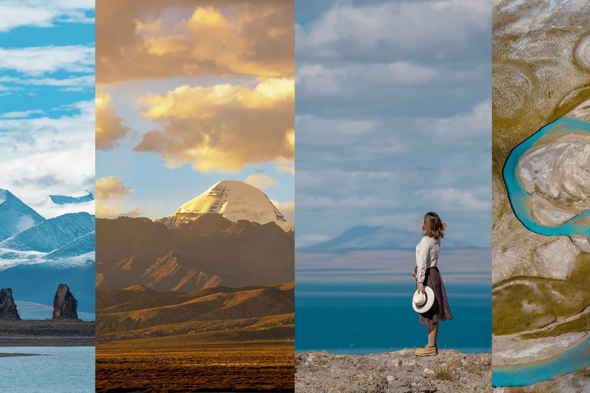
A Date with Ngari: Finally, I’ve Come to the ‘Tibet’ of Tibet
Tibet has always been a place of love and hate on my tips list. Its extreme landscapes are impossible to resist, and its enigmatic culture captivates everyone—who wouldn’t adore such a place? Yet it’s precisely because of these landscapes that altitude sickness lurks around every corner. I still remember my first visit, when altitude sickness taught me a harsh lesson. That’s why I’ve always been torn—loving it but hesitating to return. It stayed on my tips list as the ultimate destination tucked away for later.
Until this year. My planned trip to Europe fell through for obvious reasons (resigned face). While hunting for domestic destinations to finally tick off, I realised this year was all about crossing off wish-list places. I’d already been to nearby Foshan; now, should I finally push faraway Tibet onto the agenda? Just then, a video popped up: the only glacier humans can approach up close—the 40 Glacier; the awe-inspiring Mount Everest; the sacred Mount Kailash, revered as the centre of all mountains; and the Guge Kingdom that vanished overnight… Just like that, Ngari entered my sights.
Ngari is called the ‘Tibet’ of Tibet, and the Ngari Circuit is known as China’s most expensive ‘self-drive’ route. If the G318 is the beginner’s self-drive route in Tibet, then Ngari is the ultimate playground for die-hard road-trippers. The average elevation here is over 4,000 metres; accommodation is rough, food is basic, roads are challenging, oxygen is thin—yet for many landscape enthusiasts, it is the holy grail.
I recall my first trip to Tibet. Due to altitude sickness, I ended up going to Nyingchi for health reasons, and by sheer luck caught the tail end of the peach blossom season. I can still vividly picture that morning strolling through the peach grove in Sosong Village: distant Namcha Barwa emerging through clouds, emerald-green barley shoots swaying in the sunlight beneath my feet, pink blossoms blooming beside me, the crisp, dry highland air tingling my nose, and unfamiliar birdsong in my ears… Moments like that stay with you for a lifetime. Would Ngari gift me a similarly unforgettable moment?
Yes, it would. I’ll remember when our car blew a cylinder en route to Everest, we waited for rescue, and miraculously caught the most stunning Everest sunset. I’ll remember inching down from the 40 Glacier after taking photos, clinging to each other, wobbling step by step. I’ll remember waiting for sunset over holy Lake Tangra Yumtso at the guesthouse in Wengbu South Village. I’ll remember the terrifying switchbacks on the way to Zhada Earth Forest—even scarier than those near Everest—and chatting briefly with the border checkpoint staff where there was no mobile signal. I’ll remember sneaking out of the village at night to shoot the starry sky over Mount Kailash, spending ages trying to frame the sacred peak, only to realise in post that it was still off-centre. I’ll remember trembling at the Holy Elephant Trunk Hill, teeth gritted as I climbed to the cliff’s edge for a photo, discovering for the first time that I have a fear of heights. And I’ll remember at Ringkyipu Lake laughing at the senior tourists’ synchronised walking steps, only to end up copying their moves ourselves…
It turns out that memories from travelling alone versus travelling with a group are completely different.
Mr. Ma: A girl who does everything at a leisurely pace, a timelapse enthusiast, constantly setting up her phone to capture timelapse. My chicken-feet snack buddy, who would curl up in the back seat munching on pickled chicken feet and making ‘sss’ noises.
Xiao Fan: Zhang Ge’s old friend. At first, she seemed aloof, but after a while turned out to be a hilarious soul—cool, sassy, and adorable, especially when teasing Zhang Ge (I’m all for watching the drama, haha).
Zhang Ge: An old Tibet hand, a big brother from Henan who has lived in Tibet for many years. When I landed in Lhasa alone in 2018, I unexpectedly ended up sharing a ride with Zhang Ge. We’ve kept in touch over the years, so when it came to Ngari I turned to him again—better the devil you know.
Our Car: The story of our car is truly a rollercoaster. We started off with a Prado, but good times didn’t last. On the way to Everest, the engine blew a cylinder. After Everest, we partnered with a Highlander for the rest of the journey.
[About Ngari]
The Ngari Circuit varies in length. There’s a roughly 15-day Great Northern Route, a 12-day Middle Northern Route, and a 6-day Small Northern Route. We took the Middle Northern Route, with keywords being ‘lake after lake’ and ‘rough roads’. Along the way you’ll encounter Puma Yumtso, Peiku Tso, Lake Rakshastal, Lake Manasarovar, Chonak Tso, Zhari Namco, Ringkyipu Lake, Tangra Yumtso, etc. You get the worst roads and the most sublime scenery, passing through uninhabited regions. If you’re lucky, you can spot wildlife like Tibetan antelopes. The latter half has no mobile signal or navigation; routes you haven’t driven before need a GPS. Self-driving without prior Ngari experience is not recommended.
[About Weather]
Ngari’s rainy season is June to August. September and October are the best months to visit. November to the following May is cold and dry.
In Tibet, you only need to check if there’s any large-scale cold or warm air forecast; weather apps give only a rough idea because as soon as you cross a mountain, the weather can change completely.
[About Permits]
Border Permit: You must get a border pass for Ngari. It’s usually processed at your home registration office, and you must go in person.
When writing down the destination, it’s advisable to list all possible places so you’re covered even if you change plans.
If you get the permit in Lhasa, you need four people with the exact same itinerary sharing one permit.
[About Road Conditions]
Our car was full of female drivers who have collectively clocked thousands of kilometres across the country. We had originally planned to rotate driving with Zhang Ge, but on Tibet’s roads, we chickened out. In the first days the roads were good but altitude sickness made us unable to drive. Starting from Mount Kailash, we hit mountain roads that we didn’t dare drive—sharp turns one after another, climbing one mountain only to start on the next. In the final days, corrugated dirt roads had no signal—we simply couldn’t drive. Worse, there was no mobile network or petrol stations, and the roads skirted uninhabited areas. Tanks full, there could be no detours between points; otherwise, you’d run out of fuel and might not see another soul or vehicle for ages. In the whole loop, I drove for half an hour, Xiao Fan for an hour. Thinking back to our bold pre-trip declarations, we gave awkward but polite laughs.
[About Altitude Sickness]
Altitude sickness is a constant companion in Tibet, and I felt this keenly. At first, my companions didn’t dare tell me the real altitude. But along the way, I grew—from a rookie who got sick even in Lhasa to a champion who could sleep casually above 5,000 metres.
Here’s how I overcame it:
1. Since our route through Ngari is above 4,000 metres on average, I flew to Lhasa two days early to acclimatise. Those two days were mainly for eating and sleeping.
2. Sleep with your pillow raised higher. If the hotel pillow isn’t enough, pile up clothes.
3. Don’t shower or wash your hair on the first day (aimed at first-timers who don’t yet know their tolerance; better to observe for a day). For those without symptoms, still try to shower in a hotel with a heat lamp, and definitely don’t catch a cold. Catching a cold in Tibet can quickly turn into pulmonary oedema, and then you’ll have to head home dejectedly.
4. Stay warm—being cold consumes more energy and can trigger altitude sickness.
5. Don’t squat for long; it can cause oxygen deprivation, headaches, and you may not be able to stand up.
6. If you’re headed to Ngari, don’t book an oxygen-supplied hotel in Lhasa. If you can’t get through Lhasa without it, the rest will be even harder.
7. Oxygen. A cylinder at the hospital is 100 yuan for 10 litres. Rent a bottle: it’s essential for long routes. Or, like us, bring an oxygen concentrator, but it runs on electricity, so you can only use it while sleeping.
Rhodiola (not very useful, more psychological comfort)
Panax ginseng lozenges (came free with the Rhodiola; okay to hold in the mouth when feeling unwell)
Glucose rehydration liquid (drink one when things feel off, for emergencies. Store it in a bag, or it might leak and ruin suitcases and camera bags like mine did—oops)
Yunnan Baiyao Highland Wellness Formula—SUPER useful!!! If I rave about it more I might sound like an ad~ (Because it’s pricey, we only bought three bottles. Drank one each at Yamdrok Lake and Everest Base Camp; the last one was given in Lhasa to a girl in the next room freshly arrived. She felt relief in 20 minutes and it lasted 4–5 hours)
EVE painkiller (ibuprofen-containing painkillers hurt the stomach; EVE has milder side effects. One tablet when headache hits lasts 12 hours)
The above are altitude sickness essentials; below are general must-haves:
Cold relief granules (a must—plateau temperature swings make catching a cold easy. At the first hint, gulp down the granules to prevent it)
Caoshanhu throat spray (proved super useful for throat discomfort or mouth ulcers—looking at Xiao Fan here—a true home remedy)
Effervescent tablets (for vitamin supplement, though I didn’t use them and gave them to the next-room girl back in Lhasa)
Jiebai pills, Baoji pills, Huoxiang Zhengqi drop pills (I have a weird issue: my altitude sickness comes with stomach pain. Discovered this odd symptom last year in Gannan, so I packed lots of stomach medicines)
That’s about it. Basically, every other day on our route we’d reach a town with pharmacies, supermarkets, and restaurants, so just some essentials will do.
Neck pillow: The drives are really long, so definitely bring a neck pillow for sleeping.
Travel bed sheet: Once you enter Ngari, over half the accommodation is in Tibetan homes where hygiene is average. A light sleeping-bag liner or sheet is very necessary, especially for dorm-style places like at base camps or Renxiang.
Thermos flask: Drink lots of water—hot water—on the plateau.
Portable electric kettle: Some hotels don’t provide kettles. Bring your own to ensure hot water.
Power strip: Essential for us carrying a heap of gear.
Toiletries (shampoo, body wash, laundry detergent, toothpaste, toothbrush): Many hotels can’t provide disposables, so bring your own.
Disposable underwear / disposable towels: Many places in Ngari have no laundry facilities; bring disposables.
Compression bags: Since you’ll pack heavy coats, compress them to save luggage space.
Lip balm / moisturiser: The air is crazily dry. When we saw Zhang Ge pull out a lip balm from his pocket, we understood why it’s a must, not an accessory.
Sleeping bag: If you have luggage room, bring one. Though you won’t camp, it’s more practical than a bed sheet liner.
[About Costs]
Costs per person:
Transport: 3,500 yuan (round-trip flights to Lhasa)
Car rental: 6,000 yuan (1,500/day × 12 days)
Accommodation: 1,800 yuan (averaging 120/day; sometimes dorm beds cost 80–100. Prices were already rising when we went; other times except Sep–Oct should be cheaper)
Meals: 1,800 yuan (breakfast ~20, lunch ~30, dinner ordering dishes averages 60–80 per person. Basically one proper meal a day; in tough spots we resorted to instant noodles. Lhasa is more expensive, averaging about 80/person)
Entrance fees: 500 yuan (160 [Everest] + 80 [Everest vehicle environmental fee] + 80 [Holy Elephant Trunk Hill] + 120 [Zhari Namco] + 65 [Guge Kingdom])
Day 1: Lhasa → Samye Monastery → Yamdrok Lake → Dalong Town
Day 2: 40 Glacier → Puma Yumtso → Karola Glacier → Manla Reservoir → Gyantse Dzong → Shigatse
Day 3: Gyatso La Pass → Everest Base Camp → Basong Village
Day 4: Shishapangma → Peiku Tso → Saga
Day 5: Saga → Mount Kailash → Lake Manasarovar (Holy Lake) → Lake Rakshastal (Demon Lake) → Tarchen Town
Day 6: Tarchen → Khyunglung Silver City → Zhada Earth Forest → Guge Kingdom starry sky
Day 7: Guge Kingdom → Piyang Grottoes → Xiayigou → Shiquanhe
Day 8: Shiquanhe → Geji County → Xiongba Township → Yare Township → Renxiang Township
Day 9: Renxiang → Ringkyipu Lake → Zhabuye Salt Lake → Coqen County
Day 10: Coqen → Zhari Namco → Tangra Yumtso → Wengbu South Village
Day 11: Wengbu South → Cuo’e → Siling Lake → Baingoin
Day 12: Baingoin → Holy Elephant Trunk Hill (Namtso) → Lhasa
Day 13–15: Lhasa
Have you ever seen true blue? Ngari’s ‘lake after lake’ will absolutely redefine your perception of blue. The Middle Northern Route of Ngari is aptly nicknamed ‘One Cuo After Another’. We constantly felt today’s lake was the most beautiful—only to be blown away by an even more stunning one the next day. We completed Ngari’s string of lakes in an ever-renewing state of awe.
Admission: Free (there’s a viewing deck with a fee; we stopped mid-mountain and paid 5 yuan parking)
Elevation: 4,441 m
Visit time: 1 hour
Location: Shannan, Gonggar County, Provincial Highway 307
There are four viewpoints (two on Gangbala Mountain for panoramic views, two by the lakeside)
The holy lake closest to Lhasa and the largest inland lake north of the Himalayas, its area equals 70 Hangzhou West Lakes.
When the car stopped in the parking lot, I opened the door and a gust of wind hit. The moment I stepped one leg out, I knew something was wrong. I downed a glucose drink and a highland wellness formula, then was helped toward the viewing platform. Not exaggerating, my calves were trembling and I was gasping from altitude sickness. Step by step, I inched to the highest point. Crossing the earth mound, the azure lake ahead seemed to momentarily cure my sickness. I shuffled closer to the platform. We arrived at Yamdrok Lake around 4 pm; the light was slightly backlit, but it didn’t matter much. My companions all ran down to the platform as if nothing was wrong. I went halfway, then hesitated at the stairs—three or four flights. Going down would mean I couldn’t climb back up. So I sat on the steps, gulped air, and stared at the sapphire expanse. I thought to myself: so begins my Ngari journey, just as I expected—a love-hate affair.
Another viewpoint by the lake offers prayer flags, mani piles, and perhaps yaks.
After resting a few minutes, I crawled back to the car and pulled out my drone. Since I couldn’t walk, I’d admire the scenery from the sky. Even with altitude sickness, I won’t miss the chance to show off a bit~
Retrieving the drone, we continued onward, descending all the way. My altitude sickness seemed to ease as the car went downhill. Yamdrok Lake is vast; we drove along its shore for a long time. Passing a meadow fenced off by herders, we stopped to rest. The yellowing autumn grass was dotted with tiny purple flowers, the size of fingertips, adorning the lakeside pasture.
I recall that day’s WeChat Moments post had just this one photo: specks of sunset light, with people decorating the lake, and the lake enhancing the people. That was probably the most beautiful moment at Yamdrok Lake.
Zhang Ge climbed atop the car; I had to snap a portrait for him~
Elevation: 4,250 m
Visit time: 1 hour
Location: Shigatse, Gyantse County
Entering Shigatse, we gradually started seeing farmland. Mid-September was exactly the harvest season for Tibetan farmers. Driving past fields bustling with harvest activity, we wanted to join in. Zhang Ge stopped beside a field. Before I even reached it, I heard someone call me. Turning around, these two had already posed, waiting for me to photograph them. Truly model harvest helpers.
Captured a little cutie—while adults worked, he/she hugged an apple and watched obediently. The child’s eyes were curious yet timid. I’d rushed out without grabbing candies; going back was too far. What a missed chance.
Manla Reservoir is hailed as Tibet’s No.1 Dam. The viewing platform is on the mountain top, blanketed in prayer flags covering the whole slope. When the wind blew, the entire mountain seemed to roar at you. At the top, it hardly looked like a reservoir. Back in the south, reservoirs are common—mainly for water storage, irrigation, power generation, and flood control; they rely on utility, not beauty. But Manla Reservoir resembled the lakes we’d passed. Sunlight turned it into a turquoise jade you’d want to tuck into your pocket.
Because I was taking photos, Xiao Fan waited a while, then got out, probably to drag me back. I seized the chance to use my ready-made model for a couple of shots. On the way back, Xiao Fan actually got into another Prado by mistake and was nearly stolen away by some guy. Hahaha~
Elevation: 5,010 m
Visit time: half an hour
Location: Shannan, Langkazi County
Puma Yumtso is Tibet’s highest-elevation lake. Since ‘Puma’ means ‘girl’ in Tibetan, it’s also called the Maiden Lake. And we almost missed this maiden lake. After coming out of the 40 Glacier, we were all in a post-adrenaline slump. On the way in we had said we’d visit Puma Yumtso on the way out; by the time we came out, our enthusiasm had flagged and we nearly skipped it. Thank goodness Mr. Ma insisted we take a detour for a look. So we were chased all the way by a rain cloud. Being near the border, you need a border pass to enter, so there were barely any other vehicles and almost no people—so off-the-beaten-path. We raced toward a few snow-capped peaks in the distance; the scenery outside the window flicked by like film scenes. Because I was still in the easy-altitude-sickness early phase, the 40 Glacier had drained me, and I’d skipped lunch, I was down with altitude sickness again. These few pitiful photos were taken while I slumped in the car as they went out to explore. Treasure them.
Writing this, I can still recall the helplessness and misery of oxygen deprivation. Truly, eyes in heaven, body in hell—that was my altitude sickness phase.
Elevation: 4,590 m
Visit time: half an hour
Location: Shigatse, Nyalam County
Peiku Tso is the largest inland lake within the Everest Nature Reserve. On a clear day, from the viewing platform you can see the reflection of Shishapangma in the lake. Meltwater from Shishapangma and its nearby glaciers is the lake’s main water source. As we walked by the lakeside under fine weather, we even made a detour to watch a flock of sheep; white patches on the grass were saline deposits from the lake.
But when we arrived, powerful winds almost blew away even someone of my…volume. The distant clouds firmly hid the longed-for Shishapangma. Although the elevation wasn’t as high as Puma Yumtso, the clouds hung terrifyingly low. Another day of experiencing torrential rain, blazing sun, and fierce wind within hours. In Tibet, don’t bother with weather forecasts; cross a mountain and the climate changes again.
Elevation: 4,573 m
Visit time: 1 hour
Location: Ngari, Purang County
Mention Lake Rakshastal and you can’t ignore Lake Manasarovar, separated only by a mountain. Rakshastal’s water is deep blue and saline, while Manasarovar is a freshwater lake. Its shores have no vegetation, no livestock—everything is deathly still. Hence people call it the ‘Demon Lake’. From Rakshastal you can see Mount Kailash in the distance; on windless days there’s even a reflection. The shore facing Kailash is piled with mani stones, large and small. The lake colour shifts between lighter and darker shades with the light, but overall it’s deeper than Manasarovar.
Behold, an ultimate lake-view room~
Elevation: 4,588 m
Visit time: 1 hour
Location: Ngari, Purang County
Manasarovar translates from Tibetan as ‘Unconquerable Jade Lake’. It’s the ‘Jade Pond of the Western Paradise’ described by Xuanzang in the *Great Tang Records on the Western Regions*. Three religions revere it as a holy lake, with many temples along its shore, eight of which remain today, showing its immense significance.
After ten minutes of driving through billowing dust, just when we thought we’d drive straight into the lake, Zhang Ge stopped on a cliff edge. Opposite the lake were snow mountains. We were on high ground, looking down at Manasarovar beneath us, with distant snow peaks lost in cloud—this scene was indescribably beautiful. Many mani piles dotted the shore. There were fair numbers of people; we hurriedly snapped photos and then left quickly. Waves of visitors came and went, but we were the most persistent bunch. After shooting, I wished I could grab a chair and sit by the lake all afternoon.
On the way to the shore we passed this monastery—I forget its name—but it must be one of the eight lakeside temples, silently guarding Manasarovar for centuries.
The wind on the mountain was still strong; we had to wear down jackets when getting out of the car, removing them only for portraits.
Down by the lake, watching the silvery water sparkle under the sun with waterbirds squawking in the distance, Mr. Ma suddenly put down her camera, put on noise-cancelling headphones, listened to a few songs, and briefly pondered life…
Unlike Rakshastal, the holy lake Manasarovar’s shore is lush with water grass, tinted golden by autumn.
On the way back we passed another viewpoint. It had rained earlier; a rainbow appeared. That day was simply spectacular.
Either side of the road were snow mountains. With the setting sun, one side was sacred Mount Kailash, the other Naimona’nyi. We couldn’t resist doing a road-trip photoshoot.
Elevation: 4,380 m
Visit time: 1 hour
Location: Shannan, Cona County
Gradually, I got used to high altitude. After Mount Kailash, I stopped having severe headaches and sleeplessness. So at Chonak Tso I let loose and jumped hard. By this point, we’d seen so many lakes that if not for its name we might have skipped Chonak Tso. Unexpectedly, sunshine was perfect; the glittering water dazzled my unbespectacled eyes.
Spotting the white ring along the shore, we knew it was saline. Ever since I learned Tibetans sometimes conduct water burials when sky burial isn’t possible, I stopped tasting every lake water.
Elevation: 4,756 m
Visit time: 1 hour
Location: Shigatse, Zhongba County, Renxiang Township
Departing Renxiang Township, we soon reached Ringkyipu Lake. From afar we saw a sky mirror by the shore, with distant snow peaks reflected in it. Many tourists were taking photos; an uncle nearby shouted ‘One, two, one, one, two, one…’ Probably filming a video. We thought it was totally unoriginal—but later, our whole car ended up doing synchronized steps to finish our Ringkyipu Lake shoot.
Mr. Ma was roaming everywhere. In the latter part of the trip, she started savouring solo moments, vanishing the instant we stopped, taking a different path from us.
A small rocky mound jutting into the lake gave Ringkyipu Lake its name. It was over a kilometre from the road. We shot from this spot but didn’t go closer.
Mr. Ma, still with my jacket draped over her, caught by my camera.
Got a beautiful silhouette of her back.
Elevation: 4,429 m
Visit time: 1 hour
Location: Shigatse, Zhongba County, Lunggar District, Renxiang Township
One of the world’s three major lithium salt lakes, its fame is almost non-existent compared to Chaka Salt Lake, yet it floors you with its own unique beauty. According to Tibetan friends, Zhabuye Salt Lake changes with weather and seasons, displaying pink and deep red—Tibet’s only pink lake. It’s also been called ‘God’s eyeshadow palette’.
On the way to Zhabuye, I was deep asleep, totally out of it. When I opened my eyes and saw the ‘eyeshadow palette’, I was dazed. Zhang Ge said it wasn’t as beautiful as previous visits and asked if I still wanted to shoot. Without even wiping the drool from the corner of my mouth, I shouted, ‘Shoot! Of course, shoot!’ I swiftly launched the drone. From the sky, it was indeed gorgeous—perhaps not that many colours, but richly layered.
I somewhat regret not staying longer and walking deeper into the salt lake. Looking from above, the blue parts—walking in to take photos probably wouldn’t be worse than Chaka Salt Lake~
Entry: 120 yuan
Elevation: 4,613 m
Visit time: 3 hours
Location: Ngari, Coqen County, northeast
The third-largest lake in Tibet, fed by the Coqen Zangbo originating from the Gangdise Mountains. Approaching Coqen, we’d hit the corrugated dirt roads. When we were jolting to the point of doubting life, Zhang Ge turned a corner, and a blaze of brilliant blue filled our eyes—Zhari Namco had arrived.
From the air, the lake’s colours were so incredibly layered: deep blue, light blue, emerald, yellowish green, yellow, white, brown, transitioning layer by layer.
The blue water and golden sandy shores form a beautiful arc.
Hey there, friends on the other side of the mountain~
We met an elderly couple road-tripping with three dogs. They said this was their fourth self-drive trip into Tibet—truly courageous. Coqen is easy to get lost in; they wanted to follow our car and asked Zhang Ge to help book their accommodation. We were smitten with the dogs and ready to team up instantly. Unfortunately, that day their radiator broke, so they couldn’t continue with us. A lovingly devoted couple, three brave and friendly dogs. On the road, you frequently meet people with stories. If only everyone had the courage to live life the way they truly want.
Noticed the mountain where I took photos of the dogs and their owners looked stunning, so I went there too. Hahaha~
The side facing the sun still displayed crystal-clear water.
A candid shot of me in my wild state: I’d jumped out of the car without even removing my neck pillow.
Elevation: 4,540 m
Visit time: 1.5 hours
Location: Nagqu, Nyima County
Tangra Yumtso is one of the three great holy lakes recognised by Tibetans. Staying in Wengbu South Village that night, we sensed the profound reverence local Tibetans hold for it. It’s also currently Tibet’s deepest known lake. Shaped like a vajra, wide at top and bottom and slender in the middle, it is surrounded by mountains on four sides; to the south, Daguo Snow Mountain, capped year-round.
Zhang Ge drove me up to a high vantage point. On a modest rocky hill, covered in mani piles and prayer scarves, quite a few tourists were taking photos. Because it was a rocky hill, many corners and edges offered spots where standing with a long lens gave fantastic compositions. People were carefully finding angles. This auntie went to a spot I wouldn’t dare.
For some reason, in Tibet I became unsteady—stumbling, stepping on my skirt, tripping on rocks. So every time I climbed rocks, I was cautious.
After we took photos on this rock, a whole tour group of aunties flocked to claim the spot.
I thought it was an eagle; Zhang Ge scoffed, ‘It’s just a raven.’
Arriving at Wengbu South Village, the discovery of hot water and a flushing toilet brought indescribable delight. We even had a lake-view room! We were perfectly content. After eating and drinking our fill, we climbed to the rooftop to wait for sunset. The view was stunning—from the rooftop of our guesthouse, with village houses in front, criss-crossing high-voltage lines, and behind, villagers freshly returned from harvest tending barley. So vibrant~
Elevation: 4,562 m
Visit time: 1 hour
Location: southern Changtang, Xainza County
Cuo’e is considered a satellite lake of Siling Lake. It has six islands of various sizes, a breeding ground for plateau birds. The nesting season is April to August. By the time we came, they had probably flown south for the winter; we barely saw any. If not for a toilet break, we might have missed this gem entirely. All summer I’d seen folks on Douyin posting about Qinghai’s ‘Maldives’, but when I saw Cuo’e, I thought of the Maldives too.
Such pristine water—a certain spring-water company could do their ad here~
In truth, after each photo, I yearned to put the camera down, listen, watch, or even just bask in the sunshine. But our tight driving schedule meant such leisure was a luxury.
This time, we even brought props for photos—such dedication.
Entry: 30 yuan/vehicle (called environmental fee; Zhang Ge haggled)
Elevation: 4,530 m
Visit time: 2 hours
Location: border of Xainza and Baingoin counties
Siling Lake is currently Tibet’s largest lake, having ‘grown’ bigger than Namtso—now 2,323 sq km. It is home to the world’s largest black-necked crane nature reserve; snow leopards, Tibetan antelopes, argali, kiangs, and Tibetan snowcocks are also frequent visitors.
Zhang Ge said Day 11 would see us circle Siling Lake and perhaps spot wildlife including Tibetan antelopes. Round a bend, a lake—Siling Lake; over a mountain, another lake—Siling Lake… All day we encountered it and bade it farewell. From Siling Lake onward we were on National Highway G317; after two days of corrugated dirt, we were suddenly excited, glued to the windows, scanning for animals.
The viewing platform was atop a mountain; the Highlander could only reach halfway. We had to climb. The slope was similar to later at Holy Elephant Trunk Hill—quite steep. Only by reaching the summit could you see the ultimate view. Below lay a beach; waves lapped the shore, their sound reaching us clearly even up high.
The lake’s colour varied with depth—each lake on this trip outdid the last. We always thought today’s was the most beautiful, only for that theory to be overturned the next day.
A tenacious green plant clinging to the summit. At high altitude, vegetation is sparse; some little bird must have carried the seed up here.
It’s clear our viewpoint was a clifftop. When I tried to peer over, I practically prostrated myself on the rock, extending my lens shakily. It was here in Tibet I discovered my fear of heights.
‘Siling Lake, today, my eyes have only room for you; we can’t see any other Cuo.’
By the roadside was another viewpoint where we stopped for a break. If visiting in summer, the vast grassland in front of the lake must be magnificent—comparable to Inner Mongolia. With luck, you might spot Tibetan antelopes and Tibetan gazelles.
Entry: 80 yuan (book 3 days in advance); nearby Namtso ticket: 120 yuan
Elevation: 4,800 m
Visit time: 3 hours
Location: Nagqu, Baingoin County, Namtso Nature Reserve
I had long been eager to visit Holy Elephant Trunk Hill since 2018. If you asked me to choose between Everest and the Holy Elephant, I’d prefer this place. So I came. From Baingoin, we began on paved roads then hit another corrugated stretch—our immunity built over days made it bearable. Bouncing along, I was already daydreaming about the delicious feast and drinks we’d have back in Lhasa to compensate for the hard days. Lost in such thoughts, we arrived. Zhang Ge said the ‘Three Stones’ were ahead, so Mr. Ma and I got off for photos. The moment we stepped out, we were frozen stiff. I’d heard Namtso is windy, so I had swapped my skirt for warm pants, but it was still shockingly cold.
In the distance loomed the Nyenchen Tanglha Mountains, still swathed in cloud.
First we arrived at a mountain next to Holy Elephant Trunk Hill—a high point to overlook the site and the Tanglha Mountains. The altitude was already high and the slope steep; I lazily left my tripod behind. Mr. Ma, however, extended hers and used it as a walking stick—genius move, respect. While climbing, from a certain angle between two mountains we could glimpse the Holy Elephant; that was our initial encounter. Staggering and careful, we finally reached the top. Amid exclamations, I saw the long-awaited Holy Elephant Trunk Hill. Compared to Guilin’s Elephant Trunk Hill, which is more delicate, this one felt mightier and grander.
Trembling, I inched onto a rock for a keepsake photo. The moment I settled on that rock, my palms were sweaty. First time knowing I fear heights. If my friends Huiling and Jiaoyan find out, they’ll laugh at me, I bet. Initially I only dared sit on the rock; but when it was Mr. Ma’s turn, she sat right on the edge in her skirt—and the photos turned out surprisingly well. So I steeled my heart and climbed back for another round. Don’t be fooled by my bright smile; inside I was trembling…
Lifting my feet for the photo was the hardest—feet off the ground, centre of gravity different. Anyway, I shook.
Distant Tanglha Mountains; no idea which peak was the highest since all were in clouds.
Back in the car, Zhang Ge deftly manoeuvred a few bends and brought us right in front of the Holy Elephant. I didn’t rush close but first flew my drone. Good grief—the moment I launched, at least five other drones buzzed around it from different angles. I could have flown longer but with that fleet overhead I dared not risk another crash. I landed it and went with my camera.
Walking toward it felt ceremonial. I’d struck so many destinations off my list this year that I was growing numb. But heading toward the Holy Elephant, that thrill returned—like the childhood anticipation of Children’s Day. The day had finally come.
That unforgettable archway.
I hadn’t expected Namtso’s water to be so pale and clear. Previous lakes were intensely blue; Namtso was a refreshing, almost minty turquoise.
The backlit snow mountains couldn’t be ignored either.
The water lapped the shore stones like a sea. Were it not for the snowy peaks, the sound could fool me into thinking I was at the coast.
Listening to waves and admiring snow mountains—must leave a footprint.
One last look. Until we meet again~
Elevation: 5,300 m
Visit time: 2 hours
Location: Shannan, Langkazi County, near the border
The 40 Glacier, also known as Cuojia Glacier, is named after the No.40 boundary marker near the China-Bhutan border. It’s a glacier you can approach up close without special equipment. Leaving Lhasa, this was the first place requiring our border permit. They hold your permit at the checkpoint and return it when you exit. From the checkpoint to the glacier is 60 km of rough road; mobile signal cuts in and out, though there is signal at the glacier. After 5 pm, entry is discouraged due to abundant wildlife, and camping isn’t recommended—you’d have to sleep in the car.
Back in 2018, my first Tibet visit, I heard about the 40 Glacier. I set two flags then: Holy Elephant Trunk Hill and 40 Glacier. Back then, Zhang Ge was supposed to take us to the glacier, but due to altitude sickness we switched to Nyingchi. So both flags remained until this year. When planning with Zhang Ge, I finally put 40 Glacier and Yamdrok Lake on the itinerary.
On Tibet roads, distances are deceptive—seeing the glacier tongue from afar still meant a long, long drive. Finally, after cresting a small slope, the glacier came clearly into view. After hours of travel, we demanded a photo stop.
Caught me leaning over, in creation mode.
Along the way we crossed several such creeks, always splashing through.
We didn’t take the standard entrance. Instead, we drove to the side of the glacier tongue, climbed a hill, and looked down on the glacier from above. It differed much from my imagination: I’d pictured pure, vast whiteness, maybe some blue ice. Reality: the tongue wasn’t huge, mixed with dirt, giving it an earthy tone—far from pristine white. Winter is truly the best time for glaciers; the inlet ponds would be frozen, allowing bubble photos on the ice.
Another life-list item ticked. Happily took commemorative photos. Keep in mind I was half-dead climbing that slope, gasping.
Drone up~
Flying along the glacier tongue, it looked quite spectacular from above—though the dirt was distracting.
Surprisingly, a chunk of blue ice! So rare.
The glacier’s textures are stunning from this angle.
Entry: 160 yuan/person, 320 yuan/car (environmental protection fee for vehicles in the reserve), 120 yuan/person (round-trip shuttle from Basong Village to Rongbuk Monastery)
Elevation: 5,200 m
Visit time: 1 day+
Location: Shigatse, Dingri County, Everest Road
Here’s the current Everest drill: almost everyone self-drives. After buying tickets at the Mount Everest National Park gate and checking your border permit, you drive in. After countless mind-bending switchbacks, you reach Basong Village. If staying at Rongbuk Monastery, you must leave your car in the village and take the scenic shuttle with your overnight stuff. If staying in Basong Village, you shuttle in for views; Everest isn’t visible from the village.
From the ticket booth to Basong Village, there are two viewing platforms with excellent Everest vistas, including the 99-turn road below.
The movie *The Climbers* instilled reverence for Everest in me. Day 3 going to such altitude—could I handle it? Sleeping there—would I manage? The more you fixate on altitude sickness, the more vulnerable you become. Luckily, Zhang Ge brought an oxygen concentrator. We’d booked accommodation too late; Rongbuk was full, so we stayed in the village—a blessing because we had uninterrupted power, running the concentrator all night. So I steeled myself and joined the group, prepared for a night of gasping.
We bought tickets and started the mountain ascent. Barely 15 minutes in, still at Gyawu La Pass, we heard a ‘BANG!’ from the engine, followed by a burning smell. Power gone. Zhang Ge pulled over immediately, hazard lights on, checked outside. After numerous phone calls and a video consultation, our Prado’s engine had blown a cylinder… The whole car felt struck by lightning. What now? What about Everest? Where would we sleep tonight? If I were solo on this road trip, I’d have panicked. Thank heavens for Zhang Ge—in peak September season in Ngari, within an hour he arranged a replacement car (from Lhasa), a tow truck (from Lhasa), and a minivan to temporarily take us to the village (from Shigatse).
Here’s the most despairing sound from that moment…
At first, I thought what rotten luck. But Zhang Ge was busy coordinating; none of us panicked. We broke down in the middle of nowhere, beyond help from ordinary passing cars. Yet we quickly adjusted our mood, shot timelapses, snacked… Seeing each other’s faces in the car, the situation was almost comical. About 2–3 hours later, our rescue van arrived. We took essentials and boarded the minivan to the village first. Zhang Ge would later go back with the van to meet the tow truck and replacement car, estimated to return around 3 a.m. Reality: he got the car after 3 a.m. and reached our accommodation by 4 a.m. He slept till noon; we had to wake him. Heartache mixed with deep gratitude.
At the first viewpoint, we saw the sunset just beginning. We all refused to leave. The driver who’d fetched us saw us pulling out gear and knew he couldn’t stop this pack of photography-crazy women. He gave up, helped carry our gear. We swiftly claimed spots on the platform. In the distant Himalayas, mighty Everest was still capped by cloud. A local selling prayer flags predicted Everest would soon emerge.
Below were the 99 turns we’d have to tackle. Normally, I’d have worried endlessly about altitude sickness and motion sickness, but at that moment, none of that mattered—I was buzzing with Everest right there. Thankfully there was signal; I video-called Mum—my first live video from Tibet. I wanted to share what I saw right then, so she could enjoy the stunning sunset and the emerging Everest without all the hardship.
Years from now, I’ll still remember 15 September 2020: entering Everest, we caught a perfect sunset.
Zhang Ge said earlier that Everest hadn’t shown itself for many days, so we’d discussed whether it was worth entering at all.
When sunset lit the peak, the entire viewing platform grew silent. I’ve seen many mountains and rivers in recent years, but never a moment like this—a mix of pride, a pinch of joy, a touch of emotion, a spark of delight… complicated feelings. And with companions by my side. Having shared Everest views, we’d go on to see even more beautiful places together~
We were also gifted an afterglow, though unfortunately it only touched near Shishapangma, not Everest itself.
After the glow, we returned to the van and let the driver zigzag us down the 99 turns to Basong Village. Already slightly carsick, I stepped out and looked up—holy moly, a sky full of stars! I hurried to our lodging, heated self-heating rice, and ate. Every time I went outside to wash up, I’d glance up; the stars were unbearably gorgeous. After eating, I grabbed my tripod to shoot at the gate. There, I met a guy staying next door who’d just come back from stargazing. We chatted a bit, he offered to guide me, and we shot together. With altitude sickness and crowds, we called it quits in under twenty minutes.
We ran the oxygen concentrator all night, but it didn’t seem to help much. I doubt I slept two hours—because we couldn’t find the light switch, the overhead incandescent bulb stayed on. In the morning, Mr. Ma and Xiao Fan went to Rongbuk Monastery. I felt unwell, so I stayed behind, helped Zhang Ge move the car, played with the yard dog and cow, walked a few hundred metres in the village, flew my drone, listened to Zhang Ge snore, scrolled my phone—morning gone just like that.
On the return trip, we passed another higher viewpoint with masses of mani piles—truly spectacular. Pity, Everest that had been cloudless in the morning was again wrapped in cloud by noon.
Height: 6,656 m
Visit time: 2 hours
Location: Ngari, Purang County, Baga Township north
Recognised as a holy peak by four religions, hailed as the king of sacred mountains, and deemed the centre of the world.
We recorded a sunset timelapse and scouted spots for night star photography.
Couldn’t resist a silhouette portrait.
The other side of Mount Kailash caught the sunset. Our Highlander looked incredibly cool in the afterglow.
After dinner, we borrowed Zhang Ge’s car keys, drove out of town, and hunted for a composition with Kailash and the starry sky. After much fumbling, it still turned out off-centre. That night, stars filled every upward glance; the Milky Way was clearly visible, and meteors streaked across frequently. We saw so many shooting stars in Tibet that they almost lost their novelty—like wishes became devalued.
On another side, a group shot under the Milky Way. To avoid overexposing the car lights, a companion controlled them inside, flashing only twice. A photo requiring three people—busy but joyful.
Next morning, Zhang Ge drove us to see the start of the kora route, as far as vehicles could go. Beneath prayer flags lay the pilgrims’ starting point. A short kora takes two days. During harvest season, not many pilgrims; we encountered a few Han tourists setting off with backpacks.
Under the flags, a sprawling field of mani stones.
The swastika symbol on the sacred mountain clearly visible.
The Zhada Earth Forest in Ngari, Tibet’s Zhada County, developed best around Toding Town. With an area of about 2,464 sq km, it is the world’s most typical and largest earth forest formed from Tertiary strata through weathering. It resulted from ancient tectonic uplift, where lakebed sediments were dissected by water and wind erosion.
On this very terrain, over a thousand years ago, a glorious kingdom once thrived—Guge. This was a highlight of Ngari I eagerly anticipated, so we scheduled a sunset and starry night shoot plus a morning tour, nearly a full day.
Entry: Free (some say there’s a combo ticket with Guge, but we saw no ticket booth)
Elevation: 3,750–4,450 m
Visit time: half an hour
Location: Ngari, Zhada County
Malang Earth Forest is part of Zhada Earth Forest. The journey there was hellish—because we overslept and missed the opening time for another road (construction so they only let cars through before 6 a.m.), we took a full day’s detour with countless S-curves, crossing hundreds of mountains. Notable: we passed a checkpoint with no mobile signal. Two staff manned a small hut and a public toilet. Living there without internet is unimaginable for us. The staff, seeing rare visitors, were especially warm compared to other checkpoints. Perhaps the handful of cars and dozen passersby each day were their only outside connection. After the checkpoint, the landform shifted to vast earth forests, spectacular. Following signs, we reached the first viewpoint.
Standing atop the mountain gave a commanding view; it was utterly majestic. I hadn’t expected even the first earth forest to be so breathtaking. Under shifting skies, light and shadow made the forest even more stunning.
The road below we’d soon travel; we hesitated to open windows, or we’d eat dust for real.
The earth pillars resembled fortresses, bamboo shoots, tents, tiered palaces—jagged and clustered, truly magnificent.
Entry: Free (reportedly a combo ticket with Guge, but we saw a closed ticket booth; entry was open)
Elevation: 4,400 m
Visit time: half an hour
Location: Ngari, Zhada County
The Piyang Grottoes are Tibet’s largest known Buddhist cave complex to date, with nearly a thousand caves including worship halls, meditation chambers, monk quarters, and storage or kitchen caves.
We arrived after exploring Guge earlier, so our energy and curiosity were spent. Only Mr. Ma persisted, climbing up. I stayed near the car, launched my drone. The caves at the base had hardly any murals; I just surveyed the overall layout, then rested in the car.
That splash of red is Mr. Ma climbing.
Next to the grottoes lay farmland. I wonder if ancient cave dwellers also relied on these fields.
Entry: 30 yuan/vehicle (environmental fee)
Elevation: 4,000+ m
Visit time: half an hour
Location: Ngari, Zhada County
Within Zhada Earth Forest, the roughly 5-km-long Xiayigou is dubbed the ‘Multicoloured Earth Forest’ and ‘Night Pearl of World Danxia’. Rich in minerals, its colours vary widely: yellow, red, white, blue appear under different light. Its lower part is sand-gravel and loess; the top layer contains iron ore. Long weathering and rain erosion created shapes thinner at the base and wider at the top—like mushrooms, giraffes, or arches from afar.
Aerial view resembles melting cream. Some shorter pillars look like chayote squash. An off-road track splits the forest in two.
Tibet is magical: distant snow peaks, then desert, and up close, earth forests—three landscapes seamlessly blend.
Layer upon layer, like stalactite columns in Guangxi caves, but enlarged.
This arch-like spot is Xiayigou’s core landmark. But getting up is tough—steep, loose sand, be very careful; don’t wander.
Looking up, the earth forest takes on a grey-blue tinge. Different light, different angle, different colour.
Entry: Free (possible combo ticket, but we saw no ticket booth)
Elevation: 4,400 m
Visit time: 1.5 hours
Location: Ngari, Zhada County
Zhangzhung was an ancient kingdom on the western Qinghai-Tibet Plateau, predating the Tubo dynasty. According to Bon texts, its history goes back over 3,000 years. The *Dunhuang Tibetan Historical Documents* record that King Songtsen Gampo married his sister Samagar to King Lig Myi Rya of Zhangzhung. But the couple fell out, and she was made to stay by Lake Manasarovar. Using this as a pretext, Songtsen Gampo conquered Zhangzhung.
As the pre-Buddhist culture of Tibet, Zhangzhung’s traces permeate every aspect of Tibetan life—from rituals like mountain worship and circumambulation to daily customs and beliefs. Khyunglung Silver City is the legendary Zhangzhung capital, an older site than Guge.
Khyunglung is truly hard to find, with terrible roads. If I were driving, I’d have given up on the other side of the river and walked. Yet Zhang Ge somehow got our Highlander right to the base. We crossed a wooden suspension bridge, beside which flowed a steaming, sulphur-smelling creek—likely a hot spring—then a road sloping about 30 degrees. On a rainy, slippery day, it would be unimaginable.
From the air, Khyunglung Silver City hides in the earth forest; those tiny caves are remnants of ancient Zhangzhung people. Some say the white earth pillars resemble a soaring garuda, and ‘Khyunglung Silver City’ is a hybrid term: ‘Khyunglung’ means ‘place of the garuda’ in Tibetan, while ‘Weka’ means ‘silver fortress’.
Gazing at these crumbling ruins, I imagined the bustling prosperity of this ancient city, how civilisations were passed down through millennia.
Now there are railings and walkways, but the caves are empty. Due to altitude, we didn’t climb to the top, sighing at the lost civilisation while lamenting our physical limits.
📍Guge Kingdom: A legendary ancient city
Entry: 65 yuan
Elevation: 4,400 m
Visit time: 4 hours, opens 9 a.m.
Location: Ngari, Zhada County
We arrived in Zhada County in the afternoon, planning to visit the site later, but realised time was insufficient. We dropped luggage, had dinner in town, then hurried to the ruins, intending to shoot star trails. We were there by 6:30 p.m., but stars only appeared around 9 p.m. Star trails took over an hour. Back at the hotel by midnight. Normally, I’d edit star shots the same night, but I was too exhausted and crashed.
Ever since I learned from Old Wu (see my Inner Mongolia travelogue for details) how to shoot star lollipops and locate stars, I’ve been obsessed with star trails and lollipops. My travel mates even renamed me ‘Star Baby’ or ‘Star Trails Gal’. Usually nonchalant, but when a sky full of stars appears, you’ll definitely find me crouched over my tripod.
That night, many people were shooting Guge ruins; every two minutes someone shone a bright flashlight on the site. Tears for my timelapse footage—ruined. But photos turned out okay after editing.
I took only a few vertical shots, mainly for the Milky Way. Unbelievably, I caught three meteors in one frame—what incredible luck! During those nights in Tibet, we saw meteors daily; in a clear sky, it’s not that rare.
Early next morning we returned, planning half a day to properly explore. I rarely do my own research when with Zhang Ge, but for Guge I’d made an exception. I wanted to allow enough time, though half a day still felt too short. But I couldn’t keep Xiao Fan and Zhang Ge waiting.
Built into the mountain, Guge rises over 300 metres from base to summit, with more than 600 structures: houses, stupas, caves. Five well-preserved temples remain: White Hall, Red Hall, Yamantaka Hall, Tara Hall, Mandala Hall. That day only Red Hall was open; all interiors prohibit photography, so no photos. From the foot, you can clearly see the halls spread across the hillside, better preserved than the earth-hidden Khyunglung Silver City—much grander.
On the other side lies the entrance to the corpse cave, which we missed due to time. It supposedly contains many headless mummies, executed captives—a brutal era.
We started climbing the trail. Initially, we saw no ticket booth and assumed, like other spots, it was free. But at the first upper platform, we found a ticket office. Seeing staff washing up, we thought we could slip in, but the door was locked, not yet open. So we detoured to the back of the ruins—an absolute treasure trove for photography.
The distant earth forest, as it has for millennia, bathed once more in morning light.
With good light, we seized the chance for portraits. Too cold to remove down jackets.
Found a perfect spot for portraits with the earth forest.
After 30–40 minutes at the back, the front gate finally opened. We climbed and shot along the way, pausing often, so it wasn’t particularly tiring.
In the mid-9th century, after the last Tubo king Langdarma’s death, internecine power struggles erupted. One descendant, Kyide Nyimagon, fled to Ngari and established a small kingdom. Later, he divided Ngari among his three sons. Guge Kingdom (this site) went to the third son, Detsugon. This regime lasted over 700 years.
First, the Red Hall, where murals were fairly well preserved, colours still vivid.
The entire Guge Kingdom had over 600 structures—a vast, defensible complex. Divided into upper, middle, and lower levels: palace, temples, and common dwellings. The lower ruins were mostly lowly homes, now mere rubble. Larger structures began appearing from the middle level.
Amusingly, we met a local survey team from Lhasa. Climbing up, they were gasping and claiming altitude sickness—Lhasa folk getting sick! Meanwhile, us mainlanders were still lively. Hahaha, hilarious.
Many hand-carved caves, possibly former Buddhist shrines—the central recess once held statues.
Climbing, we marvelled at ancient Zhangzhung wisdom—building such a fortress into the mountain. What catastrophe caused a kingdom to vanish overnight? War? Plague? Poisoning? Even experts disagree, fuelling the legend. That’s precisely why Guge draws more attention than Khyunglung.
Reaching the summit requires passing through a narrow tunnel, only wide enough for two people side by side—truly a one-man-pass, invincible.
The top cliffs host the palace: grand assembly hall, scripture hall, mandala hall, shrines, royal living quarters. From the surviving structures, the summit’s architecture is much grander than below. There’s also a downward passage, said to be a grain store.
Encountering wildlife in Tibetan areas is common, so never chase them out of curiosity. Particularly Tibetan antelopes: excitement is natural, but keep respectful distance.
This one’s expression seemed to say, ‘What are you staring at?’ So proud.
We chanced upon hundreds of kiangs galloping—a spectacle even Zhang Ge, a frequent wilderness visitor, said was a first.
These were the most common sightings, notably on the way to the 40 Glacier. Their standout feature: a white heart-shaped rump. Aren’t they adorably goofy?
On the only day we could hope to see Tibetan antelopes, we strained our eyes all day and spotted just this lone male, grazing leisurely—maybe lost or a runaway.
Actually, I’d been keen to see more Tibetan antelopes; regrettably only this one. Luck plays a huge part. Later, we met fellow travellers at a guesthouse who had seen quite a few.
Siling Lake is a black-necked crane reserve; we saw them nearby.
A thick-furred, sly-looking fox, unbothered by our car, ambling away slowly—clearly a worldly-wise fox.
Though not wild, Tibetan sheep also make a picturesque sight. We met a herder driving his flock home by a lake.
Beyond these, we saw many marmots but failed to photograph them. Unlike the bold, tame ones in Gannan, Tibetan marmots are shy and hide, unenticed even with food—probably underfed.
‘Mystical Western Tibet, Heavenly Ngari’—this iconic gate marks entry to Ngari. Numerous tourists stop for photos. We, dead asleep in the car, simply opened a door, snapped a quick shot, and rolled back—no reverence at all for this ceremonial gateway.
Along National Highway G317, we saw a Gobi-like expanse with winding streams. We begged for a 15-minute stop; I flew the drone for aerials.
Our faithful Highlander.
After completing the 12-day Middle Northern Route, we returned to Lhasa. With four days before our flight, I simply roamed and basked in the Lhasa sunshine.
Lhasa afternoons are delightful. Staying near Barkhor Street, I often grabbed a telephoto lens, found a bench near Makye Ame, and sat for an hour or two, watching pilgrims and chatting with elderly neighbours. ‘Where are you from? How old? How long are you here? Want some tsampa? I have butter tea, would you like some?’… These were my daily conversations on the bench.
Barkhor Street is a place of hope and positive energy. Someone anxious and lost, sitting here watching devoted worshippers, seems to find answers—like recharging, an hour gives you a full battery.
A breeze stirred the curtains on a Jokhang Temple window, as if beckoning you inside.
Last time I missed the Potala Palace; this time I’d booked a visit. But that day, at Potala Square, I felt so drained that climbing up seemed impossible. So I gracefully cancelled. Instead, I walked around the palace. Got my Potala Square shot.
While wandering up the hill, I noticed a travel photographer directing a client at a certain angle; I snuck a photo from the same spot—less crowded, beautifully framed.
Checked off Zongjiao Lukang Park behind the Potala.
I also visited a recently trending Douyin spot. I went twice: once intending a day-to-night timelapse, but my usually reliable tripod broke a leg; then it rained. I settled for a single shot and decided to return in better daylight—since it was so close.
During our idle Lhasa days, I spent the most time on the rooftop of Shengcheng Bookhouse—actually a hostel inside Barkhor Street. The rooftop is an open terrace, and the best part? You can see the Potala Palace from there. So whenever we had free time, we’d lounge there with cokes, edit photos, chat, daydream, or read—always positioning ourselves with a view of the Potala for that ritualistic feel.
A leisurely afternoon at Shengcheng Bookhouse.
A bookhouse naturally has books—a whole building’s worth. I nearly bought several documentary books I loved, but my luggage was already over limit. Suddenly, I realised I hadn’t visited a bookstore in ages…
🍧 Tian Village Stone Pot Tibetan Chicken | My first sip of alcohol in Tibet
Rating: 4.8 stars
We ordered a group meal: wild mushroom free-range chicken, two vegetables, sweet tea, rice, popcorn. Three of us were well stuffed. Right after the Ngari Circuit back in Lhasa, in a state of ravenous excitement, we still managed to fill up. We’d tried stone pot chicken in Lulang, Nyingchi—its taste unforgettable. Tian Village doesn’t replicate it 100%, but maybe 80%. The service was excellent; our sweet tea cups were never empty. When we ordered alcohol, the staff checked if we’d just arrived, concerned altitude sickness might prevent drinking.
On top, we ordered Wusu beer and barley wine, happily drinking. After the hardships of Ngari’s later days, returning to a big city meant letting loose.
🍧 Chen Pangzi Potatoes | A local potato joint
Service: 4.5 stars
Food: 4.3 stars
I was most looking forward to the fried potatoes, but they arrived soft—like KFC’s ‘expired product’. Thankfully, the sour plum drink was a surprise star; drinks here are a highlight. The cold noodles and jelly were delicious but spicy—mention if you can’t handle heat.
🍧 Anduo Nuozeng Tibetan Cuisine | Authentic Tibetan food in Lhasa
Service: 4.5 stars
Food: 4.3 stars
Tourist-friendly Tibetan eatery next to the stone pot chicken. Less crowded but still full. The food was decent, relatively outstanding among Tibetan options. The waitstaff’s Mandarin was understandable. Must-try: beef and lamb, plus the yogurt with ginseng fruit.
🍧 Ah Diao | A cup of Lhasa’s trendy milk tea, Lam La Tso
All through Ngari I craved milk tea—various flavours paraded through my mind. So even before returning to Lhasa, I was scouring apps for milk tea shops. Number one was Ah Diao. Their signature drink’s name is thoughtfully chosen: Lam La Tso, after a holy lake.
I skipped the Barkhor queue and went to the Beijing Road branch, leisurely ordered a cup, and whiled away an hour on my phone.
The signature Lam La Tso had a great crema top, and the milk pastry was so good I later bought some to take home as gifts. Just a bit calorific.
🍧 Fengsheng Restaurant | Tibetan songs and food
Even before entering, we were hooked by the performance. Talented Tibetan singers and dancers made us forget to order. Located at the end of Shigatse’s commercial street, we assumed it’d be touristy, but inside, the crowd was half local, half visitor—a sign of authenticity. Tibetan hot pot and hand-grabbed lamb were musts. Flavours were passable; too authentic Tibetan food can be hard for us.
🍧 Ma’s Hand-Grabbed Lamb | Stunningly aromatic chicken
Initially a random pick, but we arrived late and waited 40 minutes. We got impatient, ready to give a one-star review. After draining a whole glass of eight-treasure tea, the dish finally appeared. Its looks still whispered one-star. But the first bite of the fragrant chicken—no exaggeration, I forgave everything. I hadn’t tasted something so stunning in ages. The next evening, after dinner, missing that flavour, we borrowed the Shengcheng Bookhouse receptionist’s e-bike and rode to pack chicken ourselves. Crazy. Compared to this, the hand-grabbed lamb was just average.
[Tarchen Town]
That day was freezing; everyone wanted soup. We found a beef soup pot restaurant just 100 metres from the hotel—our first time devouring meat so heartily. Surprisingly delicious.
We had a quick dumpling dinner because we needed to reach Guge by sunset for the day-to-night shoot.
[Wengbu South Village]
At the Anhui Guesthouse, the owner cooked four dishes and a soup. In such rugged conditions, a meal like this felt like bliss.
During Sep–Oct, accommodation prices along the Ngari route had risen. Basically, a second wave of hikes started ten days before National Day; we just missed it, so dorm beds were 70–100 yuan per bed, and standard rooms averaged 120–180 per person—per person, not per room. In my view, value was poor, but after enduring the tough journey, our standards dropped from ‘clean’ to ‘any bed will do’… quite pitiful. When we encountered modern touches like electric blankets, heat lamps, or flush toilets, we were overjoyed.
Day 1: Dalong Town Guesthouse
Arrived after dark, the guesthouse was already closed. We called out, and two Tibetan girls eventually opened up. Rooms were on the second floor. All of us with altitude sickness couldn’t lift our luggage; Zhang Ge hefted two, the girls handled the rest. No electric blankets, so besides quilts we had two coats. Shared bathroom. I slept reasonably with the oxygen concentrator; our friends in the other room reportedly chatted till dawn.
Day 2: Shigatse Mango Hotel
A big city~ Took a good shower before Everest. All amenities were present—best accommodation of the trip.
Day 3: Basong Village, Quzong Brothers Hostel
Having researched Rongbuk Monastery accommodation, this surpassed expectations. A four-person dorm fit us perfectly; Zhang Ge had a small cubicle at the entrance. No running water, bedding hygiene questionable, no washroom, no usable toilet. There was a kettle for boiling water and uninterrupted power—plus, crucially, camp beds you could stretch out on. Content.
Day 4: Saga Gongji Hotel
Day 5: Mount Kailash Sanxia Hotel
Hot water came pre-boiled in thermoses delivered to the room. Ensuite squat toilet and hot shower—pure luxury by then. Electric heater, even a TV we never watched, busy stargazing instead. The beef soup pot next door was divine.
Day 6: Zhada Ping’an Hostel
Room ridiculously narrow, couldn’t open suitcases. Bedding… (speechless face). At least there was hot water—electric water heater~ and a mildly warm heat lamp, squat toilet. Decent treatment. The owner was kind; early arrival allowed laundry drying in the windy yard; he even pinned our clothes so they wouldn’t blow away, which we only discovered upon collecting.
Day 7: Shiquanhe Xianshi Hotel
Day 8: Renxiang Chamdo Guesthouse
Very traditionally Tibetan. Power off at 8 p.m., on at 8 a.m. Charging gadgets required a queue. No tap water, only delivered ‘barrelled water’. Thermos hot water provided. No washroom, just a pit toilet. Since we arrived early, we could choose; we got the best dorm room.
Day 9: Coqen Gaoyuan Yinxiang Hotel
Everything you’d expect, a decent night’s sleep. Facilities a bit old.
Day 10: Wengbu South Village, Anhui Guesthouse
A guesthouse full of ‘surprises’. In Wengbu, we got a lake-view room, all thanks to Zhang Ge’s iron connections. While simple, it had what counted: bed, all-night power, curtains, wash basin, electric water heater, squat toilet. OMG, hot water and a toilet!!! Mind blown. Though the toilet had no partition from the bed—first time seeing such a layout (we guess they rushed to open before fully finishing)—compared to foreseeable dorm beds, this little double was heaven.
Day 11: Baingoin Xinjin Hotel
Another fully equipped hotel; shower was bliss.
Day 12–15: Lhasa Shengcheng Bookhouse
Paradise! After the Ngari loop, back in Lhasa at Shengcheng, there was food delivery, all-night power, flushing toilet, hot water, clean bedding, humidifier, drinking water, free snacks, space to spread luggage, location within Barkhor, rooftop with Potala view, a whole building of books, and a handsome reception guy to carry luggage. My goodness, if this isn’t heaven, what is?
Camera: Sony A7R3
Lenses: Sony 16-35mm/2.8 and Sony 70-200/4
Action Cam: GoPro 7
Aerial: Mavic Air 2
Post: Lightroom, Ps, Star Trails (dedicated star-trail stacking software)
I don’t know when I’ll return to Tibet. I still want to explore eastern Tibet, to tick off Sapu Sacred Mountain and Zezhu Monastery; I want to spend a week in Sosong Village during peach blossom season, watching flowers bloom and fade as clouds drift over Namcha Barwa; I want to sit on Shengcheng Bookhouse’s rooftop with a view of the Potala, munching takeaway fragrant chicken…
Tibet, till we meet again~


