2020 Tibet Everest 10-Day Self-Drive Journey
Day 1 We took an early morning flight from Chongqing to Nyingchi, landing at Nyingchi Mainling Airport around 9 a.m. After a quick inspection (pandemic control), we stepped out of the terminal nearly at 10 o’clock. We contacted Xiao Tian from the car rental company and agreed to meet at the triangular billboard. Shortly after, we went to the rental office to complete the paperwork. For this trip we rented a “Volkswagen Tayron 2.0T”.
Off we go! Our Tibet journey officially begins… Following the plan, we headed straight for Suosong Village, located in the Yarlung Zangbo Grand Canyon. The distance wasn’t far, and the scenery along the way was ordinary. About 1.5 hours later, we arrived at the canyon scenic area entrance. The ticket was 150 yuan per person. Since we were self-driving, we saved the 90 yuan per person sightseeing bus fee, but the condition was that we drive along the canyon’s north bank. The south bank attractions like boat rides and hot-air balloons were off-limits for us. No matter – we hadn’t planned to do those anyway.
Entering the scenic area, we wound our way along twisting mountain roads. The “Golden Week” holiday had just passed, so traffic wasn’t too heavy. Just before reaching Suosong Village, at a bend, we looked up and saw Namcha Barwa Peak emerging from the sea of clouds, revealing its main summit. Seize the moment – we pulled over quickly to take photos. The clouds were drifting in and out, and the afternoon sun hung just right in the sky. The exposed summit looked like a giant ice cream cone towering in the clouds. What a rare and fortunate encounter! Such good luck on the very first day of our Tibet trip – the journey ahead was worth anticipating. Soon after, the clouds covered Namcha Barwa again, and under the blue sky only a blanket of cloud remained, hiding the peak’s true face. That brief appearance felt like a small welcoming ceremony. We understood and silently said: Tashi Delek!
Continuing to Suosong Village, we reached the entrance where the “Zui Mei Suosong Hotel” was located. Our room had a large floor-to-ceiling window facing Namcha Barwa – perfect! We could keep an eye on its movements at any time. The hotel rooftop was the best photo spot. Tripods and cameras were ready… Rest, wait… wait a bit more… In the early evening, the weather finally stirred. We grabbed our gear and rushed to the rooftop… Set up the camera, adjust focal length, ISO, and aperture. By then, the wind had blown away a small patch of cloud, revealing Namcha Barwa’s main summit again. The sunset glow bathed the snow-capped peak in golden brilliance, dazzling and radiant. Surrounded by clouds, it looked like a fairyland floating in the air – absolutely breathtaking! The stunning beauty of Namcha Barwa was more than evident. That fleeting magnificence was captured by the shutter, and our eyes stored it in memory forever!
As night fell, Suosong Village returned to its quiet self. Under the starry sky, the village had only a few twinkling lights. Namcha Barwa once again drew its mysterious veil. Until we meet again! Good night! Tashi Delek!
Early morning, clouds shrouded Namcha Barwa. The silence of Suosong Village was broken by the rumble of starting engines from self-driving cars. We joined the convoy heading onto the winding north-bank road of the Yarlung Zangbo Canyon.
The warm, moist air from the Indian Ocean (southwest monsoon) blows in along the canyon, bringing plentiful rainfall to the Nyingchi area. That’s why the mountain landscapes here are so different from other parts of Tibet, with extensive forests, lakes, rivers, and wetlands. The Yarlung Zangbo Canyon combines all these features in one place.
Driving on the north-bank road, we could overlook the intoxicating scenery on both sides from a high vantage point. The Yarlung Zangbo River alternated between calm and rushing stretches. Gradually, we noticed a pattern – villages settled in the calm sections, while the torrential parts were sparsely populated. Looking far into the distance, hamlets dotted the deep mountain forests at the foot of the slopes. Morning cooking smoke intertwined with mist from the valleys; when a breeze stirred, they would gather and scatter, adding a touch of vitality to the silent canyon. As midday approached, the clouds slowly dispersed, and the sun returned to the gorge. The vibrant forests and sparkling river took center stage again. At that moment, Namcha Barwa also lifted its veil to reveal a cluster of peaks, and the afternoon canyon suddenly radiated enchanting charm.
Leaving the canyon, we headed straight for Lulang. Along the way, we passed Niyang Wetland, a small plateau wetland but highly valuable, playing a great role in regulating the local ecosystem. Pausing to admire it, we completely forgot we were on a high plateau – it felt like being in a gentle, humid plain. Nature’s generosity to Tibet is truly unsparing.
After passing briefly by the Benzhi Holy Mountain, our self-drive journey merged onto National Highway 318. By crossing Serkyim La Mountain, we would reach Lulang. At the pass (elevation 4,720 meters), we unexpectedly encountered Namcha Barwa once again. The viewing platform was full of joyful crowds. The G318 road sign, the altitude marker at Serkyim La Pass, the full view of Namcha Barwa, and the colorful prayer flags all became popular photo spots. Perhaps everyone silently thought: It’s really not easy to come here!
In the evening, we entered Lulang Town. This was a paired assistance project between Guangzhou and Tibet. The town’s layout, municipal construction, and hotel facilities all bore a strong Guangzhou imprint. As locals from Guangzhou, we felt warmly at home here. We stayed at the Hengda Hotel and had dinner: “Motuo Stone Pot Matsutake Stewed Tibetan Fragrant Chicken” – extremely delicious! I had already stayed at this Hengda Hotel twice this year; it’s highly recommendable! The starry sky in Lulang is also great, with dim ambient light, making it perfect for photographing the Milky Way and star trails – strongly recommended! Alright, after a whole day on the road, it’s time to wash up and sleep…
After breakfast at Hengda Hotel (the breakfast was slightly less impressive compared to June), we packed up and headed to Bomi. Our plan was to stay two nights in Bomi, and tomorrow we’d visit Midui Glacier and Ranwu Lake. So today’s drive to Bomi was estimated at about 3 hours – a fairly relaxed schedule.
Turning out of Lulang Town, we got onto the G318 heading east. Winding mountain roads became the norm, and along the way we encountered several road maintenance works with several bumpy stretches. The speed couldn’t go up at all. One after another big trucks kept coming; they crawled uphill and raced downhill like runaway horses. Our SUV seemed like a toy next to them. Carefully dodging them was the best policy, and overtaking at the right moment to put safe distance was necessary. “Don’t overtake on uphill, do it on downhill; honk on curves and stay in your lane” – that’s the G318 rule of thumb, and it applies to all winding mountain roads.
Halfway through, we arrived at Tongmai. G318 (the Southern Sichuan-Tibet Route) used to have two most dangerous sections: Tongmai Natural Barrier and the Nujiang 72 Switchbacks. Now, a suspension bridge has been built at Tongmai. Construction in such a perilous spot must have been incredibly difficult; the builders’ courage and wisdom are truly admirable. Not far from the bridge stands the “Monument to Ten Heroes,” erected in memory of the brave souls who sacrificed their lives building this road. “Green mountains bury loyal bones; the once-deadly pass becomes a thoroughfare.” As I crossed the bridge, I was deeply moved. I sincerely salute all the builders who have struggled on the G318 (Southern Sichuan-Tibet Route)! Thank you for your bravery and dedication. This is not only a scenic avenue but a strategic lifeline built with blood and sweat!
Around 3 p.m., we reached Bomi. This small county is famous for its peach blossoms. With its low elevation (2,700 meters) and many nearby attractions, almost everyone driving the G318 into Tibet chooses to rest and explore here for a day or two. The small town spreads along the highway in two directions. The streets are mainly lined with restaurants, hotels, and local specialty shops, plus car repair garages and supermarkets. After checking into our hotel, we strolled around the town center and found it quite lively. In the evening, people gathered in the square to dance the Guozhuang, a traditional circle dance. The supermarket had a very complete range of products – almost everything available in Guangzhou could be found here. It seems self-driving tourism is changing local consumption patterns. On the road, there were plenty of cars with Guangdong license plates. Chatting with fellow travelers felt particularly warm; they knew every landmark by heart. You could feel their overwhelming pride in their tone. Driving the G318 is indeed something a man can brag about often… Ha ha ha!
Day broke dimly as we were already on the G318 (eastbound). Today’s destinations: Midui Glacier and Ranwu Lake.
Setting out early helped us avoid traffic and crowds on the road and at the sites. Everything went smoothly. After a 1.5-hour drive, we reached the main gate of Midui Glacier Park. There were hardly any visitors; the huge parking lot had only three cars – we had timed it just right. We bought tickets and boarded the sightseeing bus by around 9 o’clock (ticket price: 86 yuan per person, including round-trip bus). Fifteen minutes later, we arrived at Midui Village. Villagers were already preparing their horses to welcome tourists. From here, it’s about a 40-minute walk to the glacier on foot (walking is slower at high altitude). Riding a horse takes only 20 minutes, saving energy and preventing altitude sickness – so horse riding was the top choice. The price was acceptable: 100 yuan per person per horse (round trip), with a 10-minute stay at the viewing platform. After some bargaining, we paid an extra 50 yuan to extend the stay to 30 minutes. “Time is money” was perfectly interpreted here!
Stepping into the stirrup and swinging onto the horse in one fluid motion – though my posture was a bit clumsy, I didn’t feel dizzy or light-headed, so that was good… Heh! I rode an old horse. The villager trusted it completely and actually let me hold the reins and steer on my own – it seemed I had true “free travel” this time… The old horse kept a steady pace, carrying me with ease. A few hundred meters in, just before entering a small forest, the horse veered off the main path, picking its way through rocks to a stream for a drink. That made me, a novice rider, a bit nervous. The old horse didn’t care about my feelings; it lowered its head and drank contentedly. When it finished, it looked up – oh, we had strayed off course. No problem, we’d take a shortcut to catch up! It sped up along the stream, then lunged forward with its hind legs, landing hard on a small mound with its front hooves, followed by the hind legs pushing off again. In one motion, horse and rider leaped from the stream up over the mound back to the main path. That move gave me quite a start. I’d heard old horses know the way, but not that they have such strength! What an eye-opener. The rest of the ride was smooth; on steep slopes, the horse even walked in a zigzag pattern to save energy – smart horse!
A 20-minute ride brought us to the viewing platform. Under a blue sky and white clouds, Midui Glacier stood right before our eyes. Its towering, pure white ice cap looked both like a mountain peak and a fortress wall. The glacier tongue stretched down to the lake, flanked perfectly by surrounding forests. The glacier’s reflection was clearly duplicated on the calm lake surface where lake and mountain met. The entire scene was extraordinarily beautiful. Seeing Midui Glacier reminded me of Mendenhall Glacier in Alaska. The two are similar in shape, both with tongues reaching into a lake. The difference is that Mendenhall has more prominent blue ice, while Midui’s ice cap is more majestic. Moreover, Midui Glacier is a low-latitude glacier, making it more accessible. Time was up; it was time to say goodbye. Riding back, I noticed the old horse had a five-colored ribbon tied to its tail (symbolizing “good luck and happiness” in Tibetan areas). Hmm, may we both enjoy good luck and happiness! Tashi Delek!
As we left Midui, the number of visitors was increasing. Early start was really necessary. Alright, on to Ranwu Lake. Continuing east on the G318, the landscapes began to show early autumn hues. Dense forests displayed delightful yellow-green contrasts, very pleasing to the eye. Soon, winding streams appeared beside the road – these must be tributaries, signaling that Ranwu Lake wasn’t far. Gradually, a long, narrow lake surface unfolded alongside the road. We had officially entered the Ranwu Lake scenic area in Qamdo Prefecture. Driving on, the lake shadowed us continuously. Ten minutes later we reached the main viewing platform. What a vast lake! The platform was spacious, with two levels. A crescent-shaped viewing hotel embraced it, facing the open expanse of Ranwu Lake, commanding a grand view of the lake and mountains. Due to the season, the water color wasn’t ideal, but the emerging autumn colors made up for it somewhat, plus the blue sky and white clouds – it was barely passing. We originally wanted to continue to Laigu Glacier on the lake’s southern side, but a check on Amap showed another 2.5-hour drive. Returning to Bomi that late would be too late. After discussing, we decided to drop it. Let’s leave something for next time and make it a priority in a future trip…
It was nearly 3 p.m. when we started back. The navigation showed 3 hours to reach Bomi. We set off happily, encountered a 30-minute delay due to road work, and entered the county around 6:30 p.m. It wasn’t dark yet. We grabbed a casual meal and rested. The beauty of Midui Glacier and Ranwu Lake was already etched in our minds. Tomorrow the journey continues.
In the early morning, light rain fell in Bomi. After breakfast at Pingcuo Kangsang Hotel, we packed up and headed to Bayi District in Nyingchi.
The G318 was still busy. Westbound traffic was still dominated by big trucks, with flashy motorcycles and bicycles mixed in. Their riders’ professional, eye-catching gear made them a scenic line on the road into Tibet. About 3 hours later, we crossed Serkyim La Mountain again. The weather at the pass was no longer as clear as two days prior; thick clouds with occasional drizzle, and Namcha Barwa was nowhere to be seen. No wonder people say seeing snow mountains in Tibet depends on fate. After descending for about an hour, we got onto the “Nyingchi-Lhasa Expressway” – the first time in days we’d escaped the winding mountain roads and rolled onto smooth, wide asphalt. Driving pressure dropped instantly. We exited at “Nanyue Boulevard” (the name itself felt familiar – Nanyue is a poetic name for Guangdong), and soon we were in the city and at our hotel. Nyingchi is Guangzhou’s paired assistance area, so there are road names like Guangzhou Boulevard and Nanyue Boulevard; in Bomi there’s Meizhou Road, Maoming Road, and so on. The feeling of two places being one family was quite strong.
Mealtime meant looking for a taste of home, naturally. “Guangdong Shunde Restaurant” was the top choice. It’s located on Shuangyong South Road in Bayi District, Nyingchi. The huge signboard was easy to spot. Stepping inside, you could immediately feel the hometown atmosphere. The proprietress greeted us warmly, and diners chatted away in Cantonese, making it feel as if we were back in Guangzhou. The dishes were authentic, some ingredients even air-freighted. They could even serve “yusheng” (raw fish salad) – impressive! The proprietress said November marks the tourism low season; she planned to return to Shunde for a rest and come back next March to welcome the peach blossom peak season. It seems the restaurant operation is mature and smooth, on its way to becoming a “time-honored brand.” Fellow Cantonese traveling to Nyingchi should definitely patronize it – the food is good…
After dinner, we strolled back to the hotel; the short distance helped with digestion. Tonight, sleep early. Tomorrow we’ll visit Basum Tso first, then head to Lhasa.
In the morning, we left Bayi District of Nyingchi and got onto the Nyingchi-Lhasa Expressway. The October weather in Nyingchi was fresh and pleasant. Mist, like thin silk, was gently wafted by the morning breeze, and sunlight spilled over the towering mountains. The empty asphalt road tempted one to floor the accelerator and fly…
After exiting at the Bahe exit on the expressway, it’s about another 50 kilometers to the Basum Tso scenic area gate. From Nyingchi, it’s roughly a 2-hour drive. Be extra careful with speed cameras!
If you’re not staying at a hotel within the Basum Tso scenic area, you can’t drive in. You have to buy a ticket and sightseeing bus pass, a combined 170 yuan per person (120 yuan entry + 50 yuan bus). The sightseeing bus ride took about 30 minutes to “Jieba Village.” We got off and walked along the plank path for 20 minutes to the viewing platform. On this section, it’s best to slow down and take it easy, since the elevation is 3,600 meters; climbing too fast can easily trigger altitude sickness. The viewing platform there is a two-story pavilion. From it, Basum Tso and the two snow mountains in the distance – “Torch” and “King’s Throne” – were all in clear view. In June, I visited when the rapeseed flowers were in full bloom – a beautiful picture. This autumn trip lacked the golden hues but gained more clouds. “Torch” and “King’s Throne” were partly hidden like a pipa player’s face. The emerald-green lake water was the same, maybe even greener. Basum Tso shows three different colors in different seasons: dark green, emerald green, and deep blue, hence it’s also called the “Three-Color Lake.”
Leaving Jieba Village, we took the sightseeing bus to the island in the lake. The island was full of towering trees. One “Thousand-Year Greenbark Oak” particularly caught our eye. Its leaves naturally bear patterns resembling Tibetan script and the Chinese zodiac animals. If you’re lucky enough to pick up a leaf matching your zodiac, it’s seen as a wonderful blessing from heaven. Unfortunately, no leaves had fallen at that moment, so we couldn’t verify it. Hmm… maybe the heavens were too busy to notice our arrival. No worries, sincerity works wonders – I believe that!
There’s also a Red Sect temple on the island – Tsodzong Gongba Monastery, noted for its phallus worship. The temple isn’t large; prayer wheels, white stupas, and phallus sculptures are its main architectural features. An hour on the island was enough. Back on the sightseeing bus, we headed to the next spot – Dachala Viewing Platform.
To reach this platform, you need to climb nearly a hundred plank path steps. Ascending at high altitude is exhausting. When we finally panted our way up to Dachala, the view made all that effort worthwhile… Nestled among the surrounding mountains, Basum Tso lay like a piece of jade, perfectly calm and mirror-like with clear reflections. The clouds hung low, as if you could reach out and touch them. Utterly beautiful! Phones and cameras clicked nonstop. After the clamor, everyone fell silent; sitting and quietly appreciating the scene felt even better… Peace, calm, silence, gazing; Basum Tso’s mood became even more profound. In that moment, my mind emptied completely, immersed in it. I savored that feeling, even if only for a brief moment…
Reluctantly, we said goodbye to Basum Tso and returned the way we came, getting back onto the Nyingchi-Lhasa Expressway heading west. We were bound for Lhasa. The “City of Sunshine” was beckoning. After a 5-hour drive, we would meet it. Goodbye, Nyingchi! Lhasa, here we come!
We arrived in Lhasa last night around 8 p.m. Due to pandemic control requirements, entering Lhasa involved strict health checks, causing a slight delay – understandable in these special times.
Yesterday, we had already reserved on the official Potala Palace website to visit at 12:00 today. And it happened that from today until December 31, admission was free – what a good day! Tashi Delek! After breakfast, we first strolled around the square. Passing security at the East Square entrance, we flowed with the crowd toward the Potala Palace. Looking up at the palace perched on the hill, its imposing presence and colors immediately evoked a feeling of solemnity and gravity. Passing Tibetan pilgrims murmuring prayers, their small hand-held prayer wheels spinning rapidly, their solemn, unsmiling expressions – all vividly interpreted the word “worship.” Continuing toward West Square and crossing the road, we reached Chakpori Hill. The viewing platform there is the best angle for photographing the Potala Palace; the back of the 50-yuan note of the fifth series of RMB features the Potala from this very angle. Descending from the platform and turning right, we arrived at the Central Square. There, ceremonial guards stood solemnly by the flagpole; the national flag fluttered in the wind, symmetrically aligned with the “Tibet Peaceful Liberation Monument.” The square and the Potala Palace formed a harmonious whole. In the exact center of the square, engraved on the ground, were the words “Altitude 3646.31m,” authoritatively defining Lhasa’s true elevation.
Time was about right; it was time to enter the palace. We passed security again at the East Square and, with our mobile reservation, officially entered the Potala Palace through the main gate. “Potala” is a transliteration of Sanskrit meaning “Buddha’s holy land.” It was built by Songtsen Gampo of the Tubo dynasty to welcome Princess Wencheng. After centuries of lightning strikes and warfare, it gradually declined. In the 17th century, the Fifth Dalai Lama established a theocratic regime and rebuilt and expanded the Potala. Government institutions were concentrated in the White Palace (named for its white exterior). Later, when the Fifth Dalai Lama passed away, stupas, Buddha halls, and scripture halls were built to enshrine him. Because of their red exteriors, they’re called the Red Palace. From then on, the Potala took its current form and appearance. That it still stands so authentically after hundreds of years is truly remarkable!
We slowly ascended the zigzagging stone steps up the hill. The thin oxygen at high altitude made it even more difficult; we panted like oxen and walked at a snail’s pace. After several rests, we finally reached “Deyang Shar,” a small courtyard halfway up. It was the Dalai Lama’s outdoor activity venue in the past. Nowadays, even the restroom here has become a sight – the drop from the squat toilet is said to feel like a waterfall plunging thousands of feet. This spot is also the last place tourists can take photos; photography is forbidden inside the Red Palace. Phones and cameras went into the bag, useless now. We’d have to experience the Red Palace tour with only our eyes and ears. We clambered up wooden stairs into a narrow entrance, passing through a dim foyer. Murals of the Four Heavenly Kings looked even more imposing and eerie in the low light. Inside the Red Palace, stairs were steep and narrow, passages deep and cramped, and the air was filled with the aroma of incense. Among the stupa halls, the Fifth Dalai Lama’s stupa was the largest. The golden stupa was studded with countless jewels. What fascinated us most was a bright pearl embedded high on the stupa, said to have formed from the white brain matter of an elephant – very rare and astonishing. A life-size statue of Songtsen Gampo was also lifelike and drew a crowd. The Dalai Lamas’ bedchambers, thrones, and giant thangkas were places where we lingered. Exquisite craftsmanship, truly artistic masterpieces. Precious stones like dzi beads, amber, and turquoise that we usually hear about were commonplace here; a dazzling array of treasures. The Red Palace reveals to the world the history of Tibetan Buddhism in Tibet, while also displaying superb artistic achievement. The nearly three-hour visit opened our eyes and gave us deeper insight into Tibet’s culture and history. Not a wasted trip!
Descending, we headed to nearby Barkhor Street. Passing through security, we entered the small square of Jokhang Temple. The splendid, golden Jokhang holds a high religious status. Walking clockwise around Barkhor Street essentially means circling Jokhang Temple once – a daily ritual for Tibetan pilgrims. When in Rome, do as the Romans do; let’s walk… Barkhor Street is fairly wide. Shops along the way are mostly specialty stores, incense shops, and sweet tea houses. There are quite a few artistic photo studios; young men and women dressed in Tibetan costumes thronged to landmarks for photos. Plenty of “TikTok” filming was going on in the alleys. Here, modernity and tradition intermingle yet remain distinct. Strolling along, we “seniors” were particularly interested in historical traces… the Qing Dynasty’s Amban office, the prayer flagpoles at the four corners, the architectural style of old buildings – these were all worth seeing. Oh! And there was one thing we shared with the younger crowd: the “Makye Ame” café. Legend says the Sixth Dalai Lama, Tsangyang Gyatso, often met his lover here. His poems are widely known and loved. Its eye-catching yellow exterior makes Makye Ame a hot landmark on Barkhor Street. We were no exception, eagerly snapping photos for memories. In just over an hour, we finished the Barkhor circuit. Mission accomplished, it was time to head back to the hotel and rest. Today’s sunshine was full-on, not a cloud in the sky – we got quite a sunburn. The “City of Sunshine” certainly lives up to its name; we’d been taught!
The breakfast at Lhasa Holyland Intercontinental Hotel was very rich. A big eater like me loved it. Basically, it could cover both breakfast and lunch, leaving more time for sightseeing! We ate until about 10 o’clock this morning and set off contentedly for the day’s itinerary.
First stop: Norbulingka
Located in western Lhasa, Norbulingka was the summer palace of the Dalai Lamas. On the dry, high-altitude plateau, afforestation is extremely difficult and luxurious, and the lush greenery of Norbulingka showcases the extravagant life of the Dalai Lamas and the aristocracy. During the annual “Shoton Festival,” the gardens and lawns of Norbulingka are opened to devotees, allowing them to sit on the grass and enjoy picnics and gatherings, while multiple song and dance performances create a festive, people-friendly atmosphere. Entering through the main gate (still free today), we walked straight across the gardens and lawns to “Gesang Podrang.” This building was constructed by the Seventh Dalai Lama and contains Buddha halls, scripture halls, and assembly halls. Every summer since then, succeeding Dalai Lamas would handle government affairs and receive Tibetan monastic and lay officials here. Following the red eaves and yellow walls around the inner part of Norbulingka, we came to “Kangsong Silun,” a pavilion with obvious Han-style architectural influence – it was the Dalai Lama’s opera-viewing pavilion. Inside the inner area, on either side of the tree-lined path, were “Tsoji Podrang” (the lake pavilion) and “Dadan Mingjiu Podrang.” The southern “Tsoji Podrang” has a typical garden layout with waterside pavilions, bamboo groves, and rockeries, very artistic. The northern “Dadan Mingjiu Podrang” felt much more modern, equipped with a radio, phonograph, sofa, bathtub, and sitting toilet – real luxury items at the time. The treasures collected throughout Norbulingka are no fewer than those in the Potala Palace. Exiting the East Gate and looking back, I had the feeling of having just strolled through a miniature version of the Summer Palace!
Second stop: Yamdrok Yumtso
It was already midday when we left Norbulingka. Without pausing, we headed to Yamdrok Yumtso (often called “Yamdrok Lake”) in Gonggar County of the Shannan area. Going south out of Lhasa, we drove about 30 minutes (50 kilometers) on the airport expressway, then turned onto Provincial Highway 349. At Chushul County, we turned toward Yamdrok. From here, the twisty mountain road pattern began, with numerous speed cameras (limit 30 km/h). After passing through the Yarlung River Valley, Yamdrok Yumtso grew closer and closer. The steep road coiled around Mount Gambala like a thin belt, spiraling all the way to the top, where the viewing platform stood. Before us, Yamdrok Yumtso lay quietly among the mountains, curving like a crescent moon in pure beauty (from a high vantage point, the entire lake is said to resemble a coral branch). The deep blue lake water echoed the blue sky and white clouds, while distant snow mountains served as the finishing touch on this sapphire panorama. Cameras of all kinds were deployed to capture the lake and mountain scenery from every angle. Going downhill from the summit, there was another viewing platform, accessible only by self-driving (just a 10-yuan parking fee). Closer to the lake, it allowed for multi-angle viewing… Yamdrok Yumtso is crowned one of Tibet’s three sacred lakes (the other two being Namtso and Manasarovar). Apart from its intoxicating scenery, it’s also because when searching for a Dalai Lama’s reincarnation, prayers and rituals are performed here to determine the direction of the search – hence the sacred lake status. Opportunities to visit Tibet are rare; Yamdrok Yumtso is not to be missed. “One lake after another” is the right way to go…
We returned to Lhasa the same way, a drive of about 2 hours. Entering the city as night fell, we decided to find food at Wanda Plaza. Let’s have a spicy hot pot – add more fire to our excited hearts! We just wanted to prolong the joy of the sacred lake journey…
We left Lhasa around 9 a.m., drove 50 kilometers on the airport expressway, then turned off and once again stepped onto the G318 (Southern Sichuan-Tibet Route). This self-drive trip had been intimately accompanied by it all along. Today’s destination was Shigatse.
As the car rolled on, the scenery on both sides gradually changed. After Chushul County, trees and open fields slowly disappeared, replaced by barren, high mountains. Rivers, in their dry season, exposed gravel-strewn beds. The dry air was laden with dust kicked up by the wind, and countless hairpin turns added to the challenge. The geographical and climatic conditions steadily worsened – a stark contrast to Lhasa or Nyingchi. Finding a place to stop and rest on the road wasn’t easy, mainly due to narrow roads and sparse population. Also, there were numerous speed cameras, so focused, careful driving was essential. Under these conditions, it took nearly 6 hours to cover 300 kilometers. Around 3 p.m., we finally glimpsed Shigatse in the distance. On the ring road, the glittering Tashilhunpo Monastery was faintly visible. Visiting it was on our itinerary…
Tashilhunpo Monastery, situated in downtown Shigatse, is the authoritative center for religious affairs in the Tsang region. It’s the largest monastery dedicated to the Gelug sect’s Panchen Lama, which differs slightly from Lhasa’s monasteries (dedicated to the Gelug sect’s Dalai Lama). The overall architectural style also has some differences.
Entering through the main gate, we first passed a small square and walked along the left side, past rows of white-walled courtyards. This area mainly comprises monks’ quarters and scripture halls, separated by gentle steps. Several stout “Han willows” were scattered here and there. At a corner, three white stupas stood in a line, providing a place for devotees to pray. White is the dominant color in this zone, with black window frames and colorful door frames like strokes on a painting. Potted flowers on windowsills added a touch of daily life. Continuing on, the red-walled buildings soon appeared. We first visited the “Jampa Buddha Hall.” The hall’s structure featured copper pillars and gilded roofs. The Jampa Buddha statue sat on a tall lotus throne; the base was cast in copper, and the statue itself was also copper, gilded and studded with gems. The whole statue was about 30 meters high, majestic and finely detailed. Circling the hall felt like crawling at a giant’s feet – tiny and humble. In Tibetan Buddhism, Jampa Buddha is the future Buddha, known as “Maitreya” in Chinese Buddhism, and is especially worshipped and revered. Moving on, we came to a nearby stupa hall. In front of it, the ground was inlaid with a turquoise swastika symbol. Inside, the stupas of successive Panchen Lamas were enshrined, the atmosphere solemn and quiet.
Finally, following signs, we reached the “Coqen Hall,” the main assembly hall of Tashilhunpo. In the small square outside stood a towering, stout prayer flagpole, and flanking it were the assembly halls where lamas chant sutras. During Buddhist festivals, the square gathers many devotees, and the Panchen Lamas have traditionally preached and prayed here.
Following a winding, secluded path from Coqen Hall back to the main gate, I turned around for one more look at this grand monastery built on the hillside. The serene, peaceful atmosphere gave me a sense of comfort and calm. Having come a thousand miles to be here felt like stepping into another world; exiting the gate, we returned to the mundane once more…
Checked into the hotel to rest. At an elevation of 3,800 meters, sunset comes late in Shigatse, and the pace of life is slow – nice. I was truly enjoying this slowness…
We woke at 5 a.m., quickly washed, and ate some dry food as breakfast. By 5:45, we were on the road. Under a starry sky, we drove out of Shigatse, racing toward Everest Base Camp. First, we took National Highway 219, then turned south toward Tingri County. Around 8 o’clock, day broke. Endless winding mountain roads stretched ahead. We had to drive safely yet quickly, testing our driving skills and physical fitness – both held up okay…
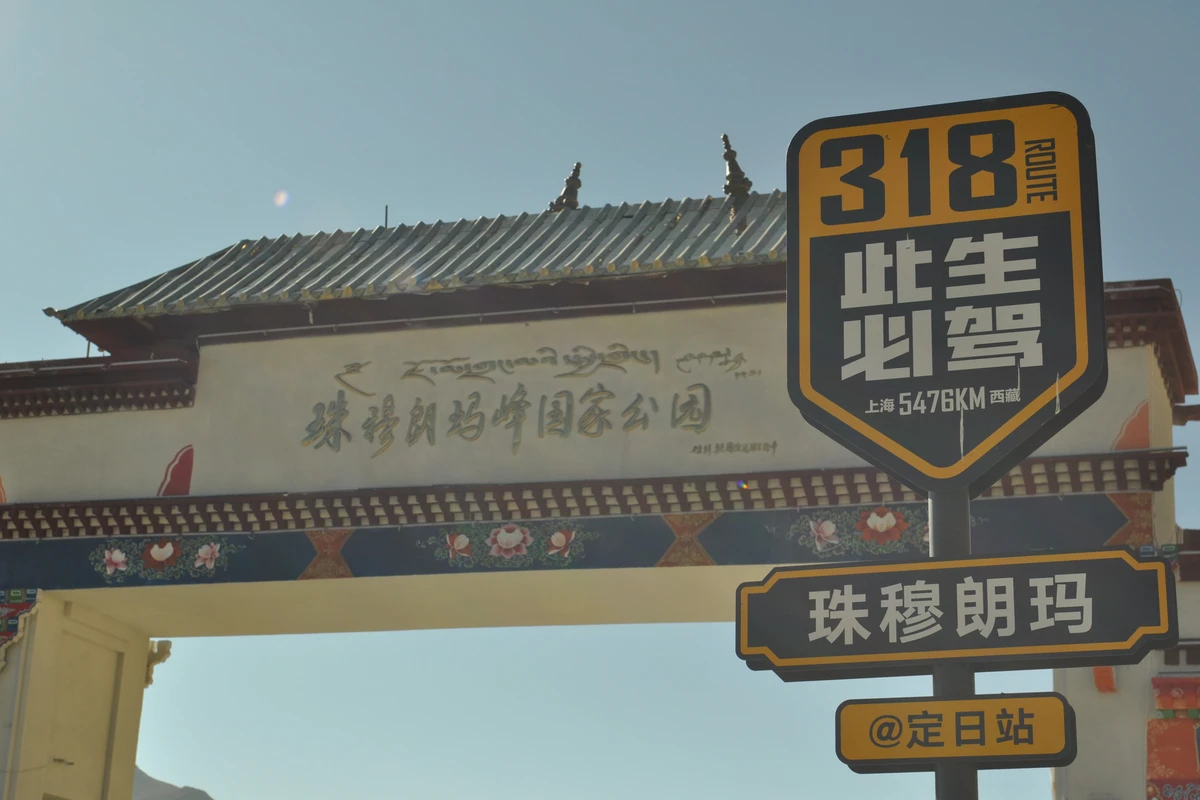
Just before noon, we finally arrived at the main gate of Mount Everest National Park. The fatigue from the long journey instantly disappeared, replaced by excitement and joy. We eagerly took commemorative photos… When buying tickets, we were told that individual entry (160 yuan per person) was free (from October 15 to December 31), and the vehicle fee was 160 yuan per vehicle (already a 50% discount). Whoa! That saved us quite a bit!
Driving in, we realized there were still endless switchbacks. The zigzag road coiled around the barren mountains. The high altitude is dry and cold, and the harsh natural environment barely supports life. Two villages we passed were sparsely populated – I really admire the resilience of the people there. Along the way, we stopped at “Gawu La Pass.” The viewing platform was covered in colorful prayer flags. Climbing up to look, the Himalayan peaks stretched out in a row. The weather was excellent: under a blue sky and white clouds, the snow-white peaks were clearly visible, especially Mount Everest in its full glory. As for height, Everest didn’t seem dramatically taller than the other peaks to the naked eye – just that tiny bit of a pointed summit taller. That small difference crowns it the world’s highest peak. Seeing Mount Everest with our own eyes was our greatest wish for this trip. To have finally fulfilled it – truly thrilling…
After about an hour’s drive inside the national park, we reached the sightseeing bus departure station. All private cars must stop here, and we transferred to the park bus to enter the base camp (ticket 120 yuan per person round trip). A 30-minute ride brought us near Rongbuk Monastery. We got off and walked along a gravel-strewn path. In the distance, Mount Everest stood solitary in the mountain gap – the other peaks had vanished due to the angle. The closer draw was a stone stele, inscribed in Chinese, English, and Tibetan: “Mount Everest Elevation Measurement Monument” with the latest altitude: 8,844.43 meters. Taking a photo with Everest beside this stele was the most meaningful memento… Getting to Tibet is not easy; getting to Everest Base Camp is even harder! Wish fulfilled! Tashi Delek! After a round of photos, we turned to look back. Rongbuk Monastery sat quietly by the roadside not far away. It’s a small temple but very famous; reportedly, every mountaineering team comes here to offer incense and pray before setting out to climb.
Time was about up. On the way back, the most heard phrase was: “Finally, our wish came true!” Yes, that’s exactly how it felt. As we grow old, many experiences may fade, but the Everest journey will not, I firmly believe. Because this is an experience I will often recall, and it will remain fresh forever!


