Heading North along the Yellow Sea Coast – A Seven-Day Tour of Taizhou and Yancheng in Jiangsu, and the Shandong Peninsula
Under the scorching summer sun, leave Hangzhou and head north along the Changshen Expressway, soon approaching Deqing.
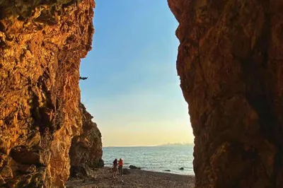
First stop, Taizhou in Jiangsu, Taizhou Old Street, with very few visitors, empty and quiet.
Quickly leave and head to Qinhu Wetland in the northeast suburb of Taizhou.
Qinhu National Wetland Park is a national AAAAA-level scenic spot, approved by the former State Forestry Administration as the second national wetland park in the country and the first in Jiangsu Province. The wetland park is located in Jiangyan District, Taizhou City, Jiangsu Province, within the Lixiahe area, one of the three famous low-lying regions nationwide. The planned area is 806.9 hectares, with a wetland area of 588.6 hectares and a wetland rate of 72.9%. The wetlands are divided into three types: lake wetlands, river wetlands, and marsh wetlands, and three forms: permanent freshwater lakes, permanent rivers, and herbaceous marshes. The park is divided into three functional zones: wetland conservation area, wetland restoration area, and rational utilization area.
In the middle of the lake stands a three-faced Buddha statue, blessing all people with safety.
The serene surface of the wetland lake.
The Zhonghua Milu Park located in Yancheng.
Jiangsu Dafeng Milu National Nature Reserve is situated on the coast of the Yellow Sea, with a total area of 78,000 hectares, including a core zone of 2,668 hectares, a buffer zone of 2,220 hectares, and an experimental zone of 73,112 hectares. It is the world's largest milu (Père David's deer) nature reserve by area, hosting the world's largest wild milu population and establishing the world's largest milu gene bank. The reserve has received nearly one million visitors from over 40 countries, including 380,000 young people from home and abroad, accounting for 40% of the total, playing a significant role in promoting wildlife conservation education and raising public environmental awareness. In July 2019, it was included in the World Heritage List as part of the Migratory Bird Sanctuaries along the Coast of the Yellow Sea-Bohai Gulf of China (Phase I).
Unfortunately, we came at the wrong time, only seeing captive red-crowned cranes. The flocks of red-crowned cranes are still far away in Siberia and Northeast China, yet to fly over for wintering.
Yancheng Red-crowned Crane Reserve
Yancheng Red-crowned Crane Wetland Ecological Park, located in Xinyanggang Town, Sheyang County, covers an area of 284,000 hectares, the largest coastal wetland nature reserve on the west coast of the Pacific. It is the world's largest wintering ground for wild red-crowned cranes and a paradise for birds and an animal kingdom.
Leaving the rainy weather of Jiangsu behind, we head straight for Penglai in Shandong, where the sun shines brightly.
Penglai Pavilion Scenic Area, located on Danya Mountain northwest of Penglai City, Shandong Province, is a national 5A-level tourist attraction covering 18,500 square meters. Penglai Pavilion was first built in the 6th year of Jiayou in the Northern Song Dynasty (AD 1061) and is known as one of the 'Four Great Towers of China' along with Yellow Crane Tower, Yueyang Tower, and Tengwang Pavilion.
Penglai lies at the northernmost tip of the Shandong Peninsula, bordering the Bohai Sea and the Yellow Sea, 66 nautical miles north of the Liaodong Peninsula. It faces South Korea and Japan across the sea to the east, with an 86-kilometer coastline and a total area of 1,200 square kilometers. Penglai Pavilion perches atop the Danya Mountain, surrounded by clouds and waves, a breathtaking sight. It consists of Penglai Pavilion, Tianhou Palace, Longwu Palace, Lüzu Hall, Sanqing Hall, Mituo Temple, and their affiliated buildings, forming a grand ancient architectural complex covering 18,900 square kilometers. Inside, literati calligraphy, couplets, and stone carvings are a feast for the eyes. To the east of the pavilion, Penglai Water City is one of the earliest ancient naval ports in China, nestled against the mountains and overlooking the sea, with water gates, docks, batteries, and other harbor and military structures, listed together with Penglai Pavilion as a key national cultural relic protection site. To the west, Tianheng Mountain, also known as Dengzhou Cape, is the southern starting point of the boundary between the Yellow Sea and the Bohai Sea. Legend has it that it was the campsite for Tian Heng and his five hundred warriors, with the sea to the north and steep cliffs. Newly built attractions include Tianheng Mountain Cultural Park, Tianheng Plank Road, and the Yellow-Bohai Sea Boundary Marker, renowned as a maritime park.
Penglai has long been known as a fairyland on earth. Legend says that Penglai, Yingzhou, and Fangzhang are three sacred mountains in the sea where immortals dwell. It is said that the Eight Immortals—Lü Dongbin, Tieguai Li, Zhang Guolao, Han Zhongli, Cao Guojiu, He Xiangu, Lan Caihe, and Han Xiangzi—after getting drunk at Penglai Pavilion, each relying on their magical treasures, strode across the waves and crossed the sea, leaving behind the beautiful legend of 'The Eight Immortals Cross the Sea, Each Showing Their Special Powers.'
On both sides of Penglai Pavilion, there are structures such as Guanlan Pavilion, Binri Tower, Biefeng Pavilion, Wobei Pavilion, and Jianggong Shrine. To the west of the pavilion, there is Biefeng Pavilion and Tianheng Mountain. Tianheng Mountain, also called Dengzhou Cape, marks the southern start of the Yellow-Bohai Sea boundary. According to legend, it was where Tian Heng and his five hundred warriors built their camp, facing the sea with cliffs as if cut by a knife. Newly built attractions include Tianheng Mountain Cultural Park, Tianheng Plank Road, and the Yellow-Bohai Sea Boundary Marker, famous as a maritime park. Biefeng Pavilion is also known as Mirage. To the east of the pavilion are Wobei Pavilion and Su Gong Shrine. The shrine was built in memory of Su Shi, with a stone portrait and walls covered in poetry and prose carvings. Further east are Binri Tower, Puzhao Tower, and Guanlan Pavilion, ideal spots for watching the sea and sunrise. Behind the pavilion is the Immortals' Bridge, said to be where the Eight Immortals crossed the sea. In front of the eastern side of Penglai Pavilion is Baiyun Palace, whose main building is Sanqing Hall, housing three deity statues. To the east of Sanqing Hall is Lüzu Hall. Mituo Temple is at the southern foot of the mountain, a standalone building. In the eastern part, Penglai Water City is one of China's earliest ancient naval ports, hugging the mountains and commanding the sea, equipped with water gates, docks, and batteries, and listed with Penglai Pavilion as a national key cultural relic protection site. Penglai Pavilion has always been a gathering place for literati, and over 200 stone carvings remain.
There are two legends about the origin of the name 'Yangma Island.' One says that in the autumn of 219 BC, Emperor Qin Shi Huang toured eastward, advancing along the coast of Zhifu. At noon one day, the entourage arrived opposite Ju Island feeling exhausted. Suddenly, a breeze brought a fragrant scent and the neighing of horses. Looking out, they saw lush peaks and verdant vegetation on the island, with a herd of fine horses playing there. Emperor Qin couldn't help but praise: 'What a wonderful island for raising horses!' He then designated this place as 'Royal Horse-Raising Island,' and ordered officials to send horses and personnel to the island for training, exclusively for the imperial court. Later, because the people resented Qin Shi Huang's rule, they dropped the word 'royal' and simply called it Yangma Island.
In the antique-style street of downtown Yantai, there is the famous Changyu Wine Company and the hotel where Dr. Sun Yat-sen once stayed.
In 1892, the renowned patriotic overseas Chinese industrialist Zhang Bishi, dreaming of 'revitalizing China through industry,' invested three million taels of silver to establish the 'Changyu Wine Company' in Yantai, thus beginning the industrialization of Chinese wine. After more than a century of development, Changyu has grown into China's and even Asia's largest wine production and sales enterprise. In 1997 and 2000, Changyu's B-shares and A-shares were successfully issued and listed. In July 2002, Changyu was recognized by the China Federation of Industrial Economics as 'one of the 16 national brands with the greatest international competitiveness marching towards world-famous brand status.' As a pioneer in China's wine industry and one of the few century-old establishments in China's food sector, the Yantai Changyu Group has created an unforgettable hundred-year legend.
Climb the beacon tower on the mountain to overlook the busy Yantai Port; in the distance, the saddle-shaped building is Yantai Railway Station.
Yantai Port, located within Zhifu Bay on the north side of the Shandong Peninsula, lies at the core of the Northeast Asian international economic circle. It is one of China's 25 important hub ports along the coast and a crucial hub on the major north-south coastal passage and an important node on the new Eurasian Land Bridge connecting Japan and South Korea to Europe. In the 11th year of the Xianfeng reign of the Qing Dynasty (1861), Yantai Port became a treaty port. In September of the 10th year of the Republic of China (1921), Yantai Port entered the ranks of modern ports. Its main businesses include passenger and ro-ro logistics, container, pipeline transportation, liquefied oil products, and bulk cargo.
A bustling loading and unloading scene.
Waiting for sunset by the seaside.
Heading to Liugong Island in Weihai.
Liugong Island, located at the mouth of Weihai Bay at the eastern tip of the Shandong Peninsula in eastern China, covers an area of 3.15 square kilometers with a coastline of 14.95 kilometers. It serves as a natural barrier for Weihai City and is of vital importance in national defense, often called 'the Eastern Screen' and 'the Unsinkable Battleship.' Numerous naval battles took place here from the Ming and Qing dynasties to before liberation, especially the First Sino-Japanese War, which left profound historical marks. The island features rolling peaks; the northern sea cliffs are steep and perpendicular, while the southern part is gentle and expansive, with a forest coverage rate of 87%, earning it the reputation of 'an immortal mountain in the sea' and 'a paradise on earth.' The island abounds in unique cultural landscapes, ranging from Warring States period sites dating back over a thousand years to the Qing Dynasty's Beiyang Naval Command Headquarters, naval academy, and ancient batteries from the First Sino-Japanese War ruins, as well as many European-style buildings left from the British lease period. Since its opening to the public in 1985 from being a closed military zone, it has become a renowned scenic area.
The Museum of the First Sino-Japanese Sea Battle.
Here, one can reflect on the naval battle that took place over 120 years ago, whose failure directly led to the cession of Taiwan.
Naxianghai in Weihai, the most beautiful seaside in the north, bar none.
The Naxianghai Tourist Resort covers a total area of about 4 square kilometers with a total building area of over 2 million square meters. Situated at the gateway of the Haoyunjiao Tourist Resort, it is bordered to the west by Weihai's eastern coastal new town, to the south by the thousand-year-old fishing village of Gangxi Town, and to the north by a 16-kilometer natural beach. It exclusively enjoys the Naxianghai Beach and boasts a 2,000-acre natural oxygen bar of black pine forest, a 300-acre inner sea Xianghai Bay, a 100-acre harbor Lover's Port, and incorporates the full range of geographical ecological landscapes including the sea, beaches, hot springs, forests, rivers, and lakes, making it an absolutely supreme tourist and holiday paradise.
The Three Great Halls at Chengshantou in Rongcheng, wishing friends great fortune.
Behind is the Sun God, and in front is Mazu.
The easternmost point of the mainland coastline – Chengshantou in Rongcheng, Shandong.
Chengshantou, also known as 'Tian Jintou' (End of the World), is located in Chengshan Town, Rongcheng City, Weihai, Shandong Province. It is named because it lies at the easternmost end of the Chengshan Mountains. Chengshantou is surrounded by the sea on three sides and connected to land on one, only 5 nautical miles from the main international north-south shipping lane and just 94 nautical miles from South Korea across the sea. It is the earliest place to see the sunrise at sea and has been praised since ancient times as 'the place where the sun rises,' called 'Chaowu' in the Spring and Autumn period, and is hailed as 'China's Cape of Good Hope.' Chengshantou stands 200 meters above sea level, stretches 1.5 kilometers from east to west and 2 kilometers from north to south, covering an area of 2.5 square kilometers. The green peaks stretch continuously, and the sea is vast and distant, making it an ideal tourist destination.
In 2004, due to its picturesque border location, it was selected for the National Geographic Directory; in 2005, it was rated by 'China National Geography' as one of the 'Eight Most Beautiful Coasts in China,' ranking among the top three alongside Yalong Bay in Sanya, Hainan, and Yeliu in Keelung, Taiwan.
Laoshan, located in Laoshan District, Qingdao City, Shandong Province, was also known historically as Laoshan, Laoshān, and Aoshān. It is the main mountain range of the Shandong Peninsula. The highest peak is called Jufeng, also known as Laoding, located at 36°10′N and 120°37′E, with an altitude of 1132.7 meters and a summit area of about 1.5 square kilometers, serving as the main peak of Laoshan. Laoshan is the highest peak on China's coastline and is known as the 'Number One Mountain on the Sea.' A local saying goes: 'Though Mount Tai is high, it is not as good as Laoshan on the East Sea.' Laoshan features steep cliffs and the sea on the east and gentle rolling hills on the west, with a mountainous area of 446 square kilometers. The range extends outward from Laoding in all directions, especially longer to the northwest and southwest, forming four branches: Jufeng, Sanbiao Mountain, Shimen Mountain, and Wushan. The offshoots of Laoshan stretch north along the east coast to the east of Jimo District, west to the shore of Jiaozhou Bay, and to the southwest into downtown Qingdao, forming more than ten hilltops and undulating hilly terrain in the urban area.
At Taiqing Palace in Laoshan, the statue behind is Taishang Laojun, Laozi.
Pu Songling, author of 'Strange Stories from a Chinese Studio,' once visited Laoshan and wrote 'The Taoist of Laoshan.'
Legend has it that Taoists practiced walking through walls right here.
Legend tells of Wang Qi, a scholar who daydreamed of becoming an immortal. He was indolent and loved reading books on immortality. One day, while deeply absorbed in a book, he hallucinated that he arrived at Sanqing Temple on the mountain and apprenticed himself to an old Taoist master. The master gave him an ax and told him to chop wood on the mountain starting the next day. Day after day, Wang Qi couldn't endure the hardship and wanted to sneak home. Suddenly, he noticed two old Taoists approaching Sanqing Temple and hid. He saw them walk through a wall. Astonished, Wang Qi begged his master to teach him the technique of walking through walls, believing it would make the journey worthwhile. Finally, he learned the skill, but the old master warned him not to use it for evil, or the magic would fail. When he returned home, despite his wife's admonitions, he planned to use it for theft. In the end, the magic failed, and a big bump appeared on his head from hitting the wall.
A fishing village at Laoshan, nestled by the mountain and sea, living in prosperity.
Leave Qingdao, and drive back across the Jiaozhou Bay Bridge, concluding this week-long trip along the Yellow Sea coast.
The Jiaozhou Bay Bridge (Jiaozhou Bay Bridge) is a sea-crossing passage located in Qingdao City, Shandong Province, China, connecting Huangdao District, Chengyang District, Licang District, and Jiaozhou City across Jiaozhou Bay. It is an important part of the provincial expressway network of Shandong. The Jiaozhou Bay Bridge began construction on December 26, 2006, initially named 'Qingdao Bay Bridge'; on December 22, 2010, the main bridge closure was completed, and the entire bridge was connected; on June 23, 2011, it was officially named 'Jiaozhou Bay Bridge'; it opened to traffic on June 30, 2011; and on March 30, 2020, the Jiaozhou connecting section was opened. The Jiaozhou Bay Bridge starts from the Licun River Interchange in the east, crosses Jiaozhou Bay, connects to the Hongdao Interchange in the middle, and ends at the Huangdao East Hub Interchange in the west. The total length of the route is 42.23 kilometers, and the bridge itself spans 31.630 kilometers. The deck is a dual three-lane expressway designed for a speed of 80 km/h.