West Sichuan! West Sichuan!
Seeking postal traces in the secret realm of West Sichuan
The Hengduan Mountains are the most concentrated area of extreme scenery in China, where the collision between the Qinghai-Tibet Plateau and the Sichuan Basin has formed vast plateaus and连绵的山脉 in western Sichuan. Here, high mountains and deep valleys are adjacent, with clear springs and turbulent streams converging. From Jiuzhaigou and Huanglong, renowned as the world's most beautiful waters, to the Wolong Nature Reserve, home to the giant panda; from Daocheng Yading, a pure land on earth, to the towering highest peak of the Hengduan Mountains, Mount Gongga—a multitude of captivating scenic spots cluster on the West Sichuan Plateau. Thus, West Sichuan has become a travel sanctuary I visit again and again.
In June 1996, I set out westward from Chengdu, entering West Sichuan for the first time, arriving at the fairy-tale world of Jiuzhaigou. The serene Mirror Lake, elegant Emerald Lake, beautiful Fangcao Lake, the deep black-jade-like Long Sea, the magical Five-Color Lake, the peculiar Liucui Beach, the rushing Pearl Shoal Waterfall (Figure 1), the majestic Nuorilang Waterfall... Lakes, waterfalls, streams, river beaches, and mountain springs interweave and complement each other, creating a picturesque landscape. Beneath the main peak of the Minshan Mountains, Xuebaoding, Huanglong appears like a giant travertine slope and valley, resembling a golden "dragon" soaring across the sky. The scenic area is dotted with numerous karst lakes, where clear water, combined with extensive travertine deposits and algae on the lakebed, creates a colorful lake landscape. Countless pools, shimmering in the sunlight, form a series of colorful jade basins. At that time, no related stamps had been issued, so I only sent some postcards along the way and collected a few postmarks (Figure 2).
In October 2005, I traveled with photography friends on a chartered car along the Great West Sichuan Loop from Chengdu. Along the way, we sent letters and checked in at Kangding, Danba, Lixian, Litang, and Daocheng, leaving many postal traces (Figure 3). Whenever I see them, the sacred snow-capped mountains, vast green meadows, clear blue lakes, deep canyons, rushing streams, and colorful forests... all the beautiful scenes come back to mind.
In the summer of 2015, while visiting Langmusi in Gannan, I made an impromptu decision to drive to the vast Zoige Wetland, unintentionally entering West Sichuan again. In summer, the Flower Lake is covered with brilliant blooms—red, pink, yellow, and various unknown wildflowers vying for beauty among the green grass. The azure lake water is tinted a light lotus color, colorful as if clouds had fallen to the ground. Looking into the distance, the water and sky merge in one color; the green grass and wildflowers are refreshing, and the misty reeds cleanse the soul (Figure 4).
In spring 2016, I drove from Chengdu to Moxi Town to visit Hailuogou. In the forest, swaying usnea hung from branches, and clouds drifted among the mountains, creating a dreamlike beauty. The crystal-clear modern glacier cascaded down from the high valley, awe-inspiring. When the clouds that had lingered for days dispersed and lifted the mysterious veil, the main peak of Mount Gongga shone brilliantly under the sun, solemn and majestic (Figure 5). Tourists on site exclaimed and bowed in reverence. For this sacred moment, some had waited a full week.
On June 22, 2019, several friends and I set off from Ningbo in the morning to begin a self-driving tour of the Great West Sichuan Loop. After two days of driving, covering over 2,200 kilometers, we crossed the Luding Dadu River Bridge over the Dadu River in Luding County around 18:00 on the 23rd. After crossing the bridge, we stopped by the river and looked back, seeing the red steel truss suspension bridge hanging high over the river, imposing and strikingly vivid (Figure 6). On both sides, steep mountains stood tall, white clouds wreathed the peaks, and the Dadu River surged and flowed endlessly. Over a month later, the stamp "65th Anniversary of the Completion and Opening of the Sichuan-Tibet and Qinghai-Tibet Highways" was issued, featuring the "First Bridge of Sichuan-Tibet" on a national stamp (Figure 7). At dusk, we reached Kangding City, full of Tibetan charm at the foot of Paoma Mountain.
Mount Gongga spans Luding, Kangding, and Jiulong counties in Sichuan, covering an area of 10,000 square kilometers. Within the area, high peaks abound, with 45 peaks above 6,000 meters and 145 ice peaks above 5,000 meters. The main peak, rising 7,556 meters, stands supreme among the peaks. The landscapes are characterized by majestic snow peaks, glaciers, alpine lakes, and hot spring groups. The scenic area centers on Mount Gongga and includes Hailuogou, Mugecuo, Wuxuhai, and the southern slope of Gongga.
On June 24, we departed from Kangding and entered the Mugecuo Scenic Area. Taking the sightseeing bus along the winding mountain road, we reached the summit viewing area, where Mugecuo looked like a huge gem, crystal clear (Figure 8). Riding horses through hillsides covered in blooming flowers, we arrived at a pass at 4,200 meters above sea level. Clouds and mist surrounded the main peak of Mount Gongga, making it appear isolated and mysterious, occasionally revealing its majestic summit (Figure 9).
Descending along the boardwalk of Dujuan Gorge, we were refreshed by rushing streams and waterfalls. Despite nearing midsummer, alpine rhododendrons were still blooming in the deep gorge. Arriving at Qise Hai (Seven-Color Lake), a lake formed by the coexistence of cold and hot springs, the water was so clear you could see the bottom, with strings of bubbles rising, creating patches of mist. Ancient trees towered along the shore, surrounded by meadows. It is said that when the lake reflects the blue sky and white clouds in the early morning, with luck, one might glimpse the reflection of Lotus Snow Mountain.
Next, we crossed Zheduo Mountain, following a winding mountain road with countless bends, climbing for a long time to reach the pass observation deck at 4,298 meters (Figure 10). Under the azure sky, prayer flags fluttered noisily in the wind. On the slopes, endless Gesang flowers formed a purple sea. Near Xinduqiao, there was an observation deck by the road. Riding horses up a high slope, we could see the snow-covered main peak of Mount Gongga. At different times, from three distant places, we admired Mount Gongga from different angles, witnessing the grandeur of the King of Sichuan Mountains.
Xinduqiao is an important hub on National Highway 318. The distant mountains, the nearby yaks, colorful Tibetan houses, and green grasslands—like a giant oil painting. Everything was so peaceful; we rested there for a while.
On the morning of June 25, we left Xinduqiao. By the roadside, the Tagong River contained many stones and slates carved with scriptures—a testament to faith. The Tagong Grassland had gentle undulations, with blue sky, white clouds, endless mountains and grasslands, and the red walls, white pagodas, and golden tiles of Tagong Monastery, creating a scene full of Tibetan charm. The only drawback was that Yala Snow Mountain was hidden in clouds and mist, making one feel something was missing.
Continuing along the 318, we saw cyclists, hikers, rollerbladers, prostating pilgrims, and even people pulling carts for livestreaming—all heading to the sacred city of Lhasa thousands of miles away. I truly admired their bravery and devotion! After crossing the pass of Gao'ersi Mountain at 4,412 meters, we arrived at Yajiang County at noon. This is a typical mountain town with narrow streets, where the Yalong River flows from north to south through the town, intersecting with National Highway 318. After a hearty meal of beef, we continued.
We traversed the "Heavenly Road Eighteen Bends," passed through the Jianziwan Mountain Tunnel, winding through serene canyons and majestic mountaintops, with green grass and herds of yaks. Then we crossed the passes at Nimagong (4,668 meters) and Kazila Mountain (4,718 meters). Looking out, thousands of mountains and valleys stretched layer upon layer, each farther and lighter in color, undulating until they met the sky—truly like walking on a heavenly road.
After passing Litang, known as the highest county in China at 4,014 meters, we crossed Haizi Mountain, covered in giant rocks and lakes. Nearby, a peak resembled rabbit ears, remarkably lifelike. After continuously crossing large mountains, coupled with varying degrees of altitude sickness, we had no mood to stop and enjoy the scenery. Gritting our teeth, we pushed on to cross Bowa Mountain at 4,485 meters, finally arriving at Daocheng Shangri-La Town before dark.
On June 26, we entered the Yading Scenic Area. Taking a sightseeing bus to Zhaguanbeng, we first took the short route via Chonggu Monastery to Pearl Sea (Tibetan: Dramalhatso). Xiannairi (Tibetan meaning "Avalokiteshvara"), at 6,032 meters, is the foremost of the three sacred mountains in Yading. Its shape resembles a large Buddha leaning back, with snow never melting at the summit, majestic and graceful (Figure 11). As clouds drifted and rolled, it appeared and disappeared, ever-changing, sparking continuous guesswork and imagination. The meltwater from Xiannairi forms Pearl Sea, like a green gem set in a lotus throne, with gentle waves reflecting the snow mountains and trees, creating a fairy-tale picture. Occasionally, rumbling thunder sounded—it was an avalanche, with snow and ice cascading down like a waterfall, magnificent and spectacular. Sitting quietly by the lake, watching the clouds drift, but the summit remained shrouded in clouds; we waited foolishly. Four hours passed, but we still couldn't see the top clearly, so we left with a trace of disappointment. Unexpectedly, on the return bus, the clouds above the summit completely dispersed, and we finally saw the full view of the sacred mountain Xiannairi.
On June 27, we entered Yading for the second time. The weather was good. On the way in the scenic area bus, we could already see the beautiful snowy peaks of the three sacred mountains. We transferred to an electric cart to Luorong Cattle Farm at 4,150 meters. Around the farm were continuous alpine meadows. In early summer, wildflowers bloomed across the meadows, covering the mountains. Flocks of cattle and sheep grazed leisurely by the river and on the slopes, with the three snowy peaks standing nearby—a harmonious scene.
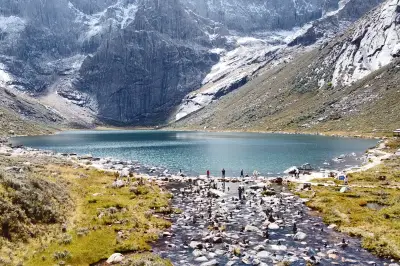
Getting off at the Luorong Cattle Farm electric cart station, we walked through a wetland meadow to a special horse farm to ride mules up the mountain. After dismounting, we began a difficult climb up the steep mountain path. After about an hour, we reached a three-way junction. To the left was a flat path to Milk Sea. Companions with severe altitude sickness or fatigue chose that route. We turned right and climbed a steep slope of about 500 meters, then over a high ridge, and Five-Color Lake (Figure 12) appeared in the embrace of Yangmaiyong Snow Peak (Tibetan: "Manjushri," 5,958 meters). Because of the reflections of snow mountains and meadows, the water color seemed ethereal and magical. To the left, surrounded by snow mountains, Milk Sea (Figure 13) was shaped like a water droplet, with blue snowmelt in the center and a ring of milky white water around it. Looking around, Yangmaiyong and Xianuoduoji Snow Peak (Tibetan: "Vajrapani") seemed within reach (Figure 14). Along the sharp ridges of the triangular snow peaks, which stretched sinuously, the side facing away from the light was in shadow, outlining sharp and angular lines against the blue sky. Walking along the ridge, we admired the snow mountains and lakes; everything here was so pure and dreamlike.
On June 28, we set out for Ganzi along Provincial Road 217. Passing Haizi Mountain again (Figure 15), we saw bizarre rocks after glacial erosion and numerous large and small lakes (glacial erosion basins) scattered all over, spectacular and breathtaking. We couldn't resist stopping to explore. Reading the roadside guide sign, we learned this is the world's largest glacial relic. This time, we made up for the regret of rushing through on the way in.
After lunch in Litang, we continued. The mountains were dark blue, clouds boundless, green grass like a carpet, yellow flowers everywhere, cattle and sheep grazing, eagles soaring, and scattered tents like white jade adorning the landscape (Figure 16). The alpine meadow greeted us with its most vibrant colors. Then we traveled along the Yalong River Grand Canyon, with rapids roaring thunderously, occasionally glimpsing snow mountains. There were few vehicles on the road. Feeling lonely, we saw Tibetan villages, prayer flags, and temples by the roadside, reminding us we were back in civilization. We arrived at Ganzi Xianggela Hotel at 7:45 PM.
On June 29, waking up and opening the window, we saw snow peaks in sight. Several snow-capped mountains surround Ganzi County. Sunlight streamed through gaps in the clouds, illuminating the plateau beneath the snow peaks, like a fairyland. We visited the White Pagoda (Figure 17), where many devotees were worshiping, walking around the pagoda while chanting sutras. Some devoutly prostrated themselves as they circled. Inside the temple, monks were also chanting.
After breakfast, we took County Road X6983, a new road opened just two months earlier, not yet on maps. The mountain road wound through mist and clouds (Figure 18). Along the way, wildflowers of all colors bloomed on the grasslands, making it hard to tell if we were in a fairyland or the mortal world. At 2 PM, we arrived at the Five-Science Buddhist Academy, surrounded by layered mountains.
We climbed steps to the top and looked out. The monks' quarters in the valley, centered around the Great Sutra Hall of the Buddhist Academy, densely covered the surrounding slopes. Countless small crimson wooden houses stretched endlessly, without an end in sight (Figure 19). These red houses were the dwellings of over 10,000 monks. Arriving here, we were deeply moved by the passionate red houses and the devout pilgrims.
Leaving Seda, we traveled along the Naqu River, with scenic canyon sights, as if mistakenly entering a paradise. Then we continued along National Highway 317, with the Seqiu River rushing alongside. Before dark, we reached Guanyin Bridge. Our hotel was built by the river; opening the window, there was a cliff and torrent below. We fell asleep to the sound of rushing water.
On June 30, we left Guanyin Bridge in the morning and traveled along National Highway 317 by the Dajinchuan River. Along the way, we saw Songgang Watchtowers on the slopes, Zhuokeji Tusi Official Village built into the mountain, and Xisuo Village facing the river with its back to the mountain (Figure 20). From Barkam, we turned onto Provincial Road S210, where road conditions were worse, with falling rocks and landslides everywhere. Thanks to the timely clearing by road maintenance workers, we could continue. Around 10 AM, we passed the Mengbi Mountain Pass, the only route from Barkam to Xiaojin County, and also the second major snowy mountain crossed by the Chinese Workers' and Peasants' Red Army during the Long March. At the foot of the mountain stands the "Snow Mountain Red Road" memorial sculpture. Shortly after passing the Lianghekou Meeting Site, we encountered a serious landslide in Mupo Township. Four large excavators and bulldozers worked together on site, finally clearing a path for us after 40 minutes.
At 2 PM, we visited Shuangqiao Valley, one of the three more developed scenic areas of Mount Siguniang. Taking the scenic area bus, we enjoyed views of forests, streams, and snow mountains. An hour later, we got off at the foot of a mountain. Various alpine flowers covered the wide lawns, cattle and sheep wandered, surrounded by beautiful sea buckthorn forests. High mountains, clear water, vast land, blue sky—like a fairyland. Strolling through Shuangqiao Valley, green trees, serene lakes, and the snow mountains and colorful forests on both sides complemented each other (Figure 21).
On July 1, we took the first bus of the scenic area into Changping Valley. The weather was clear, and at the entrance we could see the four sister peaks, each majestic and upright, with steep bodies pointing to the sky (Figure 22). Riding horses along the stream zigzagging to the Withered Tree Beach, we saw clusters of withered trees standing in clear water and silver sand, each tree independent, branches strong, their reflections in the flowing water creating stunning beauty. Continuing into the untouched primeval forest, climbing slopes and wading through water, we found high mountains and dense forests, ancient cypresses tall and straight, lush pines, and even sea buckthorn growing into large trees, trunks covered in moss, branches draped with usnea. Meltwater from high mountains flowed down in rapid waterfalls, streams winding through the forest. Occasionally we saw red rock beaches. Arriving at Muduozi, wildflowers spread from our feet to the horizon, set against the snow-covered Camel Peak and blue sky and white clouds, breathtaking (Figure 23). The guide said if we continued for two days, we could traverse to Bipeng Valley on the back side of Mount Siguniang. Limited by our stamina, we stopped there. As we exited the scenic area, the sky had clouded over, and the four sister peaks quietly disappeared into the sea of clouds.
On the way back to Ningbo, our hearts remained in West Sichuan. I believe everyone who has traveled National Highways 318 and 317, as well as those unknown provincial and county roads in West Sichuan, has their own mental journey. The glaciers, snow mountains, alpine lakes, vast grasslands, and blue sky and white clouds form incomparably beautiful pictures that make people linger. When you step into the atmosphere created by fluttering prayer flags, temples with golden roofs and red walls, lofty white pagodas, and ubiquitous Mani stones and other symbols of faith, you feel the noise in your heart stop, and the world becomes serene. You realize that there is indeed a pure land in this world, existing deep in your soul, allowing you to appreciate beauty while feeling reverence and awe!
Philatelists, when traveling, like to send letters along the way for check-ins. When passing through Kangding City, Tagong Grassland, Yajiang, Xinduqiao, Litang, Daocheng, Seda, and Guanyin Bridge, I drove to find the local post office. Sometimes if it was not business hours, I would drop the envelopes and postcards into the mailbox at the entrance. At the Yading scenic area ticket office, there was a mailbox, but the postcards I received were postmarked with Daocheng County town mark, so they were probably taken to the county town for mailing. Not being able to leave a Yading mark at the foot of the magnificent snow mountain left me deeply regretful. In Daocheng Shangri-La Town, where we stayed for three nights, even with navigation tools, I couldn't find a post office—perhaps the town really doesn't have one. At the Seda Five-Science Buddhist Academy, amid the red buildings, I spotted the familiar green sign of a post office. Walking along the path through several streets, I entered the post office. To my astonishment, the staff told me that this post office only handles mail delivery, not acceptance. The only time I managed to cancel stamps myself was on the evening of June 30 at the post office in Mount Siguniang Town, located in a newsstand. But no one was there. In urgency, I called out a few times, attracting the owner who also ran a restaurant nearby. I bought two sets of Mount Siguniang scenic postcards, sat inside to write addresses, slowly canceled the stamps, and left them at the post office for mailing (Figure 24). After returning home, the items sent from Xinduqiao, Litang, Seda, and Tagong Grassland have yet to be received; those from Yajiang were delayed by ten days to half a month (Figure 25); postmarks from Kangding and Guanyin Bridge were unclear. Compared to my travels on the Great West Sichuan Loop over a decade ago, I felt the decline of postal services and a drop in service quality. I truly hope the photos I took of the post offices along this trip won't become history (Figure 26).
West Sichuan is rich in tourism resources. As early as 1989, the former Ministry of Posts and Telecommunications issued the "Sichuan Scenery" postage prepaid postcards, with the cover featuring the scene of the golden sunlight on the snow peak of Mount Gongga at Hailuogou. Among the ten postcards, six showcased West Sichuan scenery: Jiuzhaigou Waterfall, Huanglong Autumn Color, Summit of Minshan Mountains, Hailuogou Gongga Snow Peak, Erlang Mountain Snow Scene, and Hongyuan Landscape (Figure 27). On New Year's Day 2003, Jiuzhaigou launched a tourist ticket in the form of a postage prepaid postcard with the Nuorilang Waterfall as the main image. When a friend traveled there, they had six scenic postmarks from Jiuzhaigou stamped on it (Figure 28). In 2004, Huanglong also launched a special postage prepaid postcard ticket featuring "Huanglong Zhengyan Pool" (Figure 29). In 1998, Jiuzhaigou appeared on a national stamp, featuring Long Sea (Figure 30), Fangcao Sea, Wuhua Sea, Shuzheng Waterfall (Figure 31, an envelope hand-drawn by one of the stamp designers, teacher Zhang Youju), and Nuorilang Waterfall. Regrettably, in August 2017, the Jiuzhaigou earthquake caused the Nuorilang Waterfall to collapse. The largest and most beautiful waterfall in China, captured on stamps and postcards, has become a permanent memory.
In 2007, Mount Gongga (Figure 32) appeared on a national stamp. The Huanglong stamp (Figure 33) was not issued until 2009. However, the world heritage Mount Siguniang, known as the "Queen of Sichuan Mountains" and "Oriental Alps," and Daocheng Yading, the last pure land on earth, remain hidden in the boudoir. We look forward to seeing more beautiful scenes of West Sichuan on national stamps.